Golden
Top Photography Spots in and near Golden, Colorado, United States

946 Lookout Mountain Road, CO
3.7
· 3 reviews
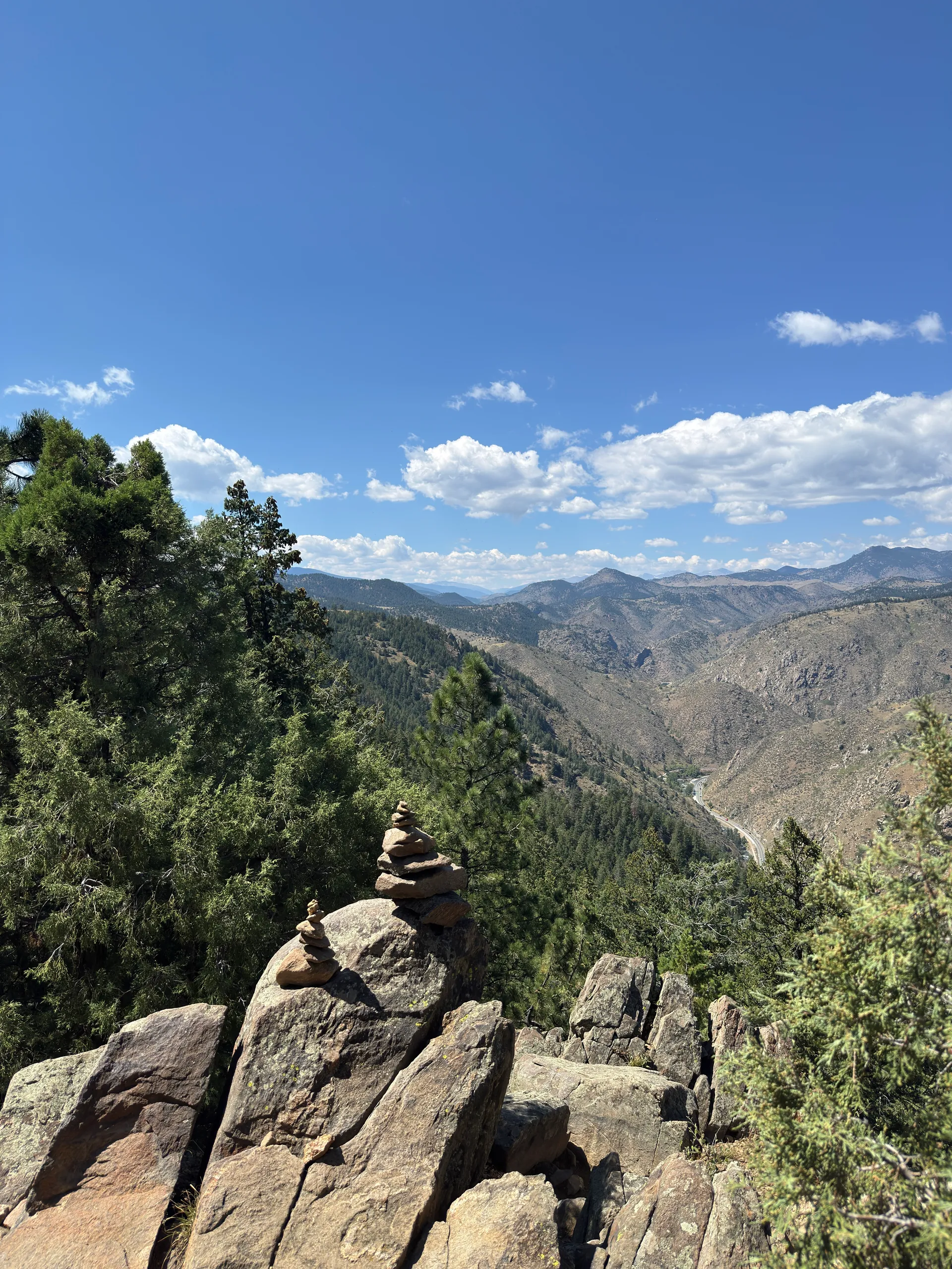
Lookout Mountain sits just above Golden and provides one of the best easy-access viewpoints near Denver. The mountain provides numerous vantage spots along the road up, with the best at a rock outcropping just below Buffalo Bill's Gravesite & Museum (with easy parking). If you're hoping to catch a s...

Windy Saddle Park
4.0
· 1 reviews
Just outside of Golden, CO is Lookout Mountain. If you’ve ever driven westbound on i70 from Denver to the mountains, you’ve undoubtedly seen this mountain to your right with antennas on the top. On the north side of Lookout Mountain lies Windy Saddle Park, about a 30 minute drive from Denver. This c...

303 19th Street, CO
4.0
· 12 reviews
This adventure crosses private property. Please do not attempt this adventure without permission from the property owner(s). Learn more JeffCO.US/1430/South-Table-Mountain-Park . You can do this one-hour hike in every season, every temperature and at any time. The best part about this hike is that e...

Golden, CO
4.3
· 4 reviews
The Village Walk, Red Rocks & Cherry Gulch Trail threads through one of Colorado's most geologically and historically layered open spaces—Matthews/Winters Park, a 2,461-acre Jefferson County preserve bordered by I-70 to the north and Red Rocks Park to the south. Here, ancient sandstone formations, a...

Golden, CO
4.3
· 3 reviews
There are over 35 miles of hiking trails in the park. The twelve trails in Golden Gate Canyon State Park are named after an animal and marked with the animal’s footprint. For a 2.6 round trip hike, start at the Burro Trailhead in Golden Gate Canyon State Park. You’ll immediately cross over a little ...

2224 Douglas Mountain Drive, CO
2.5
· 2 reviews
Elk Range Trail is an incredible and beautiful hike that is just off of Route 6 but feels a million miles away. Drive up Douglas Mountain Road for the west park access (and I do mean UP - it's a quick elevation gain), and you'll run right into the Centennial Cone Park entrance. There is a bathroom a...

25938 Genesee Trail Road, CO
5.0
· 3 reviews
After shooting a friend's wedding, I was on my way home when I noticed the sky start to light up to the west. I parked the car and ran down the road. The spot is well known for how perfectly the overpass frames the mountains as drivers leave the Denver area. The total exposure time was just over 2 m...

Golden, CO
4.3
· 3 reviews
Just outside of Golden, CO is Lookout Mountain. If you’ve ever driven westbound on i70 from Denver to the mountains, you’ve undoubtedly seen this mountain to your right with antennas on the top. On the north side of Lookout Mountain lies Windy Saddle Park, about a 30 minute drive from Denver. This c...

25373 Belcher Hill Road, CO
4.3
· 4 reviews
For this adventure, you'll be completing the Sawmill to Maverick loop. It is a short, but gentle trail that will take you through open meadows, to pine forests, and great views of Denver and Golden. Starting from the west parking area, cross the road and hit the Sawmill Trail. This trail starts out ...

Golden, CO
There are three parking lots with direct access to the Mountain Lion Trail. The main one is off of Crawford Gulch Road, but any of them are good starting points! This loop has pretty similar elevation gain and loss profiles no matter which way you go, so you can go any direction. This adventure will...

Golden, CO
5.0
· 1 reviews
The hike starts out from the North Table Mountain Park parking lot just east of Highway 93 on the North Table Loop Trail, with a half-mile fire road straight up the mountain. This fire road is by far the most strenuous part of the hike, and is essentially the sole elevation gain for the hike; once r...