Arkansas
Explore hiking, backpacking, waterfalls, hot springs and more in "The Natural State"
Top Spots in and near Arkansas
-
Hagarville, Arkansas
Backpack to the Natural Bridge
5.08 miAfter you drive across the one-lane bridge and take the dirt road immediately after it, follow that dirt road until it begins to bend to the left. Park your vehicle in the turnoff on the right, and be sure to lock it and take (or hide) any valuables in it. Even though it’s relatively remote, rand...Read more -
Kingston, Arkansas
Hawksbill Crag via Whitaker Point Trail
4.52.68 mi / 594 ft gainHawksbill Crag aka Whitaker Point is one of the most popular hiking spots in all of Arkansas and only ~60 miles from Fayetteville. However, doing the hike early in the morning provides one of the best places of all time to watch a sunrise. You begin at the trail marker which is straight across ...Read more -
Compton, Arkansas
Big Bluff via the Centerpoint Trailhead
4.96.21 mi / 991 ft gainThis adventure begins at the Counterpoint Trailhead just north of Ponca, AR. Follow the trail downhill for about 2.7 miles until you reach a split in the trail. Take the trail off to the right and follow it for another .5 miles until you reach the Big Bluff area. There is a lot of area to expl...Read more -
Sand Gap, Arkansas
Relax at Falling Water Falls
5.0This is definitely a hidden gem located in the middle of nowhere. This waterfall is literally on the side of the road, which makes for a great place to stop and have lunch. During the summer it doubles as a swimming hole and great place to chill. Getting there: Take Hwy. 16 east from Pelsor (loc...Read more -
Kingston, Arkansas
Eden Falls via Lost Valley Trail
4.92.32 mi / 453 ft gainThis is a beautiful trail that is easily accessible and only a short 3 mile hike. Start at the trailhead on the north end of the parking area. There is a map and some details about the main features of the trail. The first main feature that you come to on the trail is a beautiful bluff with a ...Read more -
West Fork, Arkansas
Yellow Rock Trail
4.03.25 mi / 531 ft gainYellow Rock Trail offers an easy loop hike with stunning views of the Ozark Mountains. The trail is located just south of Fayetteville, AR in Devil’s Den State Park. From the entrance, follow the main road past the visitors center. You’ll pass a small lake and recreational area on the left. T...Read more -
Mount Judea, Arkansas
Hike Sam's Throne
5.00.5 miThis hike starts at the Sam's Throne Campground parking area. Once you walk to the end of the campground there is a fence with three different entrances that all lead to different trails. Take the middle trial for the shortest and easiest hike to the bluffs. This hike is very easy and only tak...Read more -
Harrison, Arkansas
Twin Falls (aka Triple Falls)
5.00.27 mi / 72 ft gainProceed to the Camp Orr Campground down near the banks of the Buffalo River. Once you reach the bottom of the hill you will cross a low water bridge over a small creek. Park in the small parking lot on the right hand side once you cross the creek. Once you park simply walk through the gated are...Read more -
Jasper, Arkansas
Camp along the Buffalo National River
5.02 miThis is a night of camping that is one for the books. Head to the Steele Creek area on the Buffalo River. Once you are in the Steel Creek area simply follow the gravel road to the right and park anywhere in the grass along the river. Camping is permitted anywhere along the Buffalo River as lon...Read more -
Winslow, Arkansas
White Rock Rim Trail
5.02.08 mi / 335 ft gainThe trail around the Rim of White Rock Mountain is one of the best trails for vantage points. Nestled in the beautiful Boston Mountains in north central area of Arkansas. The White Rock Rim trail is an easy 2 mile loop trail that is moderately hiked year round. Start at the parking area and he...Read more -
Compton, Arkansas
Hemmed In Hollow Falls via Hemmed In Hollow Trail
5.05.78 mi / 1572 ft gainAfter parking at the Hemmed In Hollow Falls Trailhead, follow the path down as it descends into the valley. As you approach one of the vistas, you’ll be able to spot the emerald green waters of the Buffalo River, as well as the bluffs to your east where the waterfall hides. After reaching the va...Read more -
Witts Springs, Arkansas
Hike to Punchbowl Falls
3.24 mi / -600 ft gainGo in the early Fall or late Spring! You start off on the Ozark Highland Trail. As you start walking along the trail you can see where people have slept the night before. Camping is acceptable out here, you do not have to pay, but the downside is that the closest town is about an hour away so if ...Read more -
Rogers, Arkansas
Camp at Horseshoe Bend Campground, AR
4.0The campground has several sites along the shores of Beaver Lake. Its restrooms are clean and include free hot showers. The campground does not provide firewood. However, you are allowed to pick firewood from the surrounding woods. If there has been recent rainfall you’ll need to buy firewood ...Read more -
Harrison, Arkansas
Backpacking Cecil Creek
5.08 miFrom Tulsa, head out east along US-412 until you reach HWY 103. Take a right (south) on HWY 103 and follow it toward Compton, Arkansas. Shortly before reaching Compton, take the dirt road on the right (before the road starts to head north), and follow the road south. Keep on it as it bends to the...Read more -
Compton, Arkansas
Backpacking Along the Buffalo River
5.012 miPark at the Centerpoint Trailhead and follow the Centerpoint trail as it heads about 3 miles downhill towards Big Bluff. You’ll know you’ve reached the trail junction for Big Bluff when you come to a clearing that has a large firepit in the middle and a small unmaintained trail heading off to the...Read more -
Morrilton, Arkansas
Cedar Falls
4.82.01 mi / 305 ft gainWhen I did this hike it was unbelievable. This entire valley looks like something out of a painting. If at all possible, I recommend that you plan your trip around the rain, because after a heavy rain the valley is full of waterfalls.Getting there: Cedar Falls is located in Petit Jean State Park ...Read more
Top Activities
Top Places
Camping and Lodging in Arkansas
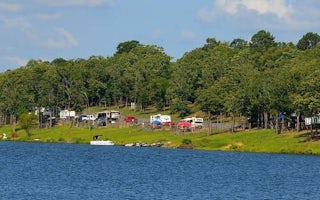
De Queen, Arkansas
Bellah Mine
Overview
Bellah Mine Campground sits along the shores of DeQueen Lake in southwest Arkansas. Recreation
Boating and water sports top the ...
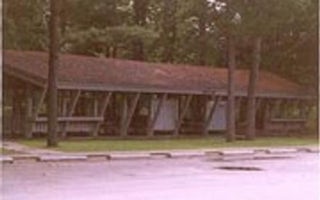
Ozark, Arkansas
Aux Arc
Overview
Aux Arc Campground sits on the shores of Ozark Lake in the picturesque Arkansas River Valley. "Aux Arc" is a name that originate...
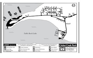
Omaha, Arkansas
Cricket Creek
Overview
Cricket Creek is a spacious and sunny campground located along the Long Creek Arm of Table Rock Lake in the Arkansas countryside...
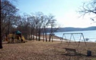
Peel, Arkansas
Highway 125 Park Bull Shoals
Overview
Enjoy the beautiful scenery overlooking Bull Shoals Lake, known in the area as a water sports paradise.
The park is a departur...
Dierks, Arkansas
Jefferson Ridge
Overview
Jefferson Ridge Campground is located on Dierks Lake in southwestern Arkansas. Rugged ridges bordering the lake create stunning ...
De Queen, Arkansas
Pine Ridge
Overview
Pine Ridge Campground sits along the shores of DeQueen Lake in southwest Arkansas. Recreation
Boating and water sports top the l...


