›
Arizona
Arizona
About this place
Find local adventures, unique places to stay, and local adventure tours in iconic destinations like The Grand Canyon, Sonoran desert, Phoenix, and more. Discover desert adventures across the state like, hiking, backpacking, rafting, and more.
Top Hiking Spots in and near Arizona, United States

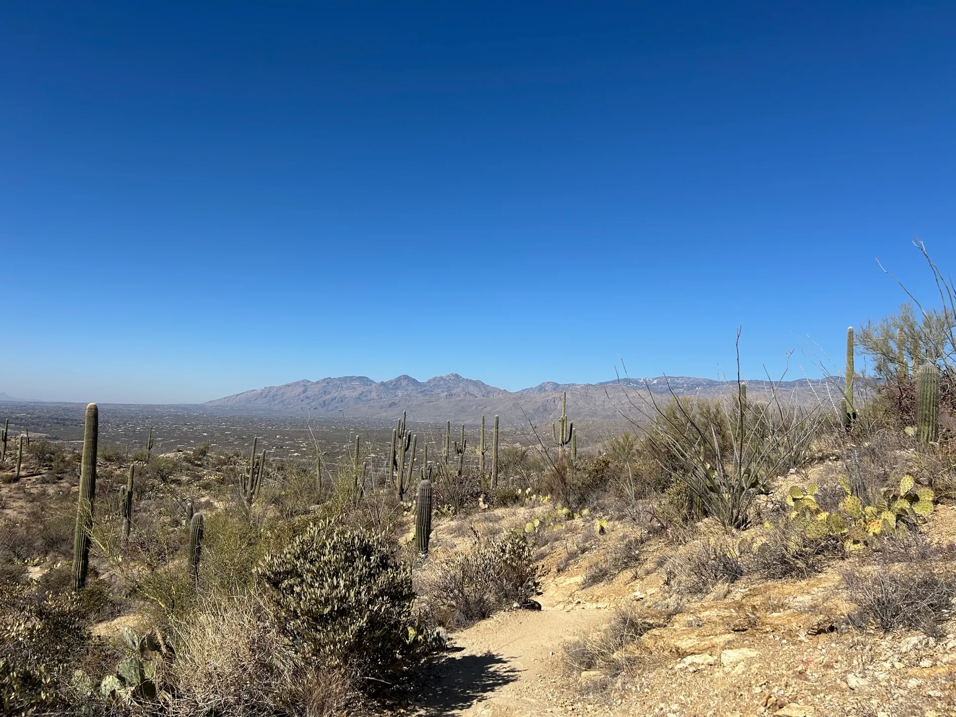
Tucson, AZ
Bridal Wreath Falls is a 5.6 mile out-and-back hike that takes you through a Seguro National Park to a picturesque waterfall near Tucson, AZ. Keep in mind, the waterfall is more "picturesque" if it has rained recently. This trail is NOT dog-friendly.

Prescott, AZ
4.0
· 1 reviews
The Watson Lake and Flume Trail is a 4.5 mile loop hike that takes you next to Watson Lake near Prescott, AZ. This trail also makes for a great workout if you throw on your running shoes. Keep in mind there is no shade, so pack water and sunscreen accordingly. Thinking about getting on the water? Ch...

Wymola, AZ
4.0
· 1 reviews
We recently hiked the Calloway Trail at Picacho Peak State Park, and while it’s not as challenging as the Hunter Trail, it’s still a bit difficult, especially with rocky terrain. However, this trail was more manageable for our family, and all of our kids were able to complete it without needing to u...

Ajo, AZ
5.0
· 2 reviews
In mid-November, my daughter and I drove south from Ajo, Arizona, on Highway 85 to have what was planned as an introductory look at Organ Pipe Cactus National Monument. Upon arrival, we checked in with the ranger at the Kris Eggle Visitor Center, bought our permits, and learned that driving the 21-m...

Black Canyon City, AZ
3.0
· 1 reviews
Zig Zag Trail is a loop trail that takes you by a river located near Canyon City, Arizona.

Black Canyon City, AZ
4.0
· 1 reviews
Castle Creek Road to Cleator is a point-to-point trail where you may see beautiful wildflowers located near Black Canyon City, Arizona.

4999 Arizona 179, AZ
5.0
· 1 reviews
The Big Park to Bell Rock Pathway Loop offers an iconic Sedona hiking experience, featuring up-close views of the famous Bell Rock formation and expansive vistas of the surrounding red rock landscape. This well-maintained trail system provides multiple interconnected paths allowing hikers to customi...

Sedona, AZ
5.0
· 2 reviews
The Little Sugarloaf and Chimney Rock Loop in Sedona, Arizona, offers hikers stunning red rock vistas and panoramic city views. Ideal for an early morning adventure, this trail provides easy parking and quiet surroundings, with low crowds reported even around sunrise. The terrain is a mix of moderat...

12235 North State Route 89A, AZ
Cookstove Trail to Harding Springs Loop located near Munds, Arizona, is an extension of 1.5-mile Cookstove Trail if you're looking to extend your hike. Enjoy scenic views along this 3.6 mile trail, but be sure to bring plenty of water and sun coverage on warmer days. PARKING Be sure you pack your Re...

Phoenix, AZ
Acer Summit Via Mormon Trail is an out-and-back trail where you may see wildflowers located near Phoenix, Arizona.

Sedona, AZ
4.0
· 2 reviews
Yavapai Vista Trail is an out-and-back trail that takes you past scenic surroundings located near Sedona, Arizona.

Tucson, AZ
Molino Basin Campground is the only campground of the Catalina District of the Forest Service to be open year round due to its lower elevation at only 4500'. Its position along the Mount Lemmon Highway makes Molino Basin a perfect basecamp for further adventures in the Santa Catalina Mountains, and ...

Apache Junction, AZ
Starting Treasure Loop from Jacob's Crosscut offers a slight variation on Treasure Loop as well as ~1.5 miles if you're looking for a little extra distance. This trail is dog friendly on-leash and is used by hikers and runners.

Winslow, AZ
...Just off Highway 40 in-between Flagstaff and Winslow Arizona, sits an abandoned ghost town called "Two Guns". I can't tell you how many times I've driven on the 40 (East or West) and had no idea this was here. This time around I made it a priority to stop and check this place out. For anyone that...

18333 North Thompson Peak Parkway
5.0
· 1 reviews
Saguaro Loop and Nature Trail is a loop trail located near Scottsdale, Arizona.

Phoenix, AZ
Ruth Hamilton Trail is an out-and-back trail where you may see beautiful wildflowers located near Phoenix, Arizona.