›
California
California
About this place
California offers a diverse range of outdoor activities. The state boasts pristine coastlines, granite mountains, and expansive redwood forests. Travelers can explore the Alamere Falls, which empties directly into the Pacific Ocean, or visit McWay Falls in Big Sur, a prominent waterfall visible from Highway 1. For those interested in hiking, the Sunrise Lakes to Clouds Rest trail is a notable choice, while the Lands End Trail in San Francisco provides a scenic coastal walk. Whether you're looking to hike, camp, or simply enjoy the outdoors, California has something for everyone.
Top Spots in and near California, United States

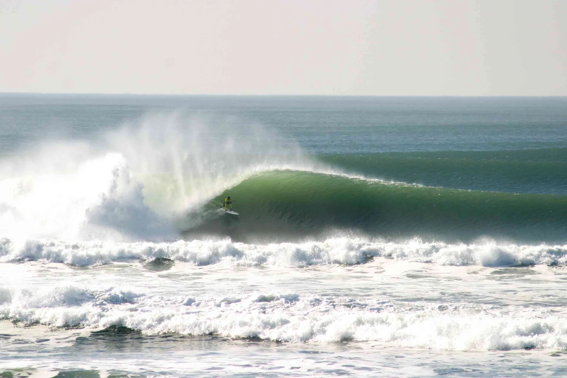
Ocean Beach
4.8
· 9 reviews
Ocean Beach has long stints of good waves during the fall and winter months. During the fall, winds are favorably offshore creating warm and hollow conditions. Once winter hits, wave size can increase to the 12-15ft range on big swells and it gets pretty cold - that's when you'll see people breaking...

Rose valley Campground
5.0
· 1 reviews
Close to Ventura and Ojai, California, this spot is an easy weekend getaway from the hectic coast of Ventura. Follow Highway 33 east toward Ojai. This road will lead into the Los Padres National Forest and become very curved and sleep as it gets closer to Rose Valley. The sign for the Park with be o...

McCloud, CA
The least technical route to the summit of Mt Shasta begins at the Clear Creek Trailhead (elevation 6390 ft). Please note that although this is a less technical route, this is still dangerous and there have been deaths on Mt. Shasta because of falling rock. To start this, you should be a good hiker ...

Panamint Dunes Trailhead
5.0
· 2 reviews
You can do this as a day trip and just wander the dunes, but I really enjoyed the overnight with great evening views, amazing stargazing, and a sunrise exploration of the sand dunes. For an overnight trip I recommend you start hiking later in the day, when the temperature is a bit cooler. If you're ...

Borrego Springs, CA
4.0
· 1 reviews
For all you desert lovers- this is a must. Or for all you SD residents that want to try something new and take a break from the populated trails within the county- spend a day in Anza Borrego and include this on your list. This state park is just a quick jaunt outside of the town of Julian. This mea...

Mt. Whitney Trail
5.0
· 8 reviews
Mt. Whitney is the highest peak in the contiguous United States. It stands over 14,500ft high at its peak (elevation gain of 6100') and it sure feels like it when you are up there. Getting There Located just West of Lone Pine, CA you take Whitney Portal Road West for 13 miles all the way to its end....

Riverside County, CA
5.0
· 3 reviews
White Tank Campground is in the perfect spot to get a taste of all that Joshua Tree has to offer. As a central location to nearby hiking and climbing, it is easy to access the various parts of the park. Removed from the border of the park, White Tank doesn't attract as many visitors as the more popu...

Yosemite Valley, CA
4.6
· 5 reviews
Tenaya Lake is located alongside Tioga Road in the park's Tuolumne Meadows region. There is a family-friendly trail that surrounds the lake. Though some spots along the trail on the western shore may require fording the waters, the 2.5-mile trip is an easy hike for all to enjoy. Many others prefer t...

Mussel Rock Parking Area
4.0
· 2 reviews
Mussel rock, a three-story, 50 million year old rock that has been carried some 500 miles northwest from Southern California, is where the San Andreas fault meets the Pacific Ocean. It's also an excellent spot to drink some wine and catch a sunset. From San Francisco, take Highway 1 south towards Pa...

Yosemite Valley, CA
4.9
· 16 reviews
Be sure to arrive early early in the morning to beat the crowds or if you want to break up the hike, first-come, first served campsites are available at Little Yosemite Valley Campground - make sure to check out the details in that adventure and obtain a wilderness permit . Even if you are just day ...

Sonoma, CA
This 12 mile bike path starts at a rental shop in Sonoma Country called Sonoma Valley Bike Tours and Rentals . Follow the trail through the quaint residential area and into the back country vineyards and dirt trails. This ride can be anything between a hardcore 2 hour cycling workout with a few incl...

Ten Lakes Trailhead
5.0
· 2 reviews
Beginning at the Ten Lakes trailhead, the trail to the lakes is a moderately strenuous uphill grind to Ten Lakes pass, followed by a quick downhill into the lake basin. We met a woman at the top who made sure we didn’t miss the short side trail to a vista point on the pass that offered a sweeping pa...

Pelican Cove
Getting There Coming from San Pedro, make a U-turn at the Hawthorne Boulevard stoplight onto Palos Verdes Drive South. From here, you can access the parking lot for Pelican Cove, where you'll get a 120° view of the ocean. It might be tempting to take in the sunset from the car, but you should defini...

The Inkwells
4.5
· 5 reviews
These natural swimming holes are filled with water flowing from Kent Lake, so they're usually pretty refreshing. And by refreshing, we mean cold. We know this first-hand by testing the pools in the winter months. Let's just say if you can stay in for more than 5 seconds, you're a hero. If you jump o...

Oakland, CA
5.0
· 1 reviews
It’s difficult to have a car in San Francisco, but oh-so worth it when it comes to weekend getaways, especially with all the Bay Area has to offer. This is a super accessible trail system just 30 minutes outside of the city that makes for a fun, easy trail run or hike. Redwood Regional Park , part o...

Iron Mountain
4.1
· 8 reviews
Iron Mountain is the longest wilderness trail in Poway, CA. The parking lot is free and provides bathroom and water fountain amenities. The distance from the parking area to the summit is approximately 3.2 miles. Beginning with a wide smooth trail, slowly transitioning into semi-technical inclined s...