Details
Features
About this place
Pico Peak (pronounced "pike-o") is a 3,957-foot mountain in Killington, Vermont, sitting in the heart of Rutland County and the famous Green Mountains. Often overshadowed by its bigger neighbor Killington Peak (4,229 ft) just to the south, Pico is one of the more rewarding mid-distance hikes in central Vermont — combining classic Green Mountain ridgeline, an iconic backcountry shelter, and a spot on the prestigious New England Hundred Highest peak-bagging list.
The 5.5-mile round-trip route is short on distance and big on character.
The Trail
- Distance: ~5.5 miles round-trip
- Elevation gain: ~1,800 ft
- Difficulty: Moderate
- Summit: Pico Peak — 3,957 ft
- Trailhead: Off U.S. Route 4 at Sherburne Pass
There are two main hiking trails to reach the summit, both starting off Route 4:
1. Sherburne Pass Trail The most popular route — climbs steadily through hardwood and spruce-fir forest. A good combination of grade and views, with the trail gaining most of its elevation in the middle third before easing into the upper ridge.
2. The Long Trail Vermont's iconic 273-mile spine trail also passes near Pico. The Long Trail / Appalachian Trail combo (the two coincide through this section) crosses Sherburne Pass and provides an alternative approach to the summit. Tag this section and you've ticked off a piece of one of America's classic long-distance trails.
Most hikers combine these for a loop or use one for the ascent and one for the descent.
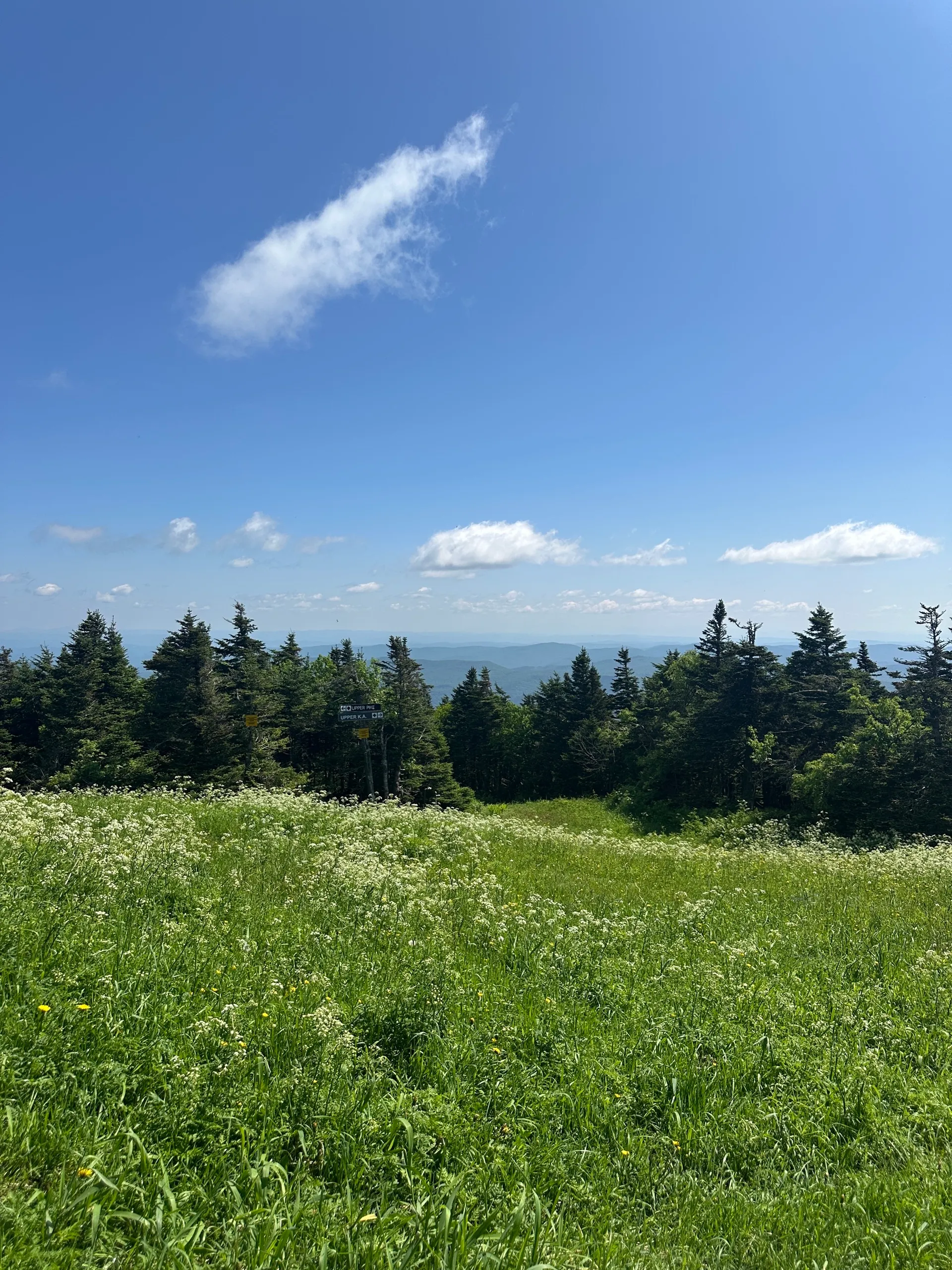
The Summit & Views
Pico's summit sits just below the cone of the Pico Mountain ski area, which means the upper part of the hike crosses or parallels ski trails. The view from the top opens up to:
- Killington Peak rising prominently to the south
- Ottauquechee Valley spreading east
- Taconic Range to the west
- The full Green Mountain spine rolling north and south
- On clear days, the Adirondacks are visible across Lake Champlain to the west
The exposed summit ridge can be windy — bring an extra layer even on warm days.
Pico Camp Shelter
Pico Camp is one of the highlights of this hike — a classic Green Mountain Club shelter located just 0.4 miles east of the summit along the Long Trail. The enclosed cabin has bunk beds for overnight hikers and is available on a first-come, first-served basis.
- Free to use — no permit required
- First-come, first-served
- Bunk beds inside the cabin
- No water source at the shelter — bring your own or filter from the spring nearby (when running)
- Pack out everything — Leave No Trace
The shelter makes Pico a great option for a quick overnight backpacking trip, especially as a first introduction to Long Trail shelter culture.
Why It's on the New England Hundred Highest List
Pico Peak is one of the 100 highest peaks in New England — a respected peak-bagging challenge that includes summits across Vermont, New Hampshire, and Maine over 4,000 feet (with a few exceptions like Pico that fall just below). The list is maintained by the Appalachian Mountain Club and is a step up from the more popular New England 4,000-Footers list.
For peak baggers, Pico is a benchmark check-off — accessible enough for a half-day hike but with the wilderness character of the bigger Green Mountain peaks.
Seasonal Guide
- Spring (April–May): Vermont's notorious mud season — the trails are often closed by the Green Mountain Club to protect them from damage. Always check trail status before going.
- Summer (June–August): Prime hiking season — wildflowers, mild temps, and full leaf cover
- Fall (mid-September–mid-October): Peak foliage — Pico is one of the best easy-access foliage hikes in central Vermont. Expect crowds on weekends.
- Winter (November–March): Snow-covered. The ski area operates and the hiking trail becomes a snowshoeing/backcountry route. Avoid ski-area trespass — stay on the hiking corridor.
Wildlife
- Black bears — common in the Green Mountains; store food properly at Pico Camp
- Moose — increasingly common at higher elevations
- White-tailed deer
- Ruffed grouse — often startled along the trail
- Birds of prey along the summit ridge
What to Bring
- Water — at least 2 liters; no reliable water on trail
- Layers — the summit can be 15–20°F cooler than the trailhead, especially in shoulder seasons
- Sturdy boots — rocky and rooted sections
- Trekking poles — helpful on the steeper sections
- Map / GPS — Gaia, AllTrails, or the Green Mountain Club's Long Trail map; cell service is spotty
- Rain layer — Vermont weather changes fast
Practical Info
- Trailhead: 722 U.S. Route 4, Killington, Vermont
- Parking: Free lot at Sherburne Pass — fills on summer and fall weekends
- Permit: None required for day hikes; no reservation needed for Pico Camp
- Dogs: Permitted on leash (and well-behaved off-leash in less crowded sections)
- Fees: Free
- Nearest town: Killington, VT — restaurants, gear shops, lodging
- Pair with: Killington Peak (a longer, harder hike to the higher summit just south), the rest of the Long Trail / AT through this section, or a stop at one of Killington's famous post-hike spots like the Long Trail Brewing Company (just down the road in Bridgewater Corners)
Long Trail Context
The Long Trail runs the full length of Vermont — 273 miles from the Massachusetts border to the Canadian border — and is the oldest long-distance hiking trail in the United States, predating the Appalachian Trail by over a decade. The Green Mountain Club, founded in 1910, built and maintains the Long Trail and all the shelters along it, including Pico Camp. Hiking even a short section is a piece of American trail history.