Details
Features
About this place
This 2.6 mile isn't too strenuous, but is rocky in parts. The exact geo-coordinates of False Kiva are 38.415860, -109.917388. Once you arrive, explore the historic, Native American ceremonial and Class 2 archeological site.
False Kiva is an off the beaten path destination located in the “Island in the Sky” district of Canyonlands National Park, a bit outside of Moab, Utah. It is an archaeological site containing a large circle of rocks supposedly (hence the “false”) constructed by Native Americans as a place of ceremony. To reach the parking area, you must enter the park from the Island in the Sky entrance on the north end of the park and follow the main park road until turning right onto Upheaval Dome Road. Once you’ve turned, follow this for roughly 3.5 miles. You will see a small pullout on the right side of the road where you should park. The trail starts across the street behind the brush used as a trail marker.
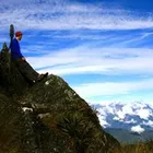
The hike into false kiva not necessarily strenuous one, but the difficulty lies in following the somewhat ambiguous trail through the desert. A GPS is very handy, but with a good eye and some patience you’ll get to the same place. The trail begins traversing through the Utah Desert, showcasing the incredible plant life in the area with a variety of cacti, desert wildflowers and desert soil crust. After about a mile of hiking you’ll reach the canyon rim and be greeted by an expansive of the canyon and Candlestick Tower. From here the trail descends right taking you down the cliff face leading you to your first view of the Kiva. Follow the switchbacks up towards the cave and you’ll encounter the Kiva.
False Kiva offers grandiose views of Canyonlands, an up close look at Native American ruins, and a tranquil spot to watch the light change or catch a glimpse of the milky way. Canyonlands National Park is considered a dark spot with almost no light interference, making it an ideal place for stargazing.
Since your destination is an official archaeological site, the park rangers generally keep it on the hush unless you ask them specifically. The trail gets a bit ambiguous at points but a GPS and a good eye for Cairns can keep you on the right track. There is a fee for any vehicle entering the park. Any camping must be at a designated campsite and reserved through the park service.
Leave No Trace