Williams, Arizona
Top Spots in and near Williams
-
Williams, Arizona
Hike the Kelsey Spring/Hog Hill/Dorsey Spring Loop
13.4 mi / 2200 ft gainThis hike starts at the Kelsey Spring Trailhead. Park at the end of Forest Service Road 538G. There is parking for about 6-7 cars. Just past the signage for the trail, which is also called Kelsey Winter Trail, there is a trail registration box. Be sure to sign in. The trail descends steeply for t...Read more -
Flagstaff, Arizona
Explore Flagstaff's Lava River Cave
4.1If you’re looking for a truly unique hiking experience in Arizona, look no further than the Lava River Cave, 14 miles northwest of Flagstaff. The longest lava tube in Arizona, the cave was formed approximately 700,000 years ago after a volcanic eruption in Hart Prairie. As the lava from the erupt...Read more -
Flagstaff, Arizona
Snowshoe at the Arizona Nordic Village
2.5 miTo get to the Nordic Village from Flagstaff, just take the 180 North until you see the signs for the Nordic Village (on your right).Once at the Nordic Village, go inside the entrance building to buy your day pass ($10 for a snowshoeing day pass) and rent your gear. Feel free to bring your own sn...Read more -
Flagstaff, Arizona
Hike the Two-Spot Loop Trail
2.5 mi / 100 ft gainThis loop trail has two different starting points. You can start at the south end of Rogers Lake (which is what I did) or the north end. I hike in a clockwise direction. This is recommended if you are hiking in the late afternoon as I did. The sun will be at your back during the section that has ...Read more -
Flagstaff, Arizona
Camp at Red Rock
4.8Starting from Downtown Flagstaff we headed west. After making a left turn on Woody Mountain Road, we continued for 22 miles. Woody Mountain Road then becomes Forest Road 231. Continue on FS 231 until you find a killer spot to pitch it! Make sure to be wary of elk herds crossing the roads.We made ...Read more -
Sedona, Arizona
Robbers Roost
5.00.95 mi / 148 ft gainThe hike begins on the eastern side of the parking area. It is only a half mile hike but the views are amazing. Hike through the beautiful Sedona landscape of red rock and juniper before finding your way to this breathtaking cliff side view! Feel free to explore more of the mountain and find othe...Read more -
Flagstaff, Arizona
Hike and Camp at Arizona's A1 Mountain
4.76.6 miles west of downtown Flagstaff off the I-40 West is the A1 Mountain Road. Continue over the cattle guards and enter into the A1 Mountain Area—perfect for hiking, camping, and trail running.The main road is well established for a dirt road, and many of the hiking trails branch off from it. T...Read more -
Sedona, Arizona
4X4 to Honanki Heritage Site
5.0One of Sedona’s best and most scenic drives, that happens to also lead to Native American ruins, has to be Loy Butte Road (FR-525). This route also forms the eastern half of the famous Outlaw 4×4 Jeep Trail. The road is very rough in places, especially during the latter part of the drive. The roa...Read more -
Flagstaff, Arizona
MTB the Hart Prairie Loop
15.2 mi / 1198 ft gainThis outstanding loop takes in high altitude meadows, aspen glades, fabulous evergreen forest, and unbelievable views in the San Francisco Peaks. The ride lacks any technical challenges, but long and consistent uphill grades (at high elevation) make for a good workout. The reward is an ending tha...Read more -
Coconino County, Arizona
Hike Aspen Corner to Bismark Lake on the Arizona Trail
5.07 mi / 500 ft gainI started this hike at 7:00am. It was a perfect time of day. The sky was clear and the air was cool. I chose this section of the Arizona National Scenic Trail because I heard it passes through beautiful prairie and stands of Ponderosa Pine and Aspen trees. The trail did not disappoint! I started...Read more -
Sedona, Arizona
Dispersed Camping in Coconino National Forest (Edge of the World)
5.0This campsite is definitely out there. You'll take a dirt road into what seems to be a thick forest. Tell your GPS to put you on Woody Mountain Road in Flagstaff, AZ. Once you are on this road set your speedometer and follow this road for about 23 miles. Do not make any turns off of this road, th...Read more -
Sedona, Arizona
Camp at East Pocket (Edge of the World)
4.8We love coming to this site in the Summer and Fall, but wanted to "test" our cold-weather gear before backpacking this Winter. So we went to our tried and true spot, with the comfort of our cars, so we could work out our layering and sleep system. Have a few cups of warm spiked cider and enjoy! T...Read more -
Flagstaff, Arizona
Hike the Soldier's Trail
5.05.6 mi / 300 ft gainThis trail was named in honor of the military troops that trained here during World War II. Keep in mind, this loop trail is at 7000 feet, so if you are driving up from Phoenix or even Sedona, you may feel a little winded. However, there is no serious climbs on this hike so you may feel no diffe...Read more -
Flagstaff, Arizona
Winter Summit Humphreys Peak, Arizona
8.4 mi / 3335 ft gainFrom Flagstaff, take US-180 west towards the Grand Canyon. Take US-180 for 7 miles until you reach Snow Bowl Rd. Turn right/N onto Snow Bowl Rd and take this for 7 miles as it winds its way up the mountain. If it has recently snowed you will need chains for 2 wheel drive vehicles or 4 wheel drive...Read more -
Flagstaff, Arizona
Hike the Aspen Nature Loop at Humphrey's Peak
5.01.8 mi / 300 ft gainThis is a great hike that has amazing views at all times of the year. This trail might be closed for skiing season, but I am not sure. I went in October, just before Halloween and the weather was perfect. The leaves were changing and there was a nice brisk breeze. The short loop makes it accessib...Read more -
Flagstaff, Arizona
Climb Morning's Mourning at the Oak Creek Canyon Lookout
5.8+, 80ft trad climb at the Oak Creek Canyon Lookout. To get there, take the 89A North from Sedona, or South from Flagstaff. Then you will see signs for the Oak Creek Canyon Lookout. Take the turn off and park in the lot. If you think you will stay beyond closing, park across the street so you ...Read more
Top Activities
Camping and Lodging in Williams
Williams, Arizona
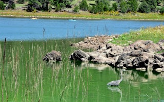
Kaibab Lake Sites And Group Areas
Overview
Kaibab Lake sits among the diverse landscape of Kaibab National Forest of northern Arizona. The lake is a popular spot for fishi...
Williams, Arizona
Williams / Exit 167 / Circle Pines KOA Holiday
Welcome to your headquarters for northern Arizona fun! The pine-filled forest setting of Williams/Exit 167/Circle Pines is perfect for es...
Williams, Arizona
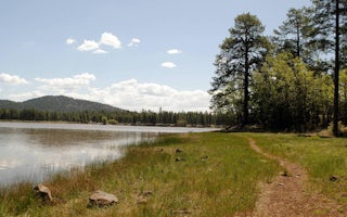
Dogtown Lake Campground And Group
Overview
Dogtown Lake offers a scenic setting convenient to Grand Canyon National Park and the cities of Williams and Flagstaff, Arizona....

Williams, Arizona
Grand Canyon / Williams KOA Journey
This cozy, quiet campground is the KOA closest to the Grand Canyon! Deluxe Cabins, Camping Cabins, RV Sites and Tent Sites all come with ...
Williams, Arizona
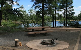
White Horse Lake Campground
Overview
White Horse Lake is an extremely popular fishing lake, 19 miles southeast of Williams, in northern Arizona. The lake's campgroun...
Parks, Arizona
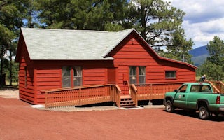
Spring Valley Cabin Bunkhouse
Overview
Spring Valley Cabin and Bunkhouse offer a peaceful retreat with spectacular views, quiet solitude, wildlife viewing opportunitie...


