
Holland Lake and Falls
Condon, Montana
Rated 5.0/5
based on 1 reviews
5.0/5
Details
Distance
3.05 miles
Elevation Gain
561 ft
Route Type
Out-and-Back
Description
Added by Outbound
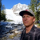
Holland Lake and Falls is an out-and-back trail that takes you by a lake located near Condon, Montana.
Download Outbound mobile app
Find adventures and camping on the go, share photos, use GPX tracks, and download maps for offline use.
Get the appFeatures
Camping
Fishing
Hiking
Dog Friendly
Family Friendly
Lake
Scenic
Waterfalls
Holland Lake and Falls Reviews
Stopped off and did this hike on our way from Bigfork to Helena. Would have loved to spend more time here!
5.0
Leave No Trace
Always practice Leave No Trace ethics on your adventures and follow local regulations. Please explore responsibly!
Nearby

Stand Up Paddle at Holland Lake
When you turn on Holland Lake Lodge road, follow the signs towards the lodge. You will notice a sign that directs to a day use area, which is an option, but I prefer to continue to the very end of the dead end road. There is parking and a vault toilet at the dead end along with a trailhead sign. Grab your gear and set off down the trail. It is about a 3-minute walk down to the water. You wi...

Snowshoe to Holland Falls
Drive on 83 through the swan until you reach the turnoff for Holland Lake. The lake, campground, ranger station, and trails are all very well marked throughout this adventure. 4WD is suggested for getting to the parking lot for Holland Lake, as some of the roads may not be plowed, and there may be a lot of snow accumulation.There is a sign which identifies the different trails that hikers may t...

Climb Holland Peak
About 2 mi. south of Condon, MT, take Rumble Creek Road east to Cooney Lookout and park at the trailhead at 4550 ft.
Follow the trail for about 1 mi. and after about 100 yards after the third bridge, look for a well worn trail heading up the hill side. Take this steep, hard-packed trail and follow it to Lower Rumble Creek Lake. From Lower Rumble Creek Lake, follow the south side trail around th...

Hike to Crescent Lake
An hour drive north of the town of Seeley Lake Montana is the Glacier Lake Trailhead and the starting point for your hike. Glacier Lake Trailhead is a popular trailhead, and the parking lot can fill up quickly on hot summer weekends since it provides access to trails which lead to three different lakes.
From the Glacier Lake Trailhead, you can access Glacier Lake, Turquoise Lake, along with Cr...

Morrell Falls
From the town of Seeley Lake, travel 0.5 mile north on Highway 83. Turn east (right) on Morrell Creek Road (small green street sign) which becomes Forest Service Road #477/Cottonwood Lakes Road, and travel 1.1 miles. Turn north (left) on West Morrell Road #4353 and travel about 6 miles. Turn east (right) on Pyramid Pass Road #4381, go 0.25 mile. Then turn north (left) on Morrell Falls Road #436...

Summit Swan Peak
This hike is about an hour drive south from Kalispell. Follow MT-83 S for about 47 mi. towards and past Swan Lake. Take a left on NF-554 and follow the road for 1.6 mi. and take a right on Squeezer Creek Rd. and follow the road for 4 mi. to a gated road and park near the gate.
Follow the gated road (hiking) for about 0.3 mi. and take a left up the near overgrown road. Continue on this road for ...
Discover
Community
Mobile Apps

© 2026 The Outbound Collective - Terms of Use - Privacy Policy