
Mount Josephine
Grand Portage, Minnesota
Details
Distance
2.52 miles
Elevation Gain
636 ft
Route Type
Out-and-Back
Description
Added by Allison Herreid
A short but slightly strenuous hike to the top of Mount Josephine leading to incredible views of Lake Superior.
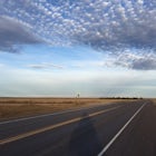
To get to the trailhead coming from Grand Marais, drive northeast on highway 61 until you come to Grand Portage Village. Turn right onto Store Rd (73) and continue straight until you come to a T (Mile Creek Rd/17). Turn left and continue straight on Upper Rd until you come to a small parking lot on the left side of the road. There will be a small sign that reads 'Mount Josephine.'
The trail begins following a ATV road running parallel to Upper Rd. After about a half mile, you will come to a sign where the trail turns left and begins climbing. You will reach the top after about a mile and be rewarded with views of Lake Superior, Wauswaugoning Bay, Pigeon Point, the Susie Islands and Isle Royale. Lots of rocky outcrops provide a nice place to enjoy a lunch before heading back down to your car. Be sure to check out the High Falls of the Pigeon River if you're in the area!
Download Outbound mobile app
Find adventures and camping on the go, share photos, use GPX tracks, and download maps for offline use.
Get the appFeatures
Mount Josephine Reviews
A fun quick, but steep, hike. Well worth your time.
5.0
Leave No Trace
Always practice Leave No Trace ethics on your adventures and follow local regulations. Please explore responsibly!
Nearby

Grand Portage National Monument

High Falls of the Pigeon River

Devil's Kettle

Huginnin Cove

Backpack Windigo to South Lake Desor, Isle Royale NP

Greenstone Ridge Trail
Discover
Community
Mobile Apps

© 2026 The Outbound Collective - Terms of Use - Privacy Policy