Mexico
Top Spots in and near Mexico
-
20.875880,-87.043548, Mexico
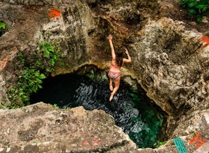
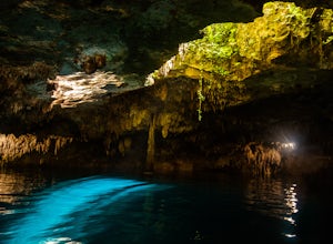
Swim in 7 Bocas Cenote
A cenote is a a natural sinkhole that appears when bedrock collapses and exposes groundwater beneath. The exposed water can be above ground, or in a series of underground caves and rivers. The Yucatan Peninsula is somewhat known for cenotes, and a trip to the area isn't complete without a swim in...Read more -
Amecameca, Mexico
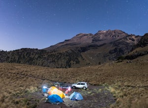
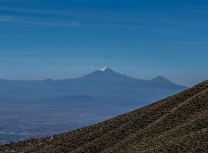
Summit Iztaccihuatl
4.58 mi / 4159 ft gainBeginning at the Izta Popo National Park entrance, obtain your permit and follow the bumpy road as it winds towards La Joya. This is the base camp area at 13,000ft that offers plenty of areas to set up your tent. Take your time and acclimate here to ensure a successful summit bid.An alpine start ...Read more -
Unnamed Road, Mexico
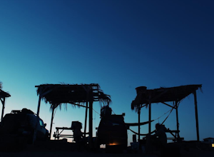
Camp at Puertecitos, Baja
Cross over into Baja via the East crossing and into Mexicali. Head South on the MX Highway 5 past San Felipe (196 KM from the boarder), which is a great stop for tacos FYI, until you reach Puertecitos (282 KM). This little town is a great stop while traveling through the East side of Baja...qui...Read more -
La Paz, Mexico
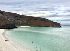
Explore Playa Balandra
Playa Balandra is one of the best beaches in Mexico. It is perfect for chilling on the white, soft sand or swimming in the clear water. There are many sections of beach within the bay, so the beach nearest to the parking lot is usually the most crowded and you will need to take a boat across the ...Read more -
San Francisco Tetlanohcan, Mexico
Climb the Malinche Volcano
5.07 mi / 3674 ft gainTo do so, you have to first get to the city of Huamantla, located in the Tlaxcala state. Once you are there, you must take road 136 and drive 8 miles before taking the exit to Teacalco. After 4 miles there is the Malinzi shelter, where there are many options. You can rent a cabin and eat at its r...Read more -
29.792285,-114.396406, Mexico
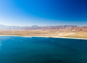
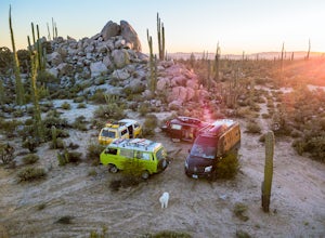
Camp at Bahia San Luis Gonzaga
Bahia San Luis Gonzaga or "Gonzaga Bay" is an absolute treasure and for many it is the first big expansive and empty-feeling section of Baja they reach as they head south down Highway 5. The wide bay is set against a backdrop of massive cacti and features a huge sand spit that leads out to Isla S...Read more -
20.860321,-87.101441, Mexico
Explore Kin-Ha Cenote
A cenote is a a natural sinkhole that appears when bedrock collapses and exposes groundwater beneath. The exposed water can be above ground, or in a series of underground caves and rivers. The Yucatan Peninsula is somewhat known for cenotes, and a trip to the area isn't complete without a swim in...Read more -
Punta Baja, Mexico
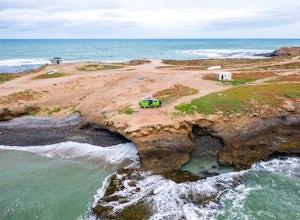
Camp at Punta Baja
Punta Baja is an old fishing camp and (mostly) summertime surf spot at the end of a dirt road about 40 minutes drive south west of El Rosario. Amenities and cel service are almost non-existent. There is a tiny market and restaurant that is rarely if ever open. You can sometimes buy fresh fish, ab...Read more -
29.760430,-114.759446, Mexico
Camp in Cataviña
5.0Cataviña is place unlike any other in Baja and therefor unlike anywhere else in the world. Massive boulder-features akin to Joshua Tree or the Alabama hills are surrounded by deep-cut washes, pinturas rupestres (painted caves), towering tentacle-like boojum, and massive cardon cacti, creating an ...Read more -
Agua de Las Flores, Mexico
Camp at Playa La Gringa, Bahía de Los Angeles
To say that Bahía de Los Angeles is remote is an understatement. It has one gas station, two "restaurants", no cell service, and one absolutely picturesque volcanic island just offshore, Isla Coronado. It is Baja in all its rustic glory.While there are a couple of campos where you can rent a pala...Read more -
Huehuetlán el Grande, Mexico
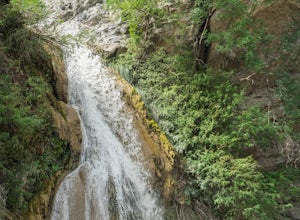
Explore El Aguacate Waterfall
In order to get from the city of Puebla, you have to cross the dam of Valsequillo. Once you have crossed, you must drive to the third town called "El Aguacate". When you're in town you must follow the road and keep you on the left for 4.5 miles, since then you must go out on a dirt road just wher...Read more -
Santa Ynés, Mexico
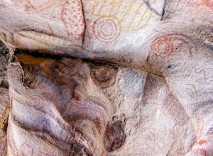
Explore the Ruins & Pinturas Rupestres of Cataviña
5.0Cataviña is one of those places that defies description and is a favorite of all who visit Baja beyond the typical tourist haunts of the border towns and Cabo. It is an almost-alien landscape of massive boulders strewn amongst the world's largest cactus, the cardón, interspersed with the giant te...Read more -
Amecameca, Mexico
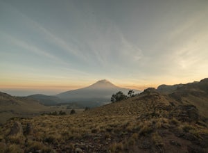
Night Photography at Popocatépetl
To get to the national park Izta-Popo, you must take the federal road "Paso de Cortes" in the direction of San Nicolas de los Ranchos and Santiago Xalitzintla. When you arrive at the park, you have to register at the office and pay a fee of less than two dollars. Once you’ve registered, you have ...Read more -
Mineral del Chico, Mexico
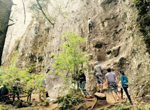
Rock Climb in Las Ventanas
5.0Las Ventanas is an amazing rock climbing spot for beginners and intermediates. It is located in a national park called El Chico. This is in the state of Hidalgo, just one hour and a half drive from Mexico City.Its is very accesible by car, you have to drive as if you where heading to the town El...Read more -
Ciudad de México, Mexico
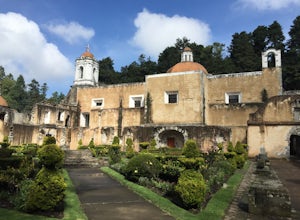
Explore Ex Convento de Los Leones
There are plenty of hiking (and mtn biking) paths that you can take around the convent, but on this adventure we really only saw the Ex Convent itself. The park is good for an entire day trip or weekend trip though (there's camping too). Getting there: Car is the easiest way (if you have a rental...Read more -
Loreto Municipality, Mexico
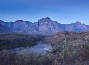
Hike El Tular Canyon in the Sierra de la Gigante Mountains
2.5 mi / 328.1 ft gainMy favorite time to make this hike is just before sunrise. The alpine glow on the range above the cool canyon is a beautiful sight. There is enough time to make the hike and get back before the sun begins to heat the canyon floor, awakening rattlesnakes and Baja's intense midday heat.About 8.5km ...Read more

