Williams, Arizona
Looking for the best photography in Williams? We've got you covered with the top trails, trips, hiking, backpacking, camping and more around Williams. The detailed guides, photos, and reviews are all submitted by the Outbound community.
Top Photography Spots in and near Williams
-
Flagstaff, Arizona
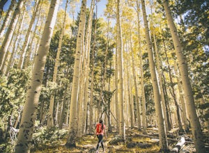
Abineau-Bear Jaw Loop
5.07.04 mi / 2031 ft gainThis trail is slightly more hidden on the northern slope of the San Francisco Peaks, but well worth the drive just outside of Flagstaff. Do it during the last week of September, when summer gives it’s last wave goodbye in a spectacle of electric yellow aspen groves. With the exception of occasion...Read more -
Sedona, Arizona
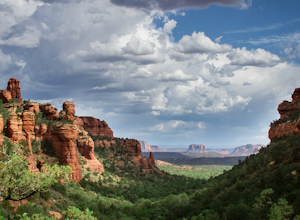
Fay Canyon Trail
3.82.56 mi / 666 ft gainLocated on the outskirts of Sedona's main attractions, Fay Canyon is a hidden gem. The Fay Canyon Trail is an easy, scenic hike that takes you through this lesser-known Sedona canyon. You won't see majestic open views like those of Bell Rock, but you will find gorgeous views, without the crowds. ...Read more -
Sedona, Arizona
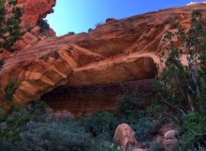
Fay Canyon Arch
4.51.5 mi / 361 ft gain...The hike through Fay Canyon goes 1.25 miles to Box Canyon and is rated easy to moderate. To see Fay Canyon Arch though is a much shorter hike. From Boynton Pass Rd, park at Fay Canyon parking lot. The parking lot offers restrooms and a few picnic tables to relax at. The start of the trail is d...Read more -
Sedona, Arizona
Hike to Bear Mountain
5.06 mi / 2000 ft gainBear Mountain is one of the more difficult hikes in Sedona but has very easy access. There is a parking area between Doe Mountain and Bear Mountain. The trailhead is across the street and the initial approach is very flat. The red rock bluff you first see on the approach is only part of B...Read more -
Sedona, Arizona
Hike the Cockscomb Trail
1.5 mi / 330 ft gainThis is a wonderful less traveled trail that is fairly easy hiking, at least until you reach the base of the Cockscomb. It does not have much shade. I recommend hiking this trail late afternoon into sunset as the trail weaves between Doe Mountain and the Cockscomb on the west side. The setting su...Read more -
Sedona, Arizona
West Fork Trail
5.06.49 mi / 1102 ft gainThis is one of the most beautiful hikes in Sedona, Arizona. It is a fairly easy hike, although it is 6 miles roundtrip. A lot of families come here, and children love to play in the water. There are various stream crossings, but for most of them, you should be able to keep dry. The canyon walls ...Read more -
Sedona, Arizona
Climbing at Oak Creek Canyon
5.0Getting There About 18 miles south of Flagstaff on the 89A, turn into the Cave Springs parking lot and look for the trail just right of the first bridge. Hike up the chossy hill until you reach a giant sandstone slot canyon in the northwest. Climbing This canyon contained the crags, known as the ...Read more -
Sedona, Arizona
Hike to the Birthing Cave
5.02 mi / 291 ft gainThe hike is an easy one, flat and not too long. In the spring you'll see lots of flowers. Note, the popularity of this Sedona cave has grown in the past year, so you will most likely encounter other hikers and mountain bikers. You start from the Long Canyon Trailhead, and I recommend going earl...Read more -
Sedona, Arizona
Brins Mesa - Soldier Pass Loop
5.07.6 mi / 1040 ft gainThis loop starts from Vultee Arch Rd. Important to note that doing this loop from here requires a high clearance 4x4. In this direction, the trail starts off flat and crosses a dry creek bed several times. The trail is relatively easy to follow. This section passes through junipers that offer som...Read more -
Sedona, Arizona
Mescal Mountain Loop
4.59 mi / 453 ft gainThe Mescal Mountain Loop Hike circles Mescal Mesa uses three different trails. Park at the Mescal Trail parking area on Long Canyon Road. The Mescal Trail is 2.4 miles long and winds up to the base of the mesa where it travels along beautiful open slick rock. It is an easy hike but the trail is ...Read more -
Sedona, Arizona
Picnic at Banjo Bill
Nestled in Oak Creek Canyon, and throughout the Red Rock District are several picnic and day-use areas. Popular sites include; West Fork, Red Rock Crossing, Banjo Bill and Grasshopper, which provide unique hiking, creek side picnicking, swimming and fishing opportunities. All Oak Creek Canyon cam...Read more -
Flagstaff, Arizona
Bike along the San Francisco Peaks on Waterline Road
4.020 mi / 3000 ft gainWaterline Road is a closed service road that follows along the southern and eastern slopes of the San Francisco Peaks of Flagstaff, AZ. You will pass through several miles of charred ponderosa pine as well as expansive groves of aspen trees as you make your way to the Inner Basin.The road follows...Read more -
Sedona, Arizona
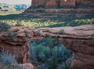
Devil's Bridge Trail
4.63.94 mi / 400 ft gainThe Devil's Bridge is the largest natural sandstone arch in Coconino National Forest and an iconic landmark. If you're visiting the Sedona area, hiking this trail is a must do. The hike: From the trailhead, the hike gradually slopes upward as it winds its way through the trees. The trail is eas...Read more -
6871 Arizona 89A, Arizona
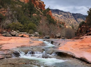
Explore Slide Rock State Park
4.6This beautiful State Park, which is the original location of the Pendley Homestead, is a historic apple farm (the apple trees are still there!). This is a favorite stop for families in the summertime, so if you come then, make sure to arrive early. It’s common to find throngs of people in the cr...Read more -
Flagstaff, Arizona
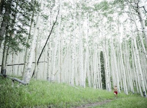
Trail Run in Lockett Meadow
4.8Getting There North of Flagstaff on the 89A, take a left turn directly after a sign for Sunset Crater. This road winds up a well-developed path; when it ends, turn right. After the road banks left, take a right at the next fork and continue on the dirt road up a single lane path until you enter t...Read more -
Sedona, Arizona
Hike the Chimney Rock Loop, Sedona
2 mi / 400 ft gainThis loop hike starts at the Andante Trailhead at the end of Andante Road on the edge of Sedona. From the parking area, turn left (west) onto the Andante Trail and follow it for a short distance until the trail ends on the Thunder Mountain Trail. Turn left and follow the Thunder Mountain Trail un...Read more

