Texas
Looking for the best photography in Texas? We've got you covered with the top trails, trips, hiking, backpacking, camping and more around Texas. The detailed guides, photos, and reviews are all submitted by the Outbound community.
Top Photography Spots in and near Texas
-
San Antonio, Texas
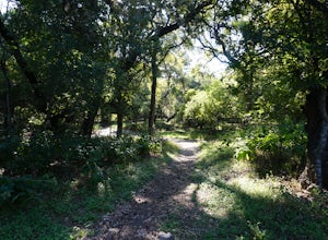
Hike the Mud Creek Loop at McAllister Park
1.5 mi / 181 ft gainI love McAllister Park. Sure it can get a little stinky after the torrential Texas rains sweep through, but on a clear, dry day you can always find a new and LOVELY trail. The Mud Creek Loop (or the Green Loop) is a 1.5 mile dirt trail used by hikers and mountain bikers. The trail itself is rela...Read more -
Big Bend National Park, Texas
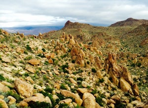
Hike Balance Rock
3.02 mi / 75 ft gainA simple, quiet drive down a dirt road (Grapevine Spring) leads you through desolate landscape until a parking lot sprouts up to your right. From here you can see that a stretch of land sandwiched in a little valley where the trail heads directly east. The trail is easy to follow, just keep yo...Read more -
Austin, Texas
Hike the Mayfield Park Lake Trail
3.01 mi / 0 ft gainMayfield Nature Preserve is a 21-acre park located just west of downtown Austin, Texas. This nature preserve is unique from all other parks in Austin in that it that features free-roaming peacocks. It's a beautiful park full of beautiful nature and the trail leads down near the lake. The trail is...Read more -
Georgetown, Texas
Hike the San Gabriel River Trail
7.6 mi / 498 ft gainThe San Gabriel River trailhead is found within Cedar Breaks Park, just northeast of Georgetown, Texas. The trail is a 7.6 mile moderate out-and-back trail. The trail is heavily trafficked and even more so on weekends. There are several inclines and declines, but nothing too significant. The trai...Read more -
Burnet, Texas
Hike the Inks Lake State Park Trail
4.04.7 mi / 347 ft gainThe Inks Lake State Park Trail is a 4.7 mile loop trail located within Inks Lake State Park, just outside of Burnet, Texas. Only a small portion of the trail follows the lake, then it veers off through the rocky and hilly terrain of the Texas Hill Country. The trail is only partially shaded at ti...Read more -
Marble Falls, Texas
Camp at Shaffer Bend Recreation Area
6 mi / 80 ft gainAfter turning off Highway 1431 you'll drive through a little quiet and narrow one road neighborhood to arrive at the entrance to Shaffer Bend Recreation Area. From there you will drive down a dirt road which will take you almost all the way through Shaffer Bend's 523 acre lot, and lead you direct...Read more -
Fort Davis, Texas
Davis Mountains State Park Loop
4.54.37 mi / 617 ft gainThe majority of the Davis Mountains are privately owned, but the state park is one of the few ways to access it. These mountains are surrounded by the Chihuahuan Desert and is one of three sky islands in Texas. There are many rare plants and species in the Davis Mountains that exist nowhere else....Read more -
Vanderpool, Texas
Hike the Lost Maples West Trail Loop
4.07 mi / 849 ft gainThe Lost Maples West Trail Loop is a 7 mile loop hike that loops around the west portion of Lost Maples State Park. This trail is mostly shaded and offers gorgeous views and scenic overlooks. There are areas for swimming, if desired. Please be advised that there are steep areas and challenging in...Read more -
Austin, Texas
Twin Falls and Sculpture Falls via Barton Creek Greenbelt Trail
3.03.23 mi / 141 ft gainThis hike is about 3.2 miles in total and is an out-and-back trail found within the Barton Creek Greenbelt stretch. The trail follows along the Barton Creek and is popularly known for the two major waterfalls it entails: Twin Falls and Sculpture Falls, which are very popular swimming destinations...Read more -
Liberty Hill, Texas
Hike the Good Water Trail
5.012.6 mi / 1270 ft gainThe Good Water Trail which is part of the larger Good Water Loop, is a 12.6 mile point-to-point hike. This trail is heavily trafficked by both hikers and mountain bikers alike. It's a great trail for scenic views, nature, and wildlife. Please be advised that the trail is severely rocky and uneven...Read more -
El Paso, Texas
Hike to North Franklin Peak
5.08 mi / 2100 ft gainEl Paso is a sprawling city that is remarkably split by the Franklin Mountains. By driving up the Transmountain Road you can get a view of city, but stopping at Franklin State Park and climbing the North Franklin Mountain Peak you can top the city! To start, enter Franklin State Park and pay the ...Read more -
Round Mountain, Texas
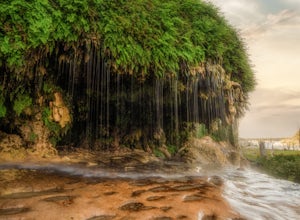
Explore Westcave Outdoor Discovery Center
0.7 mi / 80 ft gainLocated about 25 miles from downtown Austin, Westcave Preserve is a beautiful and family-friendly day adventure. The trail is out-and-back about .7 miles long. It leads down into a very lush green canyon filled with a variety of plant species and ferns. At the end of the trail is the main feature...Read more -
Heard Natural Science Museum & Wildlife Sanctuary, Texas
Hike at Heard Natural Science Museum & Wildlife Sanctuary
2 miWalking the trails at the Heard is different each time. There are seasonal surprises along each trail ranging from trout lilies in the early spring to eryngo in the fall. Plus, I never know when I'll spot a bobcat or other wildlife living out in the sanctuary.Read more -
Austin, Texas
Swim at Gus Fruh
4.00.26 mi / 79 ft gainThe trailheads are located in neighborhoods and parking isn't really too much of an issue. The shortest entrance is located off Barton Hills Dr. A quick google search and you will find it and the labeled trail. You walk down into the Barton Creek Green Belt and your spirits are uplifted. That cra...Read more -
El Paso, Texas
Upper Sunset Trail
5.02.81 mi / 581 ft gainThe trick to this view is that the park gate closes at 5 pm. Therefore you have two options: Option 1Park at the entrance of the park (outside of the gate) and hike into the park. From there walk along the road to the park entrance ($5 entrance fee) and continue to the first left road ...Read more -
Austin, Texas
Bull Creek South to North
3.67 mi / 335 ft gainThe Bull Creek Trail is an Out-and-Back trail along Bull Creek; it's a pretty beginner to intermediate hike. The trail follows along Bull Creek which runs between the hills of the Austin Hill Country. There are several waterfalls which can be found along the creek. The trail has multiple access p...Read more

