Sierra Nevada, California
Top Spots in and near Sierra Nevada
-
Wawona, California
4.0
3.98 mi
/ 750 ft gain
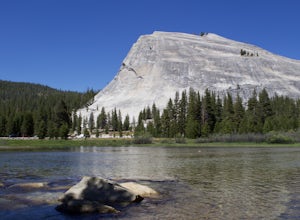
Lembert Dome may seem impossible to scale when observing it from the trailhead, but it is actually a relatively easy hike up to the summit. It is by far the best way to see and admire Tuolumne Meadows, not to mention the granite top, which is a wonderland to explore.
There are a few ways to reac...
Read more
-
Tuolumne County, California
Lembert Dome stands out clearly as it is right along the road with a fairly large parking lot, about 1/4 mile past the Toulumne Store. There are multiple routes on this dome and for detail on all climbs, pick up the Tuolumne Free Climbs climbing guide. The area around this dome is gorogeous with ...
Read more
-
YOSEMITE NATIONAL PARK, California
4.7
14.14 mi
/ 1700 ft gain
The Young Lakes trail starts from the Lembert Dome parking area and then winds up around 6 miles into the high country past alpine meadows and stunning views of the surrounding mountains. Lower and Middle Young Lakes are beautiful, but you're going to want to push on to Upper Young Lake, where y...
Read more
-
YOSEMITE NATIONAL PARK, California
5.0
19.03 mi
/ 5400 ft gain
This trip is best done as a 3 day, 2 night backpacking trip making camp at Young Lakes, however it is possible to do it in a single day long haul.
Start at the Lembert Dome Parking Lot and take the trail via the Dog Lake route towards Young Lakes. It's about 7 miles to the upper of the three You...
Read more
-
YOSEMITE NATIONAL PARK, California
3.0
3.71 mi
/ 740 ft gain
This 3.7 mile roundtrip hike begins at the center of Tuolumne Meadows (shuttle stop #2) at the Lembert Dome/Glen Aulin trailhead parking lot. There are restrooms and picnic tables at the east side of the lot, there you will also find the trailhead to Dog Lake.
The trail begins at 8,500 ft and c...
Read more
-
Lee Vining, California
From Highway 120 (Tioga Road) you can park at the lot just above Tioga Lake. Another mile up the road is the Yosemite entrance, so if you hit that, you've gone too far. Follow the trail around the south side of the lake and into Glacier Canyon. After about 2 miles you'll start scrambling on the N...
Read more
-
Bear Valley, California
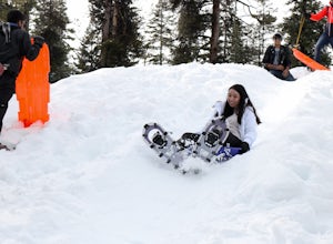
Bear Valley is a family friendly destination for snowshoeing and snow play. There are numerous trails to explore while snowshoeing. Don't be afraid to take a break and start a snowball fight! There are shops located near the resort to rent snowshoes and other snow play accessories.
There are s...
Read more
-
Bear Valley, California
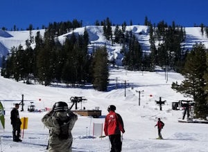
Bear Valley is nestled in the high Sierra between Yosemite and Lake Tahoe. It is a popular destination for families and nature lovers. It boasts 1,900 vertical feet over 1680 acres for skiing and snowboarding.
Winter is a popular time at Bear Valley. Most visitors come to ski or snowboard, but...
Read more
-
YOSEMITE NATIONAL PARK, California
Tuolumne Meadows at an elevation of 8,619 feet exemplifies the high country of the Sierra Nevada, with its sweeping sub-alpine meadows, granite domes, summer wildflowers and meandering rivers. When the forest opens up park along the side of the road and find a trail. There are also plenty of near...
Read more
-
YOSEMITE NATIONAL PARK, California
Before you head out for the trip, you’ll need to get a wilderness permit. You can get one online from the Yosemite website or pick one up at the Tuolumne Meadows Wilderness Center or from the Wilderness Center in Yosemite Valley.
Go to Yosemite and take Highway 120 up to Tuolumne Meadows. You ca...
Read more
-
37.876736,-119.346085
4.8
12.19 mi
/ 600 ft gain
Start your hike to this waterfall oasis in the heart of the sierra at the parking lot for the Tuolumne Meadows Visitor Center. The Glen Aulin High Sierra Camp sits along the beautifully winding Tuolumne River. White Cascade an 80ft waterfall sits at the edge of camp and provides an excellent swim...
Read more
-
Tuolumne County, California
Tuolumne Meadows is on Tioga road northeast of Yosemite Valley, at elevation 8,600 feet. Sites are available July-September at $26. Dogs are allowed but be sure to pack the leash! More info: https://www.nps.gov/yose/plany...
Read more
-
Tuolumne County, California
Head to any Yosemite wilderness station for a map, bear canister, and permit for Nelson Lake. The trail itself starts in the Tuolumne Campground at Elizabeth Lake trailhead. Follow the trail 2.2 miles up to Elizabeth Lake and remember the lake itself is in a no-camping zone, so you must continue ...
Read more
-
Twain Harte-Tuolumne City, California
5.0
4.89 mi
/ 3120 ft gain
There's something special about the landscape that Yosemite National Park offers, and the scenery around Mount Dana is no different.
The trail begins at the Tioga Gate entrance to Yosemite with the trailhead at the north end of the small parking lot south of the gate. It winds through the ponds,...
Read more
-
Tuolumne County, California
The main trail to the Middle Gaylor Lake is about 1.5 miles round-trip, but if you’re looking for more adventure, you can hike a little further to Upper Gaylor Lake (which will add a mile to your trip) or continue on to the Great Sierra Mine (which will add 2 miles to your trip). The Gaylor Lake...
Read more
-
Mariposa County, California
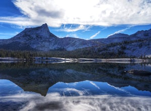
Make the .75 miles detour off of the John Muir Trail to reach this spot and you won't regret it. Lower Cathedral Lake is typically less populated than nearby Upper Lake and has some of the mot beautiful scenery on the JMT. Sunrise and sunset with the reflection of Cathedral Peak on the glassy wat...
Read more

