Mariposa County, California
Mariposa, California is a top spot for getting outdoors. With its scenic trails, top-notch activities and must-visit attractions, it is the perfect spot for an outdoor adventure. The best trails and activities in and near the area include hiking, biking, kayaking, fishing, and camping. There are also plenty of attractions to explore such as Yosemite National Park, Mariposa Grove of Giant Sequoias, and the Mariposa County Fairgrounds. Whether you're looking for a relaxing day trip or an exciting outdoor experience, Mariposa has something for everyone.
Top Spots in and near Mariposa County
-
Mariposa County, California
Sentinel Dome and Taft Point Loop
5.05.17 mi / 1076 ft gainSENTINEL DOME & TAFT POINT TRAILHEAD: About an hour drive from Yosemite Valley campgrounds. This trailhead is an intersection of the starting point of the Taft Point trail and Sentinel Dome trail. It is a short walk (and visible) from the parking lot. In doing both trails, it would be an esti...Read more -
Mariposa County, California
Sentinel Dome Trail
5.02.15 mi / 400 ft gainOne of the most popular places in Yosemite for sunset is Glacier Point, but by walking one mile from the trailhead, the crowds quickly dissipate. Sentinel Dome is great for all ages since the trail is short and not too steep. Park at the Sentinel Dome trailhead, about 3 miles from the end of Glac...Read more -
YOSEMITE NATIONAL PARK, California
Taft Point
4.92.35 mi / 200 ft gainTaft Point is such an amazing and different view of the Yosemite Valley. If you're lucky and you time it right, you'll also experience complete solitude. While driving Glacier Point Road, just a few minutes before arriving at Glacier Point, you'll see a parking lot for the Taft Point Trailhead. ...Read more -
Yosemite Village, California
Witness Yosemite's Firefall
5.00.1 mi / 0 ft gainOver 5 million visitors flock to Yosemite National Park in California's Sierra Nevada Mountain Range every year to take in the geological splendor. While most visitors get to see the park's waterfalls, very few ever get to witness the Firefall. For two weeks between mid-late February, a small wat...Read more -
Mariposa County, California
Glacier Point via Four Mile Trail
5.09.59 mi / 3200 ft gainGlacier Point is one of the highlights of Yosemite. The point is located at the end of Glacier Point Road. This viewpoint allows you to survey the entire Yosemite Valley and gives the viewer a captivating sight of Half Dome. It's a little bit of a tourist trap (especially during the summer season...Read more -
Mariposa County, California
Hike to Union Point via Four Mile Trail
6 mi / 2332 ft gainFour Mile Trail is steep, but hikers efforts are more than rewarded. Union Point sits above Yosemite Valley at 6,332 feet - offering sweeping views of El Capitan and the valley entrance to the left, and North Dome / Half Dome & Clouds Rest to the right. You can also see Yosemite Falls straigh...Read more -
Mariposa County, California
Camp at Glacier Point
4.79.17 mi / 3491 ft gainEveryone that knows Yosemite, knows Glacier Point. An overlook that attracts thousands of people per day that drive up via Glacier Point Road is rarely vacant of the hustle and bustle of people. However, there is a loop hole here, and when the stars align you can have Glacier Point ALL to yoursel...Read more -
Mariposa County, California
Four Mile Trail to Panorama Trail Loop
5.016.03 mi / 5177 ft gainFour Mile Trail to Panorama Trail Loop is a loop trail that takes you by a waterfall located near Yosemite Valley, California.Read more -
Mariposa County, California
Backpack to Clouds Rest from Glacier Point
4.023.85 mi / 6942 ft gainStart from Glacier Point around 7,200 feet leaving on the Panoramic Trail. Head down 2 miles to Illilouette Falls (5,800 feet). Once you cross the bridge at Illilouette Falls you go up Panorama Point and head back down to Nevada Falls (5,971 feet). Once you reach Nevada Falls fill up on as much w...Read more -
Yosemite Valley, California
Photograph Yosemite Falls at Swinging Bridge
5.0This is a drive up and shoot adventure in winter. The spot is at Swinging Bridge area. This area is also a picnic area and hiking trail but, in my opinion, the best spot to capture Yosemite Falls is a few steps walk after you park the car. One of not so many places that you still can go in winte...Read more -
Yosemite Village, California
Watch the Sunset in El Capitan Meadow
After entering the park, keep driving the loop until you get onto Northside Drive, and then park once you are right below El Capitan (the 3,000ft granite monolith that is very hard to miss).Once you've parked, grab a blanket, snacks, and a beverage. With these items in hand, walk over to the eas...Read more -
YOSEMITE NATIONAL PARK, California
Illilouette Falls in Yosemite National Park
4.55.07 mi / 1400 ft gainThe hike begins at Glacier Point. Find the marker for the Panorama Trail just beyond the viewing steps (to the right, if you’re looking at Half Dome). The first section of the hike will be lined with open views of Half Dome, Vernal Falls and Nevada Falls. It will be hard not to stop to listen ...Read more -
Mariposa County, California
Photograph Yosemite's Half Dome at Glacier Point
4.7Glacier Point gives you a classic view of Half Dome and Yosemite Valley. You can get a different perspective of Half Dome if you jump on any of the trails heading out of Glacier Point. Illilouette Falls trail gives you a different view of Half Dome. This trail is around 4-5 miles round trip fro...Read more -
Mariposa County, California
Stargaze and Photograph the Night Sky at Glacier Point
5.0The summer months of June, July, and August tend to provide the best views of the stars, and particularly in August during the meteor showers. Amateur astronomers often gather on Saturdays during the summer, and provide first hand knowledge and guidance. Glacier Point can accommodate hundreds of ...Read more -
Mariposa County, California
Reverse Summit of Glacier Point in Yosemite National Park
4.517 mi / 6100 ft gainYosemite's Panorama Trail is undoubtedly one of the most scenic and worthwhile trails in the entire national park. The stretch that reaches from the valley floor to the top of Glacier Point involves 8.5 miles and a monumental amount of elevation gain. If you want to see the entire stretch of trai...Read more -
YOSEMITE NATIONAL PARK, California
Hike to Eagle Peak via Rockslides Trail
4.016.07 mi / 5568 ft gainA Yosemite Valley trip in May has tourist filled buses, noisy car alarms, and crowded trails written all over it. Thus, I wanted to avoid the beaten path. Looking into possible destinations, John Muir once said in regards to Eagle Peak, "where the most comprehensive of all the views to be had on ...Read more
Top Activities
Camping and Lodging in Mariposa County
YOSEMITE NATIONAL PARK
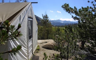
High Sierra Camps
Imagine all the joy of backpacking without the burden of a heavy backpack filled with tents and cooking gear. That’s the appeal of the Yo...
From $152 / night
Yosemite Valley, California
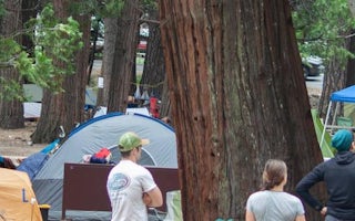
Camp 4
Overview
Beginning September 16, Camp 4 will return to first-come, first-served camping (the daily lottery will be closed during this per...
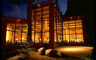
9006 Yosemite Lodge Drive
Yosemite Valley Lodge
Yosemite Valley Lodge is a favorite choice for families and large groups. Its close proximity to Yosemite Falls makes it the perfect base...
From $219 / night
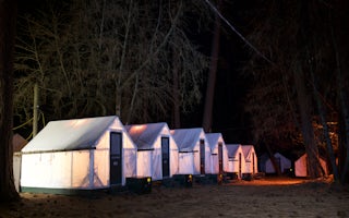
Yosemite Valley, California
Curry Village
Beneath the grandeur of Glacier Point, Curry Village is known for the same warm, hospitable feeling that was instilled by its founders, D...
From $90 / night


