Ansel Adams Wilderness, California
Top Spots in and near Ansel Adams Wilderness
-
Mammoth Lakes, California
5.0
9.76 mi
/ 2026 ft gain
Park at the Sherwin Lakes Trailhead. Begin your ascent through scrubby foliage and old pines. Once you arrive at a junction with a bench, turn around. Note that the uphill climb is pretty decent past Sherwin Lakes, so if you're feeling overly winded after the arriving at these lakes, this may be...
Read more
-
37.876736,-119.346085
4.8
12.19 mi
/ 600 ft gain
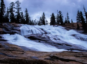
Start your hike to this waterfall oasis in the heart of the sierra at the parking lot for the Tuolumne Meadows Visitor Center. The Glen Aulin High Sierra Camp sits along the beautifully winding Tuolumne River. White Cascade an 80ft waterfall sits at the edge of camp and provides an excellent swim...
Read more
-
Tuolumne County, California
Tuolumne Meadows is on Tioga road northeast of Yosemite Valley, at elevation 8,600 feet. Sites are available July-September at $26. Dogs are allowed but be sure to pack the leash! More info: https://www.nps.gov/yose/plany...
Read more
-
Tuolumne County, California
Head to any Yosemite wilderness station for a map, bear canister, and permit for Nelson Lake. The trail itself starts in the Tuolumne Campground at Elizabeth Lake trailhead. Follow the trail 2.2 miles up to Elizabeth Lake and remember the lake itself is in a no-camping zone, so you must continue ...
Read more
-
YOSEMITE NATIONAL PARK, California
Tuolumne Meadows at an elevation of 8,619 feet exemplifies the high country of the Sierra Nevada, with its sweeping sub-alpine meadows, granite domes, summer wildflowers and meandering rivers. When the forest opens up park along the side of the road and find a trail. There are also plenty of near...
Read more
-
YOSEMITE NATIONAL PARK, California
Before you head out for the trip, you’ll need to get a wilderness permit. You can get one online from the Yosemite website or pick one up at the Tuolumne Meadows Wilderness Center or from the Wilderness Center in Yosemite Valley.
Go to Yosemite and take Highway 120 up to Tuolumne Meadows. You ca...
Read more
-
YOSEMITE NATIONAL PARK, California
5.0
19.03 mi
/ 5400 ft gain
This trip is best done as a 3 day, 2 night backpacking trip making camp at Young Lakes, however it is possible to do it in a single day long haul.
Start at the Lembert Dome Parking Lot and take the trail via the Dog Lake route towards Young Lakes. It's about 7 miles to the upper of the three You...
Read more
-
YOSEMITE NATIONAL PARK, California
3.0
3.71 mi
/ 740 ft gain
This 3.7 mile roundtrip hike begins at the center of Tuolumne Meadows (shuttle stop #2) at the Lembert Dome/Glen Aulin trailhead parking lot. There are restrooms and picnic tables at the east side of the lot, there you will also find the trailhead to Dog Lake.
The trail begins at 8,500 ft and c...
Read more
-
YOSEMITE NATIONAL PARK, California
4.7
14.14 mi
/ 1700 ft gain
The Young Lakes trail starts from the Lembert Dome parking area and then winds up around 6 miles into the high country past alpine meadows and stunning views of the surrounding mountains. Lower and Middle Young Lakes are beautiful, but you're going to want to push on to Upper Young Lake, where y...
Read more
-
Tuolumne County, California
Lembert Dome stands out clearly as it is right along the road with a fairly large parking lot, about 1/4 mile past the Toulumne Store. There are multiple routes on this dome and for detail on all climbs, pick up the Tuolumne Free Climbs climbing guide. The area around this dome is gorogeous with ...
Read more
-
Wawona, California
4.0
3.98 mi
/ 750 ft gain
Lembert Dome may seem impossible to scale when observing it from the trailhead, but it is actually a relatively easy hike up to the summit. It is by far the best way to see and admire Tuolumne Meadows, not to mention the granite top, which is a wonderland to explore.
There are a few ways to reac...
Read more
-
Tuolumne County, California
The main trail to the Middle Gaylor Lake is about 1.5 miles round-trip, but if you’re looking for more adventure, you can hike a little further to Upper Gaylor Lake (which will add a mile to your trip) or continue on to the Great Sierra Mine (which will add 2 miles to your trip). The Gaylor Lake...
Read more
-
Twain Harte-Tuolumne City, California
5.0
4.89 mi
/ 3120 ft gain
There's something special about the landscape that Yosemite National Park offers, and the scenery around Mount Dana is no different.
The trail begins at the Tioga Gate entrance to Yosemite with the trailhead at the north end of the small parking lot south of the gate. It winds through the ponds,...
Read more
-
37.872112,-119.370472
Waterwheel Falls may be the most unique waterfall in Yosemite. During high waterflow an extraordinary phenomenon appears as the raging water hits a series of ledges creating a plume, this coupled with strong gust blowing upward create cyclical "waterwheel" effect hence the name.
On a good day th...
Read more
-
Tuolumne County, California
5.0
27.56 mi
/ 2953 ft gain
Donohue Pass lies on the border of Yosemite National Park and the Ansel Adams Wilderness. Both the John Muir Trail (JMT) and the Pacific Crest Trail (PCT) route through this pass at 11,056 ft.
A challenging but beautiful hike that starts from Tuolumne Meadows and follows the JMT for 12.5 miles t...
Read more
-
Tuolumne County, California
5.0
16.6 mi
/ 1400 ft gain
Starting at the Tuolomne Meadows Visitor Center you will head south to jump on the John Muir Trail, move east for 2.8 miles on the JMT until the trail intersects with the Vogelsang High Sierra trailhead, you head south when you reach this trail. Once you hit the Vogelsang trail you are 5.5 miles ...
Read more

