Ansel Adams Wilderness, California
Top Spots in and near Ansel Adams Wilderness
-
Dyer, Nevada
5.0
10.4 mi
/ 4000 ft gain
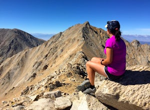
Boundary Peak received its name because it straddles the border of California and Nevada. While technically in Nevada, just a few hundred feet away lies its taller neighbor Montgomery Peak (13,442') in California. Many people bag both peaks at once, but the rotten rock and unstable trail make Mon...
Read more
-
Bishop, California
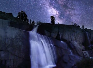
The basic part of this adventure is a backpack to Sailor Lake. From there you can enjoy small dayhikes to the nearby lakes or waterfalls, go fishing, enjoy some photography or just lounge in camp and gaze at the beautiful scenery. Although Sailor Lake looks smaller than the nearby lakes it stil...
Read more
-
Bishop, California
With so many famous hiking trails in the Sierras, its hard to find a trail as isolated as the Piute Pass Trail. This trail allows you to hike in the John Muir Wilderness, Inyo National Forest, and Sierra National Forest in one 20 mile section of trail. You will encounter amazing wilderness, spect...
Read more
-
Bishop, California
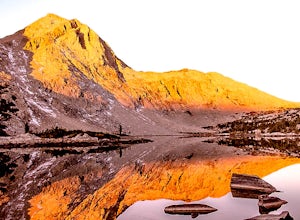
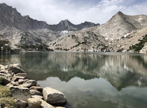
Gorgeous and sizable alpine lakes beyond Blue Lake via Sabrina Basin trail.
There are some very confusing descriptions on the internet for this so hopefully this can help. Hike for 3 miles to get to Blue Lake, which is huge and a popular camping spot for backpackers. Continue past the lake (it ...
Read more
-
Bishop, California
If you are considering this hike, then I am sure you are already familiar with the undeniable beauty that the Eastern Sierra radiates. Any season, any time- it is there. One of my particular favorites for a day hike to experience this beauty is the trek to Emerald Lake outside of Bishop.From Bish...
Read more
-
Mono County, California
4.0
7.44 mi
/ 1385 ft gain
Situated on the eastern edge of Emigrant Wilderness, Leavitt Lake is a great introduction to backpacking in the Sierra Nevada. Leavitt Lake is located at the end of Forest Service Route 077 off of Highway 108. It is actually possible to drive to Leavitt Lake, but a high clearance vehicle is requi...
Read more
-
Pinecrest, California
This trip begins at ~7500 feet at the Box Springs Trailhead This trail is at the end of Forest Route 3N20Y. The trail, which is not regularly maintained and may at times be hard to follow, initially descends slightly to 7300', then stays mostly flat before rising just before the lakes. You will p...
Read more
-
Bishop, California
Directions
The trailhead for Long Lake starts by South Lake outside Bishop, CA. You'll want to take Line Street, which is the 168, West out of Bishop. Approximately 14 miles up, you'll want to merge left towards South Lake. This junction is well-signed if you keep an eye out for it. Head th...
Read more
-
Bishop, California
Directions This Bishop Pass Trail starts by South Lake outside Bishop, CA. You'll want to take Line Street, which is the 168, West out of Bishop. Approximately 14 miles up, you'll want to merge left towards South Lake. This junction is well-signed if you keep an eye out for it. Head the rest ...
Read more
-
Bishop, California
Drive up to the trailhead near South Lake from the town of Bishop (you can get directions at the Ranger Station when you get a permit). The hike goes from approximately 9,000 ft. to 13,000 ft. over the course of 9 miles.The first approximately 6 miles are on trail to the top of Bishop Pass. From ...
Read more
-
Bishop, California
Bishop Pass Trail to John Muir Trail to Piute Trail is a point-to-point trail that takes you by a lake located near Bishop, California.
Read more
-
Bishop, California
5.0
5.79 mi
/ 1375 ft gain
The Treasure Lakes Trail is dog and kid friendly, just make sure all parties can handle the elevation gain. The scenery throughout the entire hike is amazing, and early in the summer, the creeks roar. The lake is perfect for cooling off on a hot summer day. The trail is best used in the summer an...
Read more
-
Bishop, California
It’s been called the crown jewel of the Sierra Nevada, the highlight of the entire 211-mile John Muir Trail. Whatever superlatives are used to describe it, Evolution Basin is undoubtedly one of the most incredible landscapes you’ll ever explore. There is a small catch, though: There is no easy ...
Read more
-
Bishop, California
5.0
11.13 mi
/ 2165 ft gain
To get to the hike drive twenty miles west from the town of Bishop, California up Hwy 168 to South Lake. There are two parking lots but make sure to get there early because later in the day it's harder to get a spot.
The trail starts from South Lake at an an elevation of 9,750 feet. Initially ...
Read more

