Banff National Park, Alberta
Looking for the best photography in Banff National Park? We've got you covered with the top trails, trips, hiking, backpacking, camping and more around Banff National Park. The detailed guides, photos, and reviews are all submitted by the Outbound community.
Top Photography Spots in and near Banff National Park
-
Improvement District No. 9, Alberta
Drive the Icefields Parkway
5.0145.45 mi / 6293 ft gainThe Icefields Parkway has been named One of the World's Most Scenic Drives by National Geographic and with all the scenic hikes, stops, and viewpoints, it's easy to see why. Starting at Lake Louise, a friend and I decided to drive up the Icefields Parkway which goes through Banff National Park i...Read more -
Improvement District No. 9, Alberta
Bike the Icefields Parkway
The Icefields Parkway is a spectacular highway to ride (you can see the short video here). The shoulders are wide and well paved. Drivers are typically courteous, slowing down and giving you space as they pass, making the ride a great deal more enjoyable. Starting in Jasper you load up your bike,...Read more -
Improvement District No. 9, Alberta
Moraine Lake
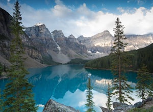
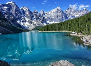
4.8Showing up at Moraine Lake before dawn is a must as to avoid the multitude of tours busses. The morning sun is subtle and magical. The lake, being glacially fed, does not reach its crest until mid to late June. When it is full, it reflects a distinct shade of blue. The color is due to the refract...Read more -
Eldon, Alberta
View the Castle Mountain Lookout
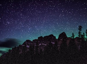
Castle mountain, so named for its fortress-like shape, is a quick hop away from the town of Banff. If you don't have time to hike to Rockbound Lake (at the base of Castle), head to the viewpoint just off of Highway 91 and snap some pictures of this epic mountain. Drive north for about 10 minutes...Read more -
Lake Louise, Alberta
Plain of Six Glaciers
4.68.96 mi / 1565 ft gainStarting from the parking lot on the east end of Lake Louise, there are a few options you can take to get to the Plain of Six Glaciers. One is to head directly along the lakeshore trail, and in about 7 km (4.2 miles) you will be at the lookout offering the best vantage point of the glacier field....Read more -
Lake Louise, Alberta
Hike Fairview Mountain
7.1 mi / 3280.8 ft gainFairview Mountain is a non-technical objective alpine summit located on the south side of Lake Louise. It's trailhead is accessed from the Lake Louise parking lot. The trail is well established and well marked throughout. You can expect a distance of about 11km return and elevation gain of 1000m,...Read more -
Lake Louise, Alberta
Hike to the Lake Louise Overlook
5.02 mi / 500 ft gainThis is a fairly steep, short hike that gives you a great view of Lake Louise. The hike begins right behind the canoe rental shop on the South side of the lake. The trail is very easy to follow and there are quite a few people that hike it. The hike is an hour and half round trip. The hike leads...Read more -
Lake Louise, Alberta
Hike to Big Beehive
5.06.2 mi / 1710 ft gainThe hike to Big Beehive begins at the base of Lake Louise. From the parking lot, hike along the paved trail on the northeastern shore of Lake Louise. The Fairmont Chateau Hotel will be to your right with the lake to your left. Continue toward the junction for the Lake Agnes Trail. Keep right t...Read more -
Improvement District No. 9, Alberta
Devil's Thumb Scramble
7.09 mi / 2575 ft gainPark in the visitor parking lot at the Chateau Lake Louise parking lot in time for sunrise at Lake Louise...not to be missed! Then follow the pathway to the right around the lake to the Lake Agnes turnoff (well marked, with a small bronze statue at the intersection.) The waterfall is just befor...Read more -
Lake Louise, Alberta
Exploring Lake Louise
4.6Lake Louise is one of the most photographed lakes in Canada, with reason. Many tourist walk the paved path round and head home. They miss out though. Hiking to the various tea houses surrounding the lake is a must. An easy 2 mile hike from the lake lies a tea house perched on a hill in a tight ci...Read more -
Lake Louise, Alberta
Hike to the Devils Thumb
5.0Park in the main Lake Louise parking lot. Be sure to have purchased your Park Pass. These can be purchased as you enter Banff National Park, or at the Banff and Lake Louise Information Centers. Follow the paved path along the lake shore in front of the Hotel, Chateau Lake Louise. At 0.8 km you wi...Read more -
Improvement District No. 9, Alberta
Scramble up Mount Niblock
5.09.3 mi / 4068.2 ft gainThousands of tourists flock to Lake Louise and Lake Agnes every year (maybe even every month) and by scrambling Mount Niblock you'll see the same magnificent sites while leaving the crowd behind and seeing so much more!Mount Niblock offers a bit of a challenge in that there are some rock ribs tha...Read more -
Improvement District No. 9, Alberta
Hike to Silverton Falls
1.2 mi / 120 ft gainStarting at the Rockbound Lake trailhead you will want to follow the flat dirt path straight, until you see the junction in the road with the sign pointing you to Silverton Falls (it will be about 500 steps or a quarter of a mile). We made the mistake of taking the first junction which lead us to...Read more -
Improvement District No. 9, Alberta
Snowshoe to Rockbound Lake
3.011 mi / 2460 ft gainThis is an amazing trail, but not for the feint of heart!The trailhead is located on the Bow Valley Parkway (Highway 1A) in Banff National Park, AB at the Castle Mountain sign. The trailhead is marked by an information sign in the north of the parking lot and the trail initially heads north - not...Read more -
Improvement District No. 9, Alberta
Scramble the Tower of Babel
4.01.94 mi / 1726 ft gainStarting at the Moraine Lake parking lot follow the trail East along behind the large pile of boulders along the lake shore. Once you reach the foot of the Tower of Babel scramble up the slope to heading towards the valley between the two peaks. The easiest route is along one of the cliff faces w...Read more -
Improvement District No. 9, Alberta
Eiffel Lake via Valley of Ten Peaks
5.07.35 mi / 1647 ft gainHike with amazing views of Valley of Ten Peaks, including Mount Fay (10,613 ft), Mount Little (10,131 ft), Deltaform Mountain (11,234 ft), and Wenkchemna Peak (10,401 ft) to two breathtaking glacial lakes in the heart of the Continental Divide. From the lake, the trail is quite easy to follow, a...Read more

