Canyonlands National Park, Utah
Looking for the best photography in Canyonlands National Park? We've got you covered with the top trails, trips, hiking, backpacking, camping and more around Canyonlands National Park. The detailed guides, photos, and reviews are all submitted by the Outbound community.
Top Photography Spots in and near Canyonlands National Park
-
Moab, Utah
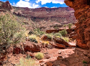
Hike the Gooseberry Trail in Canyonlands
4.04.2 mi / 1548 ft gainThis hike will take your breath away—literally. You will experience stunning views of Canyonlands National Park while literally stepping down the side of a cliff. Once you get to the valley floor, continue on to the smaller cliffs of the White Rim. To get there, follow Grand View Point Road down ...Read more -
Moab, Utah
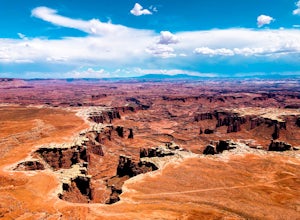
Hike the White Rim Overlook
3.01.8 mi / 160 ft gainIf you're entering Canyonlands from the north (Island in the Sky side), don't miss this quick hike! This hike is fairly level the entire way and not too long—perfect for kids. Follow Grand View Point Road down towards the middle of the park, then turn left at the sign for the White Rim Overlook. ...Read more -
Moab, Utah
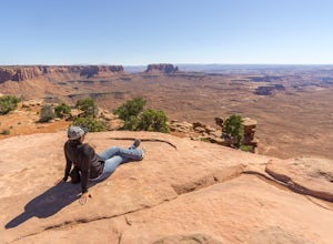
Hike to Murphy Point
4.33.4 mi / 320 ft gainMurphy Point, found in the Island In The Sky district of Canyonlands NP, takes hikers on a mesa that ends at an overlook with sweeping vistas over Murphy Basin, the White Rim, and Green River. If you're looking to get away from the tourists, then head to this quiet and often overlooked trail.The ...Read more -
Moab, Utah
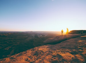
Catch a Sunset at Green River Overlook
4.5Turn right on Highway 313 after Mesa Arch Trailhead and follow the road past Willow Flat Campground to Green River Overlook. Park at the parking lot. Climb over the railing onto the rock edge. Sit and breathe in that desert wind and distant sun. Simple as that.I recommend camping at Willow Flat t...Read more -
Moab, Utah
Hike the Aztec Butte Trail
4.52 mi / 500 ft gainThe Aztec Butte Trail is a two pronged out and back trail for a total of two miles. The trail is single track and easy to follow. After a third of a mile the trail splits. To the left, a trail takes you to the top of a small mesa. There is an informative sign marking the way. On the other side of...Read more -
Moab, Utah
Night Photography at Mesa Arch
5.0From the parking lot, the hike is a .6 mile loop (20-30 min hike round trip). It took 10 minutes to get to the Arch. I arrived at 2am and hiked to the Arch to get some Milky Way shots, definitely arrive earlier to shoot the stars. I explored around when I got to the Arch and came up with a bunch ...Read more -
Moab, Utah
Mesa Arch
4.50.74 mi / 164 ft gainThis is an easy 0.6 mile loop. The hike takes you out to Mesa Arch, which is one of the most famous structures of Canyonlands National Park. If you're out with your camera, you can get amazing shots of the arch with the rugged canyon as your backdrop. Some of the best photos of the arch are at s...Read more -
Moab, Utah
Backpack the Lathrop Canyon Trail in Canyonlands
18 mi / 2130 ft gainAccess to this trailhead is a few miles south of the Islands in the Sky Visitor Center in Canyonlands National Park. An easy drive from Moab or Interstate 70. Remember to get permits and check in with the rangers if camping. If just doing a day hike then no permits are needed. REMINDER: There is ...Read more -
Moab, Utah
Upheaval Dome Overlook
4.01.21 mi / 200 ft gainUpheaval Dome is a geologic structure whose origins have remained hotly debated for years. Some scientists say it is the site of a meteorite impact while others theorize it is nothing more than a naturally occurring salt dome. No matter what the true answer is, there is no question that this shor...Read more -
Moab, Utah
Syncline Loop in Canyonlands NP
5.07.87 mi / 1955 ft gainBe advised, the NPS signs and maps that warn of a very difficult hike ahead are not hyperbole, as I thought at first. This hike is a loop around the famous Upheaval Dome on an unmaintained trail that leads you down over 1500 feet into the canyon, close to the Green River, then climbs back up 1500...Read more -
Moab, Utah
Hike the Neck Spring Trail
5.8 mi / 260 ft gainWith minor changes in elevation, a couple easy scrambles and the opportunity to find your route by cairns, the Neck Spring Trail is the perfect way to get acquainted with Island in the Sky area of Canyonlands National Park.Starting at the Shafer Canyon Overlook parking lot, the Neck Spring trail ...Read more -
Monticello, Utah
Explore Big Spring Creek Overlook
This overlook is at the end of the scenic drive in the Needles District of Canyonlands National Park. Once you step away from your vehicle the world sort of drops out below you into Big Spring Canyon. Just a short walk from the car takes you to some fantastic formations. Visitors can begin the hi...Read more -
Monticello, Utah
Explore Needles Overlook
About 1.5 hours from Moab on BLM land, Needles Overlook sits on a peninsula of rock 1600 ft. above southern Canyonlands NP. The views from here are just as commanding as Island in the Sky in Canyonlands, but with a lot fewer people due to its isolated location; there's a good chance you'll have ...Read more -
Moab, Utah
Capture Sunrise at Dead Horse Point SP
5.0Dead Horse Point State Park sits next to Canyonlands National Park with expansive views of the canyons carved by the Colorado River. The park can be accessed year-round and the best views are within feet of the parking lot. To capture the warm light of sunrise on the red rocks, head for the wes...Read more -
Monticello, Utah
Camp at Squaw Flat Campground
3.0Squaw Flat campground is an easily-accessed area full of picturesque campsites in Canyonlands National Park, Utah. It is located in the Needles District, which is well known for its colorful spires of Cedar Mesa Sandstone that cover the region. Campsite reservations must be made in advance at rec...Read more -
Monticello, Utah
Backpack to Chesler Park, Canyonlands NP
5.013 mi / 600 ft gainThe first draw of this adventure is the roadtrip to the trailhead itself. Set out pre-dawn from Moab, UT and head 77 miles south and west to the Needles District Visitors Centre on Utah 211. En route you'll pass Newspaper Rock, a treasured collection of pictographs well worth the detour if you're...Read more

