
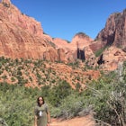
Syncline Loop in Canyonlands NP
Moab, Utah
Details
Distance
7.87 miles
Elevation Gain
1955 ft
Route Type
Loop
Description
Added by Andrew Slaton
The Syncline Loop is an unmaintained, difficult trail that gives hikers a unique perspective of and challenging hike around Upheaval Dome.
Be advised, the NPS signs and maps that warn of a very difficult hike ahead are not hyperbole, as I thought at first. This hike is a loop around the famous Upheaval Dome on an unmaintained trail that leads you down over 1500 feet into the canyon, close to the Green River, then climbs back up 1500 feet and out.
We did it in Summer, not knowing anything about it, and I would recommend going in a different time of year, or at least bringing a gallon of water per person.
The trail conditions range from easily identifiable single track and well-built (though steep) stone staircases to completely unmaintained routes through desert washes and canyons marked only by cairns, and even sections that require some scrambling/ bouldering. This trail is not for the casual hiker.
When at the trailhead for Upheaval Dome overlook, you have the option to go left or right on the Syncline. I recommend going left, as the descent here is very steep, and the ascent at the end is a bit more gradual. However, both ways are challenging. Give yourself at least 4-5 hours to complete.
A good map and navigation skills are very important!
The views are amazing, and the adventure is worth it though, if you are properly prepared and in good shape!
If you're planning to stay overnight in the Synchline Campground, make sure to get a backcountry permit. Check here for more info: https://www.nps.gov/cany/plany...
Download Outbound mobile app
Find adventures and camping on the go, share photos, use GPX tracks, and download maps for offline use.
Get the appFeatures
Syncline Loop in Canyonlands NP Reviews

Probably the coolest hike I’ve done in Canyonlands NP (although I haven’t done many). A lot of elevation change, first descending towards the river before ascending back up. Make sure you are familiar with the route before going as it can be hard to know where you’re supposed to be going.
5.0
This is not a trail to take lightly especially during summer months and flash flood season. Expect to drink a gallon (easily) or more and pack accordingly as there are no water sources except 8mi round trip trail to the green river. Temps in the canyon during august were easily 100-110+ with little relief in the shade. I got a permit to camp solo and started clockwise on the loop, brought about 40lbs of gear including a gallon of H2O and a 1 man tent. I was almost half way through my water when I reached the crater trail (another 3mi round trip) so I dropped my pack in the shade and walked in with a 1L nalgene to at least see the crater for a short time. Ended up hiking back the way I came, was brutal but saw some amazing views and Geology. I DO NOT recommend going solo if you are not familiar with basic desert survival techniques. Also flash floods kill dozens of people every year, and this hike is %60 going through old washes. Follow the carins and you shouldn't get lost.
5.0

I did this loop as a training run on Sunday, May 14, 2017. The temperature was around 80 degrees. When doing it as a tempo run as I did, you really have to keep your eyes open wide and on the trail at all times, as there are many hops, skips, slick rock sections, jumps, and terrain variations to navigate tempo speed. There are definitely a few sections where you are not running, but rock climbing and bouldering. In these sections there's also some exposure, with steep drop-offs, so if you have acrophobia these will be sections where you'll have to face that fear. ;) Also, since I was running tempo, I really had to pay attention to the cairns, as there are many places where you can go off trail, or in the wrong direction, as there are quite a few gullies and dry stream beds, especially in miles 4-6, that run into the trail route. I ran up a these from time to time when my mind wandered and had to backtrack. Some guides say to take a map, but if you keep your eyes peeled, you will always be able to spot a cairn, as there are hundreds of them, yes hundreds, along this loop. HYDRATION!! Even though it was only 80°, I went through my gallon of water very, very quickly. This arid climate it really sucks it out of you....fast. In Kansas where I live, an 80° run up to 10 miles or so usually doesn't require a water stop, whereas on this loop I'd consumed my gallon by the fifth mile (with 3+ miles and 1000+ feet of elevation gain to go!), and was completely parched by the time I finished. This is a trail where people get lost and off-trail often, so this makes having plenty of water even more important. All in all, this is a wonderful loop, with lots of variation and scenery. Don't expect to set an 8 mile tempo run PR here though...lol. I did this loop in 2:26, and I'd say I was pushing it at 80-90% of my physical ability. In addition, I would definitely recommend wearing a trail-oriented shoe. If you wear a road running shoe, your grip and stability will be greatly compromised without off-road tread and a footbed designed to absorb rock impacts. #getouside!
5.0
Leave No Trace
Always practice Leave No Trace ethics on your adventures and follow local regulations. Please explore responsibly!
Nearby

Upheaval Dome Overlook

Climbing Moses in Canyonlands

Green River Overlook

Hike the Aztec Butte Trail

Mesa Arch

Night Photography at Mesa Arch
Discover
Community
Mobile Apps

© 2026 The Outbound Collective - Terms of Use - Privacy Policy