California
Looking for the best running in California? We've got you covered with the top trails, trips, hiking, backpacking, camping and more around California. The detailed guides, photos, and reviews are all submitted by the Outbound community.
Top Running Spots in and near California
-
Fawnskin, California
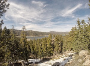
Castle Rock Trail at Big Bear Lake
4.52.7 mi / 719 ft gainFollow the directions to the trail head, and park on the side of the road. You will see a sign that says Castle Rock Trail, and the path is directly behind that sign. The hike up to the peak is steep, sandy, and very rocky, so shoes with good traction is recommended. There are also lots of oak a...Read more -
Morro Bay, California
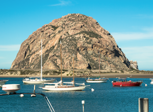
Photograph the Rock at Morro Bay
4.8Morro Bay is located west about 13 miles of San Luis Obispo. Typically Pismo Beach and San Luis are the go to spots when traveling to that area, but after spending the day there I would highly recommend giving it a visit! The first thing you'll see when pulling into downtown Morro Bay is the mas...Read more -
San Francisco, California
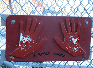
Run to Hopper's Hands
4.6Hundreds of people touch Hopper's Hands every day as a turn-around point on their runs in and around Crissy Field and The San Francisco Bay Trail. Running west through Crissy Field, passing the Warming Hut and pier, you follow Marine Drive until you dead end at Fort Point. If you continue through...Read more -
Felton, California
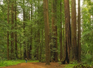
Redwood Grove Loop
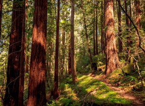
4.00.93 mi / 144 ft gainHenry Cowell Redwoods State Park is located just a few miles north of the city of Santa Cruz, along Highway 9. The park is home to an array of hiking and biking trails, but the crown jewel of the park is the Redwood Grove Loop Trail, which is only a 1/4 mile in from the park's entrance. Many peo...Read more -
Los Angeles County, California
Mt. Disappointment via Billy Riley Trail
3.5 mi / 1132 ft gainFrom the 210 Freeway in La Cañada, take California Highway 2 north 14 miles up into the San Gabriel Mountains. Make sure you have your National Forest Pass (sold at REI or Ranger Station) or your Interagency Pass because they have started checking parked vehicles. At the Red Box Picnic area, make...Read more -
Laguna Beach, California
Aliso Peak via the Valido Trail
5.01.14 mi / 325 ft gainThe Valido Trail trailhead can be found just off West street off the Pacific Coast Highway, just south of Aliso Beach. Park on West Street past the trailhead. The trail proceeds approximate .5 miles till it intersects with the Aliso Peak Trail. Go left .4 miles to the obvious summit and wooden p...Read more -
Encinitas, California
Grandview Beach
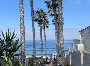
5.03 miGrandview Beach is a great spot for surfing when conditions line up (see Surfline). it's also an ideal spot to kick back and relax (bring your whole fam, dogs too). If you're looking for a little fitness, you can start at either Grandview Beach and head south along the beach to the San Elijo la...Read more -
Winters, California
Hike the Stebbins Cold Canyon Loop
4.04.5 mi / 350 ft gainStebbins Cold Canyon is a great day hike for all skill levels, accessible year round, and offers an abundance of wild flower viewing, including the California poppy. Tog get to the hike, head about 8 miles west of Winters, CA, where a silver fire gate marks the main entrance to the Stebbins Cold ...Read more -
Santa Cruz, California
Hike the Rincon Fire Trail
5.01 mi / 300 ft gainThe Rincon Fire Trail Starts at a small dirt parking lot next to CA-9 and traverses down the mountain to the San Lorenzo River Connecting with the Pipeline Trail. The trail can be a simple one of a mile out and back or up to 5 miles depending on your preference. The elevation will change by about...Read more -
Redwood City, California
Hike the Pulgas Ridge Open Space Preserve Loop
3.75.5 mi / 1000 ft gainGetting there: exit Highway 280 at Edgewood Road, travel .75 miles east, turn left on Crestview Drive, then immediately left again on Edmonds Road.Once parked, there are several different path options through the park. All of them connect in a large loop, and return to the parking lot. The Cordil...Read more -
Sequoia National Park, California
Hike to Pear Lake via the Lakes Trail
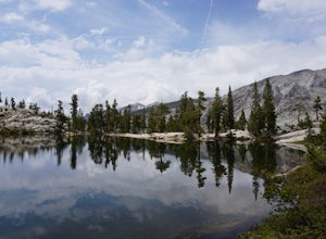
5.012.4 mi / 2300 ft gainThe Lakes Trail to Pear Lake can be done as either an overnight stay or a day hike. For overnight, you'll need to get a permit but there are beautiful camping spots available at both Emerald Lake and Pear Lake. As a day hike, plan to spend all day since you'll undoubtedly pause at each lake for...Read more -
Laguna Beach, California
West Ridge to Car Wreck Trail and Mathis Canyon Loop
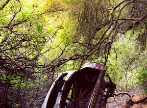
4.53.31 mi / 856 ft gainThere are numerous ways to incorporate the Car Wreck trail into a larger loop through the Laguna Coast Wilderness and Aliso Canyon Park, but a common route is to begin at Alta Laguna Park at "Top of the World" in Laguna Beach. Take the West Ridge Trail .5 miles, bearing right onto the marked Car...Read more -
Pescadero, California
Hike the Canyon Rim Route in Butano State Park
5.011.7 miLocated deep within the Santa Cruz Mountains, Butano State Park boasts a large redwood canyon with many miles of hiking trails as well as campsites. This state park is one of the quietest and least visited parks on the peninsula making a perfect place to escape the hustle of the Bay Area Butano S...Read more -
Ross, California
Phoenix Lake Loop
4.52.85 mi / 518 ft gainEnjoy the peacefulness of making it out to the lake for a quick hike without worrying too much about challenging climbs or difficult terrain. Take the wide fire road from the car uphill and then jump on the Phoenix Lake Trail. From here, you’ll combine this trail with the Gertrude Orr and Bill Wi...Read more -
Trinidad, California
Watch a Sunset at College Cove Beach
5.00.25 miFollow the trail leading from the end of the parking lot down onto the beach. From the parking lot to the beach the walk is about a quarter of a mile, with a slight decrease in elevation as you move down to the beach. To get to the beach, take 72B off of Highway 101 and turn west onto Main Stree...Read more -
Santa Monica, California
Run the Santa Monica Concrete Stairs
3.00.1 mi / 111 ft gainThe concrete Santa Monica Stairs are a great way to get in some intense leg burning cardio. There are around 170 steps that are wider and easier than the Santa Monica wooden staircase.This place has been a hot spot in the Santa Monica fitness scene for some time so it is also a good place for mee...Read more

