California
Looking for the best running in California? We've got you covered with the top trails, trips, hiking, backpacking, camping and more around California. The detailed guides, photos, and reviews are all submitted by the Outbound community.
Top Running Spots in and near California
-
Napa, California
Lake Marie Road, Marie Creek, Buckeye Trail Loop
3.55.8 mi / 961 ft gainEnter the parking lot just off of Hwy 221. Plan to pay a $5 entrance fee at the kiosk. The trail head begins at the edge of the parking lot where you'll soon be passing by the Martha Walker Native Habitat Garden on your right. Veer left to continue along Lake Marie Road where you'll enter the blu...Read more -
Vallejo, California
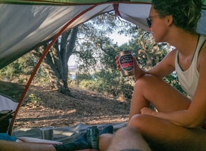
Camp at Mare Island Shoreline Heritage Preserve
1 mi / 20 ft gainThis old Naval Base is now home to, well, almost nothing. As a weekend volunteer trip, myself and about 50 others got a little dirty creating 3 new campsites for you and your friends!During the day, the island has hikers exploring everywhere, but the preserve closes upon sunset and it's just you ...Read more -
Yosemite Valley, California
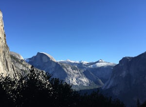
El Capitan Trail
5.014.68 mi / 5052 ft gainStart on the Yosemite Falls trailhead and work your way up. Yosemite Falls can be anywhere from a huge flow to a slow trickle depending on the time of year. Hiking boots are absolutely necessary and hiking poles are a huge benefit. Say hello to rock climbers at the top as they finish their El Cap...Read more -
Los Angeles, California
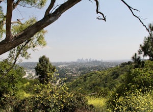
Beacon Hill via Coolidge Trail
5.02.84 mi / 587 ft gainThe starting point for your run is at the Griffith Park Southern Railroad. From the parking lot walk east crossing Crystal Springs Drive and find the Coolidge Hiking Trail. Begin running up Coolidge Trail toward Upper Beacon Trail making sure to stay straight at the first intersection (0.2 miles)...Read more -
Santa Barbara, California
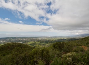
Inspiration Point
4.03.82 mi / 1109 ft gainHike up the 3.5 mile trail to an unbeatable vista that will leave you smiling! This hike has a steady uphill climb from the trailhead off of Tunnel Rd into Los Padres National Forest. Keep in mind this trail can get pretty crowded on weekends, so you're best to be at the trail early in the mornin...Read more -
Carmel-by-the-Sea, California
Hike to the Top of Inspiration Point
5.01.3 mi / 850 ft gainThis magnificent trail was recently converted into part of the Monterey Regional Parks System. Walk through pastures of cows, through coast oaks, up a steep incline with vast views of Carmel Valley, Carmel and the Pacific Ocean up to the top where a picnic table awaits you at Inspiration Point. T...Read more -
Point Reyes Station, California
Sky Campground via Sky Trail
2.66 mi / 495 ft gainEntering Point Reyes National Seashore from Bear Valley Road the Sky Trailhead is a 4.9 mile drive. Camping in Sky Camp requires a Camping Permit. Once at the Sky Trailhead parking lot. The Sky Trailhead will be on the left side pulling in. The hike is not very strenuous and not all that lo...Read more -
Corte Madera, California
Ring Mountain Loop
4.02.65 mi / 597 ft gainRing Mountain Open Space is an easy but uphill trail that take you to the top where you can explore more trails. Take the 101 exit for Paradise Dr in Corte Madera, follow the road, and park on the side of the road once you pass Westward Dr. Even though there are many places to start the trail fo...Read more -
Mendocino, California
Mendocino Cliffs Trail
5.01.37 mi / 108 ft gainThe town of Mendocino is as charming and quaint as one can find. It is no wonder why it was pegged as the perfect location spot to film the series Murder She Wrote. While the series heroine Jessica Fletcher's home can still be visited, it is the bay itself that will draw your attention. Startin...Read more -
Montecito, California
West Fork of Cold Spring Trail
3.45 mi / 1135 ft gainIf you love the mountains above Santa Barbara but hate the crowds, stick to the canyon trails on the east side. The trails running up Cold Spring canyon offer a variety of experiences without all the noise. To find the West Fork of Cold Spring Trail, take the Olive Mill Rd. exit from the 101 fre...Read more -
San Luis Obispo, California
Bike or Run the Bob Jones Trail
5 miThe Bob Jones Trail provides a variety of activities -- running, walking, biking, skateboarding/rollerblading, and some exploring by the creek. You can choose where you would like to start, across the street from the Central Coast Aquarium off Avila Beach Dr. or from the parking lot off Ontario R...Read more -
Redwood City, California
Hike the Crystal Springs Trail Loop
5.6 mi / 1300 ft gainThis is a great hike for any season of the year, with rushing streams during the winter, wildflowers in the spring, and cool, shaded canyons during the summer. Starting from near the Zwierlein Picnic area, take the Crystal Springs to the left into the redwood forest. Stay straight at the next tra...Read more -
Huntington Beach, California
Bolsa Chica Ecological Reserve Trail
4.72.97 mi / 30 ft gainThe Bolsa Chica Ecological Reserve Trail is great for birding and wildlife viewing. If you want a longer hike, you can extend the mileage by heading down the riverbed trail. The trail is open year-round. Dogs are not allowed in Bolsa Chica. Bolsa Chica State Beach is easily accessible from Oran...Read more -
Chico, California
Hike the Yahi Trail in Upper Bidwell Park
7.9 mi / 836 ft gainTo start this hike, find parking at Bidwell Park Parking Area E, near the Chico Rod and Gun Club. From there walk a short ways down Upper Park Road. You will see the sign for the Yahi Trail trailhead on the right. From here, simply follow the trail along the river. A reminder to those with dogs, ...Read more -
Stevenson Ranch, California
Hike the Towsley Canyon Loop
4.75.1 mi / 1340 ft gainThe Towsley Canyon Loop can be done in either a clockwise or counter-clockwise loop. The clockwise path starts with a gradual ascent through Wiley Canyon and steep descent into the Towsley Gorge while a counter-clockwise route starts with a steep climb out of Towsley Canyon and a gradual descent ...Read more -
Topanga, California
Parker Mesa Overlook via Trippet Ranch
4.06.75 mi / 1181 ft gainThis is a 6.8 mile round-trip hike that starts at Trippet Ranch in Topanga Canyon. Even though the range in elevation is 400 feet from peak to trough, the up and down trail totals to approximately 1800 feet elevation gain making this a beginner to intermediate adventure. The trail itself is pre...Read more


