Petaluma, California
The best Trails and Outdoor Activities in Petaluma, California offer a variety of outdoor adventures. The Helen Putnam Regional Park is a top spot with a 6-mile network of trails perfect for hiking, biking, and horseback riding. The scenic views of rolling grasslands, groves of heritage oaks, and panoramic vistas are a must-visit. Shollenberger Park is another great location for bird-watching and walking, with a 2-mile trail encircling a beautiful wetland. For a more challenging hike, head to the Tolay Lake Regional Park. The 8-mile trek takes you past unique rock formations and offers stunning views of the lake. These outdoor attractions in and near Petaluma are perfect for those seeking a mix of leisurely strolls and more strenuous hikes.
Top Spots in and near Petaluma
-
Tiburon, California
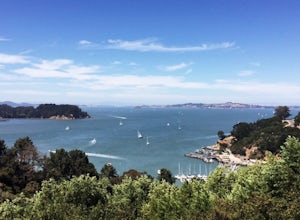
Angel Island Perimeter Loop
5.98 mi / 794 ft gainAngel Island Perimeter Loop is a loop trail around the circumference of the island in the San Francisco Bay. The island is located near Tiburon, California with views of downtown San Francisco, Alcatraz, the Golden Gate Bridge, Oakland, Sausalito, and TIburon as you traverse around the island. ...Read more -
Sonoma County, California
Kortum Trail
9.27 mi / 968 ft gainThe Kortum Trail in the Sonoma Coast State Park connects Goat Rock with Wrights Beach, winding along the top of the sea cliffs and affording incredible views of the California Coast and its numerous sea rocks and arches. To get there take the Pacific Coast Highway / Highway 1 to either Wright's...Read more -
Sausalito, California
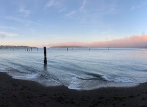
Catch the Sunset at Swedes Beach
This is a small tucked away beach in Sausalito, CA. Being in the bay, it has very calm waters and is easy to swim in, though the water will be very cold. There are pilings in the water that are remnants of the old piers. It is a great beach to watch the sunset at. There is very limited street...Read more -
Mill Valley, California
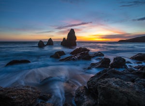
Rodeo Beach
5.0Rodeo beach is 10 minute drive past the Golden Gate. Pack up the car with a couple beverages and something to eat, then spend the afternoon and evening taking in the sunset. If you're taking the romantic angle, remember to pack a few blankets just in case the wind picks up or it's colder than ant...Read more -
Mill Valley, California
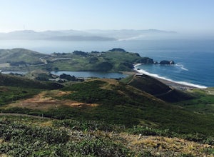
Hill 88 Loop
4.05.5 mi / 1086 ft gainThis quick, yet challenging trail run is located just minutes north of the Golden Gate Bridge. Grab your dog (on-leash), park in the large lot next to Rodeo Beach and hit the trail! The climb starts up the Coastal Trail to the right end of the parking lot if you're staring at the beach. Take the...Read more -
Mill Valley, California
Coastal Trail from Rodeo Beach to Muir Beach
11.35 mi / 3264 ft gainThis hike has beautiful views in the Marin Headlands. You'll find easy parking in the Rodeo Beach Parking lot if you get there early (by 8:30 am). This hike goes along the Coastal Trail which has a few steep areas as you make your way to Tennessee Beach. The Tennessee Beach has gorgeous dark b...Read more -
Mill Valley, California
Miwok, Marincello and Bobcat Trail
8.17 mi / 1391 ft gainMiwok, Marincello and Bobcat Trail is a loop trail that takes you by a river located near Sausalito, California.Read more -
Sonoma County, California
Red Hill and Pomo Canyon Loop
4.84.73 mi / 981 ft gainPark in the Shell Beach parking lot, north of Bodega Bay proper but just south of Goat Rock State Beach on Highway 1. Cross the road to pick up the Dr. David C. Joseph Memorial Trail heading up away from the ocean. Follow the trail, staying right toward Red Hill. (The trail forks off down Pomo Ca...Read more -
Mill Valley, California
Rodeo Cove to Point Bonita Lighthouse
5.03.64 mi / 568 ft gainIf you're looking for a little hike and a lot of beach, you'll find your ideal combo at Rodeo Beach and Point Bonita Lighthouse. Park at the Marin Headlands Visitor Center at the head of the 0.8 mile trail to the beach. From the lighthouse to the beach, it will be another 1.5-2 miles there and ba...Read more -
Sausalito, California
Slacker Hill
5.01.02 mi / 344 ft gainAlthough the Headlands can be crowded, particularly at the parking-lot chaos of the Vista Point and pull-offs along Conzelman Road, the three routes leading to the summit of Slacker Hill remain relatively quiet, even during busy weekends. Each can be tied into larger loops throughout the Headland...Read more -
Sausalito, California
Ninja Loop
9.37 mi / 1831 ft gainThis loop can start from several different locations, including Rodeo Beach and the Golden Gate Bridge parking lot. Starting from the GGB will add 2 more miles onto this run. I like to start at the Coastal Trailhead parking lot off of McCullough and Conzelman Roads (just a notch down from Hawk Hi...Read more -
Sausalito, California
Marin Headlands Trail Loop
10.5 mi / 1990 ft gainThis trail starts at the Coastal Trail in Marin Headlands Park, where there's a small parking lot and outhouse bathroom off the circle when coming from Conzelman Road.Take the Coastal Trail until you intersect with Bunker Road (you can even turn right and spit off the trail just before intersecti...Read more -
Guerneville, California
East Ridge - Pool Ridge Loop
4.53.37 mi / 810 ft gainThis park most resembles Muir Woods, and if you're looking to get out of the tourist trap, head to Armstrong Redwoods and make a day of it. This 3-mile hike takes off from the sign pointing to East Ridge Trail. As you begin a slight climb up the trail, you'll be under the cover of the redwoods, s...Read more -
Sausalito, California
Black Sands Beach
5.00.54 mi / 285 ft gainBlack Sand Beach is a beautiful, mile-long stretch of black sand just north of the Golden Gate Bridge. On a sunny day, it’s best to try and arrive in the morning, as the parking lot can fill up quickly. To get down to the beach, you’ll need to hike for about 5 minutes down 250 or so wooden steps....Read more -
Mill Valley, California
Headlands Ride to Point Bonita Lighthouse
4.3The Headlands are a quick ride over the Golden Gate. On the ride, you'll see wildflowers, rugged coastline, and the Point Bonita Lighthouse. Once you cross the bridge, take Conzelman Rd up ~700 feet to Hawk Hill. From here, continue on to the lighthouse. On the return trip, head back on Conzelman...Read more -
Sausalito, California
Hawk Hill
5.00.76 mi / 144 ft gainIf you're leaving from SF, head over the bridge and exit onto Alexander Ave. Make the immediate left under the overpass and you'll be on the road to Hawk Hill. There's a parking area just below the gate leading up to Hawk Hill. From the parking lot you can walk west about ten yards along the outs...Read more

