Benton, California
Looking for the best photography in Benton? We've got you covered with the top trails, trips, hiking, backpacking, camping and more around Benton. The detailed guides, photos, and reviews are all submitted by the Outbound community.
Top Photography Spots in and near Benton
-
Benton, California
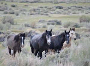
Photograph Wild Mustangs in Mono County
Since these are wild horses, tracking them can be difficult. However, they tend to play and graze in a certain field in Mono County, right outside of Mammoth Lakes and Yosemite! From CA-395 turn onto CA-120 towards Mono Lake. Take this road for 21 miles until you reach Dobie Meadows Road, a one l...Read more -
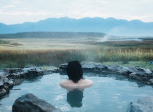
Wild Willy's Hot Spring, United States
Wild Willy's Hot Spring
5.0Also known as "Crowley Hot Springs", Wild Willey's is located a short drive from Mammoth Lakes. For more information on the hot springs and the public land restoration, check out the BLM's Website. From Mammoth Lakes, head south on the 395 for 3.5 miles until you make a left at Benton Crossing Rd...Read more -
Mono County, California
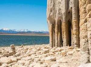
Explore Crowley Lake Columns
4.0Starting from Mammoth Lakes you head South on Highway 395 until you get to Benton Crossing Rd. (Green Church on the corner) and make a left.From Bishop you head North for about 30-40 miles until you hit Benton Crossing Rd. and make a right.From here, continue West and bending South for close to 2...Read more -
Mono County, California
Crab Cooker Hot Springs
Getting There: Take Highway 395 heading toward Benton Crossing Road. Turn onto Benton Crossing and you’ll see an adorable wee green church. Continue two miles down the road. You’ll make a left turn and head down a dirt road. Cell service is scant in this area, so you'll probably want to...Read more -
Mono County, California
Shepherd Hot Springs
4.0Located a short distance from US 395 near Mammoth/Yosemite Airport, Shepherd Hot Spring provides a great opportunity to relax while taking in spectacular views of the Eastern Sierras and surrounding area. After a hard day on the slopes or long day on the trail this hot spring provides a comforta...Read more -
Mono County, California
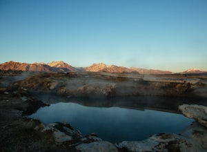
Hot Creek Geological Site
4.8Hot Creek Geological Site is a must see when you are in the Mammoth Lakes area. It is just West of Highway 395 and only minutes form the town of Mammoth Lakes, which has great food, a ski resort, world class mountain biking, and a brewery. Bishop is about 40 minutes South which is well known for ...Read more -
Bishop, California
Climb White Mountain Peak
4.314 mi / 2000 ft gainNot surprisingly, White Mountain Peak is the apex of the White Mountains, which rise out of the desert floor just north of Death Valley. The White Mountains were aptly named as they are frequently covered in snow.The trailhead starts at 12,000ft and winds it's way over a few hills before the fina...Read more -
Mammoth Lakes, California
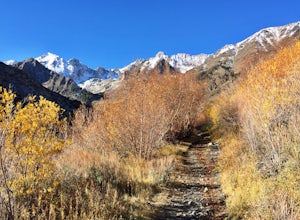
Photograph the Fall Colors of McGee Creek
5.03 mi / 500 ft gainMcGee Creek is one of my favorite spots in the Eastern Sierra to photography the fall color. Most people avoid the area because the best views require you to hike and explore but the rewards are worth it. Right close to the parking lot is McGee Creek which is a beautiful creek to photograph offer...Read more -
Mammoth Lakes, California
Hike to Steelhead Lake through McGee Creek Canyon
5.011.5 mi / 2510 ft gainWhether you’re looking for a dayhike near Mammoth Lakes, planning a backpacking trip along the JMT, or have a few extra hours to spare on a cross-California road trip, this is an easy and popular trail choice for killer mountain views.I was delighted to discover that this is one of the most easil...Read more -
Mammoth Lakes, California
Convict Lake
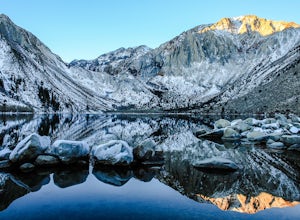
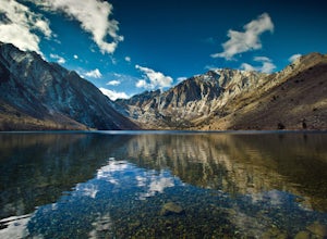
4.92.46 mi / 56 ft gainIn 1871, a group of inmates escaped from a prison and were ambushed near the lake by a posse who had tracked them down. The inmates escaped the shoot out after killing two of the men in the posse and the lake now had a name – Convict Lake. You won’t witness a wild west shootout here, but if you ...Read more -
Mono County, California
Fishing at Convict Lake
4.3Many people come to Convict lake for the fishing. Convict is located only 2 miles off the main highway in the Eastern Sierras. The lake is clear and pristine with beautiful views. There are various ways to fish here; some rent out boats or bring their own and cruise around the lake fishing. O...Read more -
Mono County, California
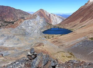
Summit Mount Baldwin (12,614')
15 mi / 5000 ft gainDirections The hike for Mount Baldwin starts at the Convict Lake trailhead. The turn off for Convict lake is about 4.5 miles south of the Mammoth Lakes exit along the 395 and roughly 35 miles North of Bishop, CA. Take this exit and follow the road West towards the mountains. Turn right at the ...Read more -
Mammoth Lakes, California
Sherwin Lakes Trail
5.04.42 mi / 850 ft gainJust outside the town of Mammoth Lakes, CA is the Sherwin Lakes Trailhead. An easy 10 minute drive down some dirt roads will get you to the dirt parking lot where you can safely leave your vehicle and begin your fairly easy 2.5 mile hike to Sherwin Lakes. (Valentine Lake is not much further beyon...Read more -
Bishop, California
Hike to Little Lakes Valley in the John Muir Wilderness
5.03.2 mi / 300 ft gainThe Little Lakes Valley located in the John Muir Wilderness provides easy access to spectacular views of High Sierra peaks as well as a long list of beautiful alpine lakes.The area is accessed via the Mono Pass Trail starting from Mosquito Flat/Little Lakes Trailhead. From the trailhead at the e...Read more -
Bishop, California
Hike Morgan Pass to 7 Scenic Lakes
5.010 miTake the 395 North for 20 miles past Bishop and make a left on Rock Creek Road. Follow this road for 10 miles until you reach the free parking area at the Mosquito Flats Trailhead. Even on a holiday weekend, finding parking wasn’t a problem. The trailhead offers easy access to bathrooms and bear ...Read more -
Bishop, California
Backpack to Ruby Lake
5.04 mi / 1000 ft gainAt 10,200 feet, the trailhead (Little Lakes Valley) for Ruby Lake is one of the highest (if not the highest) in the Sierra. Meaning you get right to the heart of the mountains quickly. Ruby Lake itself is at 11,200 feet elevation.How to get there: At Tom's Place off of Hwy 395, turn southwest int...Read more

