
Summit Mount Baldwin (12,614')
Mono County, California
Details
Distance
15 miles
Elevation Gain
5000 ft
Route Type
Out-and-Back
Description
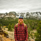
Added by Evan Thomas
Mount Baldwin (Class 2, 12,614') hosts some of the oldest rock in the range with impressive geological displays. Visit the calcite crystal “mine” near the summit. To make this an overnight, you can camp at Mildred Lake or rent one of the cabins at Convict Lake.
The hike for Mount Baldwin starts at the Convict Lake trailhead. The turn off for Convict lake is about 4.5 miles south of the Mammoth Lakes exit along the 395 and roughly 35 miles North of Bishop, CA. Take this exit and follow the road West towards the mountains. Turn right at the sign for the trailhead, which is just before the restaurant and cabins.
The ApproachTo climb Mount Baldwin you'll first need to hike to Mildred Lake, which would also make the best spot for a camp if doing the trip as an overnighter. You'll contour around the North side of Convict Lake before heading up Convict Canyon itself, traveling between Mount Morrison on your left and Mount Laurel on your right. The trail mostly follows the stream coming down Convict Canyon, which is quite lively in places. There are one or two spots where you need to cross the stream. Eventually, you'll climb out of the canyon and into the basin containing Mildred Lake, about 5 miles from the start. This should all be very straightforward on a well maintained trail.
The ClimbNow that you've reached Mildred Lake, you'll want to continue further past the lake through the meadow on a narrowing trail, which may disappear in a few spots before shortly reappearing again. Eventually, you'll want to catch a use trail heading up and left to Mount Baldwin. This is the tricky part!! (And, hard to describe, but here it goes) As you proceed through the meadow the route starts near the first point where the slopes up and to your left actually look reasonable for an ascent. You'll want to go up a small, rocky gully and exit it very soon on its right side via the use-trail. The use trail is not obvious at all until this exit. From there, you pretty much follow it to the summit, as it winds to the left and then back to the right up a ridgeline. Some ducks and cairns periodically mark the route. There is one area up high where you will pass through a cliff band. Be careful to follow the correct path here, or you will miss the mine and end up on sketchy, loose Class 3 climbing like I did. it shouldn't be much harder than Class 2, or maybe very easy Class 3, if you choose the right route. Once past here, just keep following the use trail to the summit, which becomes visible not too long after the cliff band. This last section can feel like a bit of a grind, but push on because the views are worth it!
Chow TimeNear the trailhead is arguably one of the finest restaurants in the Eastern Sierra – the Convict Lake Resort Restaurant.
It's a bit on the steep side as far as price, but worth it, for sure. Other options include heading a few miles north to Mammoth where there is a decent selection of restaurants or, if you're heading south to go home, a stop in Bishop will work, where I recommend Las Palmas or Amigos for Mexican or Whiskey Creek or Jack's for burgers.
Download Outbound mobile app
Find adventures and camping on the go, share photos, use GPX tracks, and download maps for offline use.
Get the appFeatures
Summit Mount Baldwin (12,614') Reviews
Planning on doing this next weekend. Hoping that last part of the trail is somewhat easy to find this time of year.
Leave No Trace
Always practice Leave No Trace ethics on your adventures and follow local regulations. Please explore responsibly!
Nearby

Fishing at Convict Lake

Convict Lake Loop

Relax at Laurel Lakes

Red Slate Mountain via McGee Creek

Steelhead Lake via McGee Creek

McGee Creek
Discover
Community
Mobile Apps

© 2026 The Outbound Collective - Terms of Use - Privacy Policy