Climb White Mountain Peak
Bishop, California
Details
Distance
14 miles
Elevation Gain
2000 ft
Route Type
Out-and-Back
Description
Added by Pine Watt
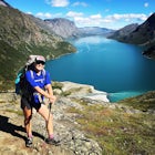
Climb California's third highest peak (14,252ft). This adventure requires no technical rock climbing skills and is a great introduction to high altitude hiking/alpinism.
Not surprisingly, White Mountain Peak is the apex of the White Mountains, which rise out of the desert floor just north of Death Valley. The White Mountains were aptly named as they are frequently covered in snow.
The trailhead starts at 12,000ft and winds it's way over a few hills before the final push to the summit. There is a toilet at the trailhead - beyond that, plan ahead.
The trail is 7 miles one way with 2,000ft vertical elevation gain, thus if this is your first attempt at high altitude hiking, plan ahead and leave your self plenty of time to complete the trip. Depending on your fitness level, the hike can take between 4-8hrs. At such high altitudes the weather can quickly change, so be sure to bring the proper amount of water, food, and clothing.
Getting there: The road to White Mountain Peak begins in Big Pine, CA. Take 168 E up into the mountains, and after approx 13 mi you will turn left onto the White Mountain Road. The road winds and traverses the spine on the White Mountains until reaching the trailhead. The road becomes gravel approx. 6 miles up; 4x4 is highly recommended. In the winter the road becomes impassable.
Download the Outbound mobile app
Find adventures and camping on the go, share photos, use GPX tracks, and download maps for offline use.
Get the appFeatures
Climb White Mountain Peak Reviews
It’s a slog up to the top. My 2nd 14er. Not nearly as epic as Whitney but a good time still. I was lucky to have stayed in the Research Center- tasty meals!
4.0
I hiked White Mountain at the end of October. Although it was quite windy and cold, it was still a beautiful hike! You can read my whole report here: http://adventuretramp.com/2019/12/05/hiking-white-mountain-peak/
4.0
This was my first 14er. I took advantage of Open Gate Day where the Bancroft Research Station opens the locked gate to allow hikers/mountain bikers to park at the research station. Saves 2 miles each way. And on this Labor Day weekend, the weather couldn't have been better. Crazy that there was cell service at the peak so I could send pics to friends "guess where I am?!"
5.0
Stopped at Barcroft research station for the nights (unfortunately not accessible for tourist hikers). Best stars in the entire world!! Straightforward and picturesque hike in August.
4.0
Hiked White Mountain this past weekend. Windy and beautiful. The entire 14 miles is on a jeep trail with very little scree making it an easier 14er. I started at 8:15 and made it back by 4:00pm with about 30 mins at the top. I also saw several mountain bikers doing this!
4.0
For me, Mt. Whitney was a breeze compared to this. Attitude hit me good here. Be prepared. Have never seen so much beauty in such emptiness and blankness.
5.0
Leave No Trace
Always practice Leave No Trace ethics on your adventures and follow local regulations. Please explore responsibly!
Nearby
Patriarch Grove Trail
Camp in Ancient Bristlecone Pine Forest
Schulman Grove and Methuselah Grove Loop
Photograph the Bristlecone Pine Forest
Methuselah Trail
Trout Fishing in the Owens River
Community
© 2024 The Outbound Collective - Terms of Use - Privacy Policy


