Benton, California
Looking for the best fishing in Benton? We've got you covered with the top trails, trips, hiking, backpacking, camping and more around Benton. The detailed guides, photos, and reviews are all submitted by the Outbound community.
Top Fishing Spots in and near Benton
-
Mammoth Lakes, California
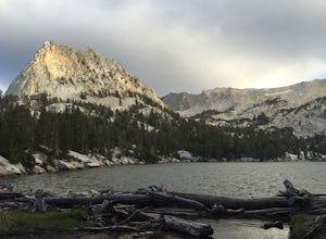
Crystal Lake via Mammoth Crest Trail
4.82.5 mi / 1257 ft gainIn Lake George, park along Lake George Road and walk towards Crystal Crag Trailhead sign to begin the hike. If you couldn't find it, you can head to the boat rentals by the lake and you will see a sign saying trailhead is behind you. The trail is well maintained and it is really easy to follow. ...Read more -
Mammoth Lakes, California
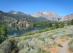
Lake George Trail
5.01.34 mi / 89 ft gainThe Lake George Loop is perfect for exploring the shoreline and fishing near the top of the Mammoth Lakes wilderness. The lake can get quite cold due to the elevation and surrounding mountains not allowing the sun to hit it for an extended time, but if you go during mid-day you should have a refr...Read more -
Mammoth Lakes, California
Backpack from Mammoth Mountain to Yosemite Valley via the John Muir Trail
5.052 mi / 6300 ft gainCross country hiking can be a daunting idea. There are so many things to plan for, and such a long distance to cover. If you are an experienced backpacker, and you want to get a taste of hiking on the John Muir Trail this hike might interest you. Planning GPS Map (Caltopo): https://caltopo.com...Read more -
June Lake, California
Gull Lake Loop
1.97 mi / 174 ft gainGull Lake trail is one of my favorite hiking spots in the June Lake Loop area. It is a very scenic trail that goes through varying terrains from meadows to marshes to aspen and conifer groves. Trailhead starts at the Mono County Community Center and winds counter-clockwise around the lake to th...Read more -
Madera County, California
Ediza Lake via Agnew Meadows
4.013.54 mi / 1804 ft gainStart at the Agnew Meadows Trailhead. You will need to arrive before 7:30AM or take the Shuttle from Mammoth Mountain. Start out by heading north on the John Muir Trail. You will pass Shadow Lake; walk around the south side of the lake for mountain views. Then, follow the trail up Shadow Creek u...Read more -
Madera County, California
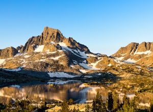
Climb Mount Ritter
Mt Ritter is a long climb, but it is worth the effort. Start out by establishing camp at Ediza Lake prior to your ascent. The SE Glacier route (first ascent by John Muir) follows the path of least resistance up the SE side of Mt Ritter.The route first gains a broad bench below Ritter and Banner P...Read more -
Mammoth Lakes, California
Agnew Meadows to Tuolumne Meadows
5.030.27 mi / 4757 ft gainUnlike most through hikes that require two cars or hitchhiking, you can accomplish this with only one car by using a YART. Another benefit is that by entering in Mammoth, it is usually much easier to get permits as opposed to starting in Yosemite where permits can be harder to get. Then once yo...Read more -
Madera County, California
Backpack the Shadows of the Minarets Loop
5.016 miAnsel Adams Wilderness is located in Mammoth Lakes, California. The trail to Lake Ediza is frequently traveled and is usually completed as an out-and-back day hike. In the summer, from 7am-7pm the road to the trail head is inaccessible to cars. To reach the trailhead you must take the shuttle fro...Read more -
Lee Vining, California
Hike to Upper Sardine Lake
Directions (from south of June Lake): 395 northTurn right onto the 158Keep right at fork onto Parker Lake Rd and go about 0.5 milesTurn right at first right and head all the way to the top until you hit a parking lot/camping ground/trail head From North of June Lake: 395 southTurn left at 158Keep...Read more -
Big Pine, California
Trout Fishing in the Owens River
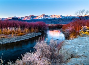
3.0Surrounded by the Sierra Nevada, Inyo, and White Mountains, the Owens River Valley is picturesque and home to some quality trout fishing on the Owens River. If you like to pair photography with fishing then this is the ideal location for you - the color pallet is beautiful, especially in the wint...Read more -
Bishop, California
Backpack Across Mt. Humphreys Basin
30 mi / 3375 ft gainBefore heading out, you will need to get a backpacking permit to stay overnight in this area. You can buy one here to pick up in town at the Bishop, CA Ranger Station, in the morning.The trailhead begins at North Lake campground (9,345'), in a beautiful lush area, with streams and aspen groves. A...Read more -
Bishop, California
Sailor Lake Backpack & Climb of Mt. Haeckel
5.013 mi / 2500 ft gainThe basic part of this adventure is a backpack to Sailor Lake. From there you can enjoy small dayhikes to the nearby lakes or waterfalls, go fishing, enjoy some photography or just lounge in camp and gaze at the beautiful scenery. Although Sailor Lake looks smaller than the nearby lakes it stil...Read more -
Bishop, California
Backpack the Piute Pass Trail in the John Muir Wilderness
21 mi / 2000 ft gainWith so many famous hiking trails in the Sierras, its hard to find a trail as isolated as the Piute Pass Trail. This trail allows you to hike in the John Muir Wilderness, Inyo National Forest, and Sierra National Forest in one 20 mile section of trail. You will encounter amazing wilderness, spect...Read more -
Lee Vining, California
Junction Campground, Mono County
Junction campground is by far one of my favorite campsites when I am visiting the High Sierra and Tuolumne Meadows. The only downside is, you can only camp certain months; usually from June through October when highway 120 is open. The Junction campground is far away from the crowds of Yosemite...Read more -
Tuolumne County, California
Mono Pass to Silver Lake Trailhead via Koip Peak Pass
20.25 mi / 3606 ft gainThis trip begins in Yosemite National Park and can be completed as an out-and-back or by hiking one-way to the Ansel Adams Wilderness and exiting at Silver Lake on the east side of the mountains. Start at the Mono/Parker Pass trailhead, a few miles past Tuolumne Meadows. Don't forget to make a pe...Read more -
Bishop, California
Long Lake via Bishop Pass
5.51 mi / 991 ft gainDirections The trailhead for Long Lake starts by South Lake outside Bishop, CA. You'll want to take Line Street, which is the 168, West out of Bishop. Approximately 14 miles up, you'll want to merge left towards South Lake. This junction is well-signed if you keep an eye out for it. Head th...Read more

