Big Pine, California
Big Pine, California, is a top destination for outdoor adventures. One must-visit attraction is the North Fork Big Pine Creek Trail. This 16.2-mile trail is moderately difficult, offering scenic views of the Sierra Nevada mountains. As you hike, you'll pass by several crystal-clear alpine lakes, including Second Lake and Third Lake, known for their turquoise hues. The trail also features striking rock formations and the largest glacier in the Sierra Nevada, the Palisade Glacier. For a shorter hike, the Ancient Bristlecone Pine Forest trail is a 4.4-mile loop near Big Pine. This trail is best known for its ancient bristlecone pine trees, some of which are over 4,000 years old. Both trails offer unique, breathtaking views and are among the best trails and outdoor activities in Big Pine.
Top Spots in and near Big Pine
-
Bishop, California
Keough Hot Springs Creek
...As many of us enjoy a good hot spring to relax in, I think most will agree that it’s even better when it’s free and out in nature. If you decide to have a little bit more of a luxurious hot spring experience, you can continue to take that road about another mile to the Keough Hot Springs campi...Read more -
Bishop, California
First and Second Lake via Big Pine Creek North Fork
5.09.57 mi / 2392 ft gainThe North Fork of Big Pine Creek is often cited as having the most unbelievable scenery reachable in a single day. And it's hard to disagree. The Big Pine Creek North Fork trail is just minutes outside of Big Pine off the 395. If going in the winter, access to the trailhead can be closed off, so...Read more -
Big Pine, California
Fourth Lake via Big Pine Creek North Fork Trail
4.012.6 mi / 3205 ft gainFrom Big Pine, you'll turn onto Crocker St. to head towards the mountains. Once you are about 11 miles down the road you will see a sign and a turnoff on the right for trailhead parking. That is where you are going to want to park if you are staying overnight but you can continue to where the roa...Read more -
Bishop, California
Big Pine Lakes via North Fork Trail
5.012.69 mi / 3196 ft gainThe North Fork Big Pine Creek Trail offers some of the best high alpine scenery in the Sierras. As the peaks of the Palisades pierce the sky with its craggy span of summits you will find it is as picturesque and dramatic as any in California. Nestled beneath these giant peaks are the glacier scou...Read more -
Big Pine, California
Trout Fishing in the Owens River
3.0Surrounded by the Sierra Nevada, Inyo, and White Mountains, the Owens River Valley is picturesque and home to some quality trout fishing on the Owens River. If you like to pair photography with fishing then this is the ideal location for you - the color pallet is beautiful, especially in the wint...Read more -
Bishop, California
Long Lake via Bishop Pass
5.51 mi / 991 ft gainDirections The trailhead for Long Lake starts by South Lake outside Bishop, CA. You'll want to take Line Street, which is the 168, West out of Bishop. Approximately 14 miles up, you'll want to merge left towards South Lake. This junction is well-signed if you keep an eye out for it. Head th...Read more -
Bishop, California
Climb Columbine Peak's NE Ridge
15 mi / 5000 ft gainDirections This Bishop Pass Trail starts by South Lake outside Bishop, CA. You'll want to take Line Street, which is the 168, West out of Bishop. Approximately 14 miles up, you'll want to merge left towards South Lake. This junction is well-signed if you keep an eye out for it. Head the rest ...Read more -
Bishop, California
Backpack into the Palisades from Bishop Pass
18 mi / 4000 ft gainDrive up to the trailhead near South Lake from the town of Bishop (you can get directions at the Ranger Station when you get a permit). The hike goes from approximately 9,000 ft. to 13,000 ft. over the course of 9 miles.The first approximately 6 miles are on trail to the top of Bishop Pass. From ...Read more -
Bishop, California
Bishop Pass Trail to John Muir Trail to Piute Trail
52.67 mi / 9173 ft gainBishop Pass Trail to John Muir Trail to Piute Trail is a point-to-point trail that takes you by a lake located near Bishop, California.Read more -
Bishop, California
Treasure Lakes Trail
5.05.79 mi / 1375 ft gainThe Treasure Lakes Trail is dog and kid friendly, just make sure all parties can handle the elevation gain. The scenery throughout the entire hike is amazing, and early in the summer, the creeks roar. The lake is perfect for cooling off on a hot summer day. The trail is best used in the summer an...Read more -
Bishop, California
Evolution Basin via South Lake
35.66 mi / 7769 ft gainIt’s been called the crown jewel of the Sierra Nevada, the highlight of the entire 211-mile John Muir Trail. Whatever superlatives are used to describe it, Evolution Basin is undoubtedly one of the most incredible landscapes you’ll ever explore. There is a small catch, though: There is no easy ...Read more -
Bishop, California
Bishop Pass Trail
5.011.13 mi / 2165 ft gainTo get to the hike drive twenty miles west from the town of Bishop, California up Hwy 168 to South Lake. There are two parking lots but make sure to get there early because later in the day it's harder to get a spot. The trail starts from South Lake at an an elevation of 9,750 feet. Initially ...Read more -
Big Pine, California
Backpack Atop Sawmill Pass
20 mi / 6700 ft gainAt 11,347 ft., Sawmill Pass lies on the Sierra Crest and enters Kings Canyon National Park in the Woods Creek area. Both the John Muir Trail (JMT) and the Pacific Crest Trail (PCT) can be accessed through this pass. The Sawmill Pass trail is a steep and arduous climb, gaining over 6700 feet of e...Read more -
Bishop, California
Snowshoe to Blue Lake
6.2 mi / 1350 ft gainStarting in Aspendale at 8500 feet, this 5 mile hike is very invigorating and beautiful. To get here, take hwy 395 until in Bishop. Turn onto hwy 168 until you pass the small town of Aspendale. The road dead ends about another mile up the road and you can park. Walk past the yellow gate toward la...Read more -
Inyo County, California
Camp in Ancient Bristlecone Pine Forest
4.0The Ancient Bristlecone Pine Forest is located in Central California quite close to the Nevada Border in the White Mountains. A short drive South from Bishop, you will come to the small town of Big Pine where there are signs leading you left on HWY 168 to the forest. You will need a decent vehicl...Read more -
Inyo County, California
Photograph the Bristlecone Pine Forest
5.0To get to the goods head east out of Big Pine, CA on Hwy 168 into the mountains for 13 miles. Turn left (north) on White Mountain Road to the Bristlecone Pine Forest. The road winds through a beautiful forest of Pinyon Pines and Western Junipers and leads to amazing views of the rugged Sierras. ...Read more
Top Activities
Camping and Lodging in Big Pine
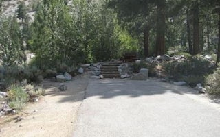
Upper Sage Flat
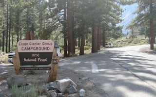
Big Pine Canyon
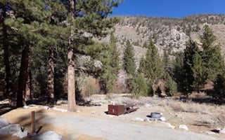
Big Pine Creek Campground
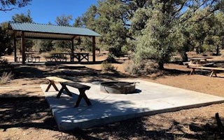
Cedar Flat Group Campground
Grandview Campground
Table Mountain (Inyo)


