Pinal County, Arizona
Looking for the best photography in Pinal County? We've got you covered with the top trails, trips, hiking, backpacking, camping and more around Pinal County. The detailed guides, photos, and reviews are all submitted by the Outbound community.
Top Photography Spots in and near Pinal County
-
Gold Canyon, Arizona
Peak 5057 via Hieroglyphic Trail
5.07.45 mi / 3045 ft gainTo get to the trailhead from US60, turn north onto Kings Ranch Road where you will begin the winding path through the neighborhoods. From Kings Ranch Road, turn east on Baseline Ave, north on Mohican Road, west on Valley View Drive, north on Whitetail Road, and east on Cloudview Ave until it com...Read more -
Gold Canyon, Arizona
Hieroglyphic Trail
5.02.9 mi / 614 ft gainThis hike is a great beginner hike for those who want to experience the beauty of the Superstitions. I suggest going early in the morning because this trail gets very crowded later in the day (especially on weekends). To get to the trailhead from US60, turn north onto Kings Ranch Road where you ...Read more -
Tucson, Arizona
Hike the Brown Mountain Trail
4.04.2 mi / 500 ft gainI really enjoyed this hike. I recommend doing the hike as an out and back from the Kinney Road parking area. Also, the best time to hike is just before sunset. The hike is just over 4 miles total out and back with only about 500 feet of elevation gain. It has a climb at the beginning then rolls a...Read more -
Winkelman, Arizona
Hike Aravaipa Canyon
5.08 mi / 200 ft gainWelcome to the beauty of wilderness and serenity! Within the boundaries of Aravaipa Canyon, you will not find any designated trails, campsites, or facilities. This canyon is one of Arizona’s hidden gems, and it is not mentioned in many travel books or in international travel magazines – yet. ...Read more -
Tucson, Arizona
Catch The Sunset on Gates Pass
4.0Get on E Speedway Blvd, and follow it West until it turns into W Gates Pass rd. Follow this for 3 miles and the parking lot will be at the top of the pass. There are a few viewing platforms that offer shade from the desert heat. There are numerous trails that you can follow to get whatever view y...Read more -
Rogers Trough Trailhead, Arizona
Hike Rogers Canyon Trail
5.08 mi / 1108 ft gainThe Superstition Wilderness is a vast rugged landscape where you can find the cultural remains of ancient Hohokam, Salado, Apache, and Yavapais tribes. Rogers Canyon Trail takes you to one of the most impressive and best preserved archaeological sites this region has to offer. These Salado ruin...Read more -
Apache Junction, Arizona
Monument Canyon and Broadway Cave
3.63.69 mi / 866 ft gain...Who doesn't enjoy a short adventure to an scenic location?! If I were to guess, I'd say a good majority of us. This four mile, low trafficked hike to the Broadway Cave will lead you to one of the best spots to hang out or watch the sunset. The Broadway trailhead is located by taking Highway 60...Read more -
Tucson, Arizona
Hike to the Bowen Stone House via Bowen Trail
2.4 mi / 300 ft gainThe Tucson Mountains are home to Saguaro National Park and the Tucson Mountain Park, the latter of which is a massive 20,000 acre park that is home to huge forests of giant saguaro cacti, a wide diversity of desert wildlife, and several long-abandoned farms and ranches like the Bowen Homestead, c...Read more -
Catalina Foothills, Arizona
Hike the Sabino Canyon Trail
4.7This popular trail is a paved road that crosses 9 stone bridges over Sabino Creek. The creek itself is pretty dry most of the year, but after a rain it's a wonderful place to cool off and escape from the merciless desert heat. Hikers, cyclists and equestrians alike share and enjoy the trail. Ther...Read more -
Catalina Foothills, Arizona
Hike Blackette's Ridge
5.05.84 mi / 1500 ft gainStarting from the Sabino Canyon Recreation Area you'll want to follow signs for the Bear Canyon Trail. Don't worry about how busy it seems - most of the people you see are probably only going as far as the dam or picnic areas. There is a good chance that you'll have the top all to yourself especi...Read more -
Tucson, Arizona
Seven Falls via Bear Canyon
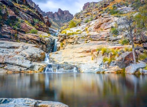
5.08.3 mi / 917 ft gainAt the main parking lot of Sabino Canyon, there are a few different trams you can take to nearby trailheads. You have the option to either hop on a tram that will take you to the 7 Falls trailhead for $4 a person, or walk the 2 miles yourself. Once at the trailhead, signs will lead you into Bear ...Read more -
Tucson, Arizona
Catch a Sunset on "A" Mountain
4.00.3 mi / 250 ft gainIn 1910 a group of University of Arizona students took local basalt rock and constructed a 160' block "A" on the east face of Sentinel Peak overlooking Tucson, giving the prominent peak its most commonly known name. Now the area is part of the 272 acre Sentinel Peak Park, and features a great net...Read more -
Mount Lemmon, Arizona
Rock Climb the Hitchcock Pinnacle
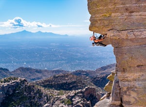
Hitchcock Pinnacle on Mount Lemmon may be the most recognizable landmark in the Santa Catalina Mountains due to its prominence over Catalina Highway and Windy Point. Ample parking is available as are bathrooms. The Pinnacle itself features several trad, sport, and top rope routes including a seri...Read more -
Apache Junction, Arizona
Hike to Praying Hands in Lost Dutchman State Park
4.04.3 mi / 954 ft gainBegin your hike in the Cholla parking lot, and start Treasure Loop Trail (this is the north side of the loop, heading east). Once you get to the base of the main cliffs, and the trail starts to veer to the right, this is where you branch off. Instead of veering right, go straight and off to the...Read more -
Apache Junction, Arizona
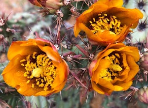
Photograph Cactus Blooms at Lost Dutchman
4.5And there is no better place to experience this beautiful display than at Lost Dutchman State Park. The State Park website shares that visitors can find "chuparosas, poppies, fiddle necks, globe mallow, chuparosa, brittle bush, desert evening primrose, lupine, ocotillo, chicory, scorpion weed, sk...Read more -
Apache Junction, Arizona
Siphon Draw to Flatiron Summit
4.95.6 mi / 3415 ft gainFlatiron is one of the most popular day hikes in the Superstition Wilderness, just outside of Phoenix, AZ. The hike begins at Lost Dutchman State Park in Apache Junction. Once inside the park, drive to the last parking area and look for a sign for the Siphon Draw Trailhead. The Siphon Draw Trail ...Read more

