Mayne Island, British Columbia
Looking for the best hiking in Mayne Island? We've got you covered with the top trails, trips, hiking, backpacking, camping and more around Mayne Island. The detailed guides, photos, and reviews are all submitted by the Outbound community.
Top Hiking Spots in and near Mayne Island
-
North Vancouver, British Columbia
Snowshoe Dog Mountain
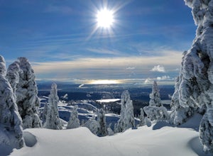
2.7 mi / 328.1 ft gainA perfect way to get outside before or after work. Dog mountain is an easily accessible snowshoe trail that takes you up to the short peak from the Mt. Seymour parking lot. This is a perfect spot for sunrise or sunset photography, and you can catch great 360 views from the top. Start at the BC Pa...Read more -
North Vancouver, British Columbia
Hike Dog Mountain, BC
4.23.1 mi / 150 ft gainThe trail begins in the furthest northwest corner of the parking lot, by a big trail map. The start of the trail is gradual and meanders through the forest. The trail then begins to become more technical and requires scrambling over rocks and up areas with roots. Although this hike has minimal ga...Read more -
North Vancouver, British Columbia
Hike to Mystery Lake
4.03.1 mi / 492.1 ft gainFrom the Mt. Seymour ski area parking lot, head towards the Mystery Peak Express. Once you have passed the base of the Mystery Peak Express, you will continue up the trail to your left (right goes to dog mountain, straight to the 3 peaks of Seymour). Follow the trail all the way up to the lake. T...Read more -
Anmore, British Columbia
Hike Lake Buntzen
4.5Buntzen Lake is located in a beautiful recreation area just north of Port Moody. Although the lake is man-made and maintained by BC Hydro, the surrounding area is full of forests, nice beach areas, and many trails for hiking including the Buntzen Lake Trail, which loops around the lake.Beginning ...Read more -
Anacortes, Washington
Hike Sares Head
2.1 mi / 440 ft gainStarting at the parking area, there is a roughly 2 mile hike through the woods. Depending on which route you take, you will suddenly end up at one of many incredible view points looking West at the Olympic Mountains, open ocean, and the San Juan Islands. In some areas you will be about 150 feet a...Read more -
Anacortes, Washington
Pacific NW Trail in Deception Pass State Park
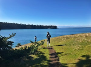
5.02.12 mi / 259 ft gainStarting from the Rosario Beach parking lot, the trail heads out past a large recreation area for families and into a wooded area leading up to Rosario Head. At this point in the trail there are beaches on either side that provide a great opportunity to explore some tidal pools. If you choose to...Read more -
Coquitlam, British Columbia
Hike to Sawblade Falls
3.9To reach the trailhead, follow Harper Road until you reach the Port Coquitlam Gun Club, then park along the side of the road. Walk past the yellow gate and take the first trail to your left. About 10 minutes down the trail, you will reach a gravel logging road. Take an immediate left down the pat...Read more -
Coquitlam, British Columbia
Hike to Woodland Falls
4.5Important: if you are planning on bringing a dog, and they are skittish around loud noises make sure to keep them leashed. This trail is beside the gun club and can spook dogs. You stop hearing the guns once you reach the powerline roadTo reach the trailhead, follow Harper Road until you reach th...Read more -
Oak Harbor, Washington
Camp & Hike at the Deception Pass Headlands
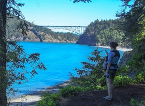
5.05 miTHE TRAIL: On the north side of the bridge, you'll come across Rosario Rd. Take this down to the Bowman Bay parking lot and your trailhead begins here. Take a moment to walk out on the fishing pier or watch what people are catching before you continue south on the trail towards Lottie Bay/Lightho...Read more -
4399 Bowman Bay Road, Washington
Hike or Run the Lighthouse Point Trail
5.01.9 mi / 285 ft gainThe Lighthouse Point Trail is yet another offshoot of Deception Pass Park’s wonderful trail system, which weaves itself through the northern corners to the southern ends of the park’s expansive walking paths. Perfect for families and for adventurers just getting their hiking legs warmed up for th...Read more -
15671 Rosario Road, Washington
Hike or Run Lottie Point Loop
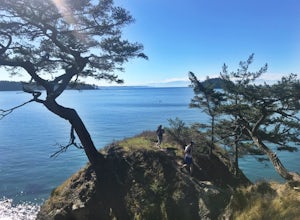
1.5 mi / 50 ft gainOne of the best routes to add to your itinerary when exploring Deception Pass State Park, one of Washington’s most popular year-round camping, hiking, and kayaking destinations; The Lottie Point Loop trail is a great offshoot of a larger trail system that takes you across soaring cliffsides and a...Read more -
North Vancouver, British Columbia
Snowshoe Mt. Seymour to Tim Jones Peak
5.6 mi / 1607.6 ft gainYou'll see traction of all sorts in the Mt. Seymour area during Winter months, including: yak tracks, microspikes, crampons, snowshoes, skis (with and without skins), and my personal favourite, the magic carpet.The Mt. Seymour trail parallels the Seymour downhill ski area. It follows up and over...Read more -
Oak Harbor, Washington
North Beach Trail
4.01.4 miA strait separating Whidbey Island from Fidalgo Island, Deception Pass and the bridges that span it are a fascinating day trip from Seattle. Located 82 miles from Seattle, a 90 minute drive will get you to the Deception Pass State Park. Once here, there are a myriad of activities to do - explore ...Read more -
Goose Rock Perimeter Trail, Washington
Hike or Run Goose Rock
2.5 mi / 482 ft gainDeception Pass State Park is one of Washington state's favorite year-round destinations; Beachside camping, salt-water kayaking, and plenty of short, accessible trails with endless views of the strait. Goose Rock, the tallest point on Whidbey Island, is just southeast of the Deception Pass bridge...Read more -
Oak Harbor, Washington
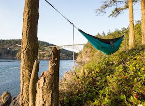
Photograph the Deception Pass Bridge
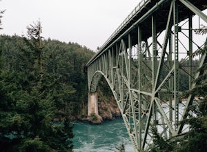
4.5Once you've parked your car, there is a $10 fee which can be paid at the station right next to the bridge unless you have a Discover Pass. From there, you can either go down the stairs to the beach or continue to walk across. Towards the middle, there are some stairs to get down and take some pho...Read more -
Bow, Washington
North Butte via Chuckanut Trail
1.07.71 mi / 2047 ft gainThe HikeThe hike there isn't short, has several steep sections, and ends at the top of the mountain. There are cliff warnings at the top, so be careful as you explore the view! The steepest portions are at the beginning and right at the end. The trail is very well maintained (because it is so pop...Read more

