Alberni-Clayoquot F, British Columbia
Looking for the best camping in Alberni-Clayoquot F? We've got you covered with the top trails, trips, hiking, backpacking, camping and more around Alberni-Clayoquot F. The detailed guides, photos, and reviews are all submitted by the Outbound community.
Top Camping Spots in and near Alberni-Clayoquot F
-
Errington, British Columbia
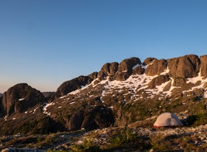
Hike and Camp at Mt. Arrowsmith
5.0Mt. Arrowmsith's claim to fame is the tallest mountain on "southern" Vancouver Island. Standing at 1,819 m (6,000 ft), it barely squeezes into the top 50 of the Island, as it stands no chance against the peaks of Strathcona, which you can see gazing north from the summit!The advantage of Arrowsmi...Read more -
Nanaimo F, British Columbia
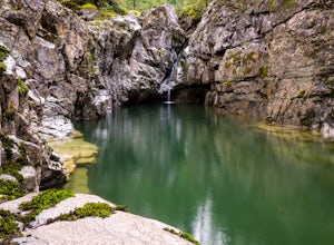
Hike Little Qualicum River and Falls
4.30.6 miLittle Qualicum Falls Provincial Park is just off the #4 highway on your way out to Port Alberni. Simply look for the signs indicating Little Qualicum Falls Provincial Park, and you will turn into the park before Cameron Lake.Easily accessible by everyone, this park can get busy in the summer mon...Read more -
Fanny Bay, British Columbia
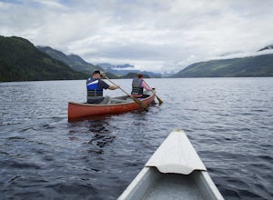
Canoe Great Central Lake and Hike to Della Falls and Love Lake
80.8 mi / 1148.3 ft gainTo get the the Della Falls trail head in Strathcona Park, you must cross Great Central Lake. This is a 45 km journey via either canoe, kayak, or speedboat. We chose to canoe, and it took approximately 9 steady hours. We parked our vehicles just on the edge of Central Lake Road across from Great C...Read more -
Youbou, British Columbia
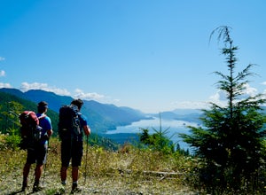
Hike Heather Mountain
20.5 mi / 3822.2 ft gainHeather Mountain is a moderate well marked out and back hike through managed forest land. The hike brings a wonderful feeling of solitude as there are no towns or buildings visible even with distant views in all directions. It is also quite lightly tracked: we saw no other hikers on the entire r...Read more -
Denman Island, British Columbia
Explore Fillongley Provincial Park
4.01.6 mi / 60 ft gainFillongley Park is located on Denman Island. To get there take the Denman Island Ferry from Buckley Bay, off Hwy #19A on central Vancouver Island. Take the Buckley Bay exit #101 from Hwy #19A. Once on the island, follow Denman Road to Swan Road. Turn left on Swan Road, then right on Beadnell Road...Read more -
Cowichan Valley F, British Columbia
Camp at Nitinat Lake
Nitinat Lake is located about 70 km from Lake Cowichan on Vancouver Island. It's about a 2 h drive from Lake Cowichan with 1 h on logging roads. When you get close to Lake Cowichan, the highway splits into two possible routes, one on the south side of the lake, the second on the north side. Since...Read more -
Alberni-Clayoquot C, British Columbia
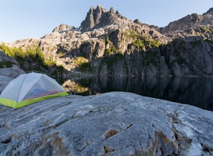
Camp at Lower Lake
4.02.5 mi / 1640.4 ft gainLower Lake is a gorgeous alpine lake located on the Triple Peak Trail. The route to the lake is very steep and scrambling is involved, but is well worth the effort. When you come to the rise above the final ridge, the stunning Triple Peak and Lower Lake come into view.The hike starts down a very ...Read more -
Alberni-Clayoquot A, British Columbia
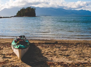
Kayaking the Broken Group Islands
The Broken Group Islands are an internationally acclaimed sea kayaking destination. They can only be done properly on a multi-day trip and it’s not recommended for novice paddlers. The stunning archipelago located on the west coast of Vancouver Island features hundreds of islands, lagoons, caves,...Read more -
Alberni-Clayoquot A, British Columbia
Hike to Keeha Beach
5.03.7 miFar on the west coast of Vancouver Island, accessed only by a harrowing dirt road, is a wild and rugged coast begging to be explored. Bamfield is about a 3 hour drive from Nanaimo, half of which is on the gnarliest (and most active) logging road I've ever been on - and I grew up driving on loggin...Read more -
Comox-Strathcona D, British Columbia
Climb Mt. Septimus via the X-Gully
16.8 mi / 5905.5 ft gainMt Septimus lies deep within the beautiful and untouched Strathcona Park on Vancouver Island. The route takes you high into the alpine where you will cross glacial fed lakes amongst large peaks and thick forest. To climb Mt Septimus the route you will be taking is the X-Gully route, a steep snow ...Read more -
Comox-Strathcona D, British Columbia
Hike to Cream Lake, BC
12.4 mi / 1312.3 ft gainThe hike to Cream Lake starts at the trailhead for the Bedwell Lake trail, which you can find directions to here.From Bedwell Lake the trail to Cream Lake heads Eastward from the campground (past the outhouse), and begins climbing steadily. Shortly you will reach a waterfall with the trail climb...Read more -
Comox-Strathcona D, British Columbia
Hike to Baby Bedwell & Bedwell Lake
5.07.5 mi / 2132.5 ft gainDriving: From Campbell River, take Highway 28 West to the bridge over Upper Campbell Lake/Buttle Lake. Do not cross the bridge, but take the road down the East side of Buttle Lake. Follow Buttle Lake road south to Jim Mitchell Lake road which is on the left just after the Thelwood Creek Bridge. ...Read more -
Port Renfrew, British Columbia
Backpack the West Coast Trail, Pacific Rim NP
46.6 mi / 360.9 ft gainIn the summer of 2016, myself and three others decided to hike the West Coast Trail (WCT) on a bit of a whim! We naively, and courageously, choose the WCT as our first major backpacking hiking trip - we thought it would be best to throw ourselves into a hike that has earned a reputation for being...Read more -
Powell River, British Columbia
Backcountry Hike and Hut Camp the Northern Portion of the Sunshine Coast Trail
31.1 mi / 3937 ft gainThis adventure is a 50km backcountry hiking and camping trip and should not be attempted without prior backcountry experience. It is recommended you attempt this trail in a group. Below is a detailed description of how to get to the trail and your options for huts while on the trail:The Sunshin...Read more -
Comox-Strathcona D, British Columbia
Hike to Flower Ridge
20 mi / 5445 ft gainWith a name like Flower Ridge, who wouldn't want to add this hike to their bucket list?The Flower Ridge trailhead is located approximately 26kms down the Buttle Lake Parkway, towards Westmin Mine, in Strathcona Provincial Park. A classic Island alpine approach, you will be more than warmed up af...Read more -
Comox-Strathcona C, British Columbia
Backpack to Circlet Lake Campground
13.9 mi / 2664 ft gainIf you are looking for a beautiful, stress-free campground nestled in the mountains far from the city but within a morning's drive and a day's walking distance, suitable for the whole family and offers tons of activities, Circlet Lake is the right choice for you. It features an alpine lake that i...Read more

