Bighorn No. 8, Alberta
Looking for the best photography in Bighorn No. 8? We've got you covered with the top trails, trips, hiking, backpacking, camping and more around Bighorn No. 8. The detailed guides, photos, and reviews are all submitted by the Outbound community.
Top Photography Spots in and near Bighorn No. 8
-
Kananaskis, Alberta
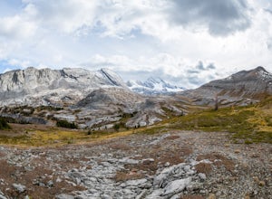
Exploring Burstall Pass
5.0Head to the northwest corner of the parking lot to find the trail. For the first 5.5 km the trail is quite easy, with only modest elevation increase. At 5.5 km you will arrive at what is known as the gravel flats. Depending on the time of year the gravel flats can be either quite dry or a wide, s...Read more -
Kananaskis, Alberta
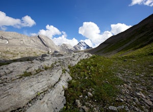
Hiking Burstall Pass
5.09.3 mi / 1542 ft gainThe trail begins along the berm beside Mud Lake. After a rather uninspiring 3 km (you can mountain bike this part) the trail narrows and enters trees where tangled roots twist across the path and you breathe in the smells of damp earth and moss.Ten minutes later the trail spits you across a spl...Read more -
Bragg Creek, Alberta
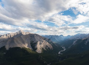
Hike Nihahi Ridge
4.58.1 mi / 2624.7 ft gainThis year on the summer solstice, I was invited to go up Nihahi Ridge to celebrate. It's in one of my personal most underrated areas of the Rockies just west of Bragg Creek, and it's a popular objective, but less so during the evening. The trail begins once you park your car at the Little Elbow p...Read more -
Bragg Creek, Alberta
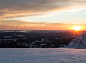
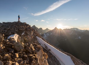
Cross-Country Ski and Scramble to Oldforgetmenot for Sunrise
9.9 mi / 2395 ft gainI think it's because I tend to watch football on Sundays that I've started doing more sunrise hikes --- can't say I regret it either! Oldforgetmenot is a perfect objective to take in a sunrise on: elevation gain isn't too intense, distance isn't too trying, and there are quite a few stretches tha...Read more -
Bragg Creek, Alberta
Scramble Mount Glasgow
3.014.3 mi / 4265.1 ft gainAs with most hikes in the Bragg Creek/Little Elbow area, the trail begins at the Little Elbow campground. To make the hike a tiny bit shorter, most people bike for the first 4 km on the Big Elbow trail to South Glasgow Creek. If you're not using a GPS trail, you'll know you're at the creek once y...Read more -
Improvement District No. 9, Alberta
Eiffel Lake via Valley of Ten Peaks
5.07.35 mi / 1647 ft gainHike with amazing views of Valley of Ten Peaks, including Mount Fay (10,613 ft), Mount Little (10,131 ft), Deltaform Mountain (11,234 ft), and Wenkchemna Peak (10,401 ft) to two breathtaking glacial lakes in the heart of the Continental Divide. From the lake, the trail is quite easy to follow, a...Read more -
Improvement District No. 9, Alberta
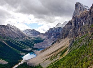
Hike to Consolation Lakes
4.03.7 mi / 196.9 ft gainOnce at Moraine Lake, the directions to Consolation Lakes are quite clear. From the parking lot, head northeast past the rockpile, which provides fantastic views of Moraine, then follow the Consolation Lakes Trail for another 2.9 km (1.8 miles) past Taylor Lake until you reach the lake. Depending...Read more -
Improvement District No. 9, Alberta
Larch Valley Trail to Minnestimma Lakes
5.05.61 mi / 1909 ft gainStarting at the Moraine Lake parking lot take, take the main trail the leads down past the cafe and lodges on the lake shore. A short way down the trail splits, to the left is just the lakeside walk. For Larch Valley take a right, it is clearly signed. Depending on the time of the year there are ...Read more -
Improvement District No. 9, Alberta
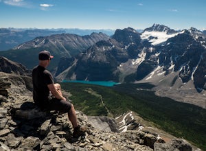
Eiffel Peak
5.07.14 mi / 3917 ft gainTake in stunning alpine views of the famous Valley of the Ten Peaks as you head to Eiffel Peak. A much more unique photo opportunity of Moraine Lake. Views of several prominent glaciers and the gorgeous Paradise Valley. The Eiffel Tower rock formation viewable from the summit. 11km roundtrip. 130...Read more -
Improvement District No. 9, Alberta
Scramble the Ten Peaks via the Perren Route
A true adventure with lots of route finding, glacier travel, loose rock and high altitude views. This is not for the faint hearted or first timers.From the Moraine Lake parking lot walk down the east side of the lake along the well maintained trail. Towards the end of the lake you will cross the ...Read more -
Improvement District No. 9, Alberta
Scramble the Tower of Babel
4.01.94 mi / 1726 ft gainStarting at the Moraine Lake parking lot follow the trail East along behind the large pile of boulders along the lake shore. Once you reach the foot of the Tower of Babel scramble up the slope to heading towards the valley between the two peaks. The easiest route is along one of the cliff faces w...Read more -
East Kootenay G, British Columbia
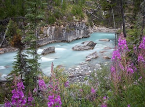
Hiking in Marble Canyon
1.2 miMarble Canyon is easily accessible off of the 93S in Kootenay National Park between Banff and Radium.This is a really beautiful area and a nice easy walk for the family with some beautiful scenery to go along with it. Make a visit here in August when the the Fireweed is at its prime, lining the f...Read more -
Improvement District No. 9, Alberta
Drive the Icefields Parkway
5.0145.45 mi / 6293 ft gainThe Icefields Parkway has been named One of the World's Most Scenic Drives by National Geographic and with all the scenic hikes, stops, and viewpoints, it's easy to see why. Starting at Lake Louise, a friend and I decided to drive up the Icefields Parkway which goes through Banff National Park i...Read more -
Improvement District No. 9, Alberta
Bike the Icefields Parkway
The Icefields Parkway is a spectacular highway to ride (you can see the short video here). The shoulders are wide and well paved. Drivers are typically courteous, slowing down and giving you space as they pass, making the ride a great deal more enjoyable. Starting in Jasper you load up your bike,...Read more -
Lake Louise, Alberta
Plain of Six Glaciers
4.68.96 mi / 1565 ft gainStarting from the parking lot on the east end of Lake Louise, there are a few options you can take to get to the Plain of Six Glaciers. One is to head directly along the lakeshore trail, and in about 7 km (4.2 miles) you will be at the lookout offering the best vantage point of the glacier field....Read more -
Lake Louise, Alberta
Hike Fairview Mountain
7.1 mi / 3280.8 ft gainFairview Mountain is a non-technical objective alpine summit located on the south side of Lake Louise. It's trailhead is accessed from the Lake Louise parking lot. The trail is well established and well marked throughout. You can expect a distance of about 11km return and elevation gain of 1000m,...Read more

