Bighorn No. 8, Alberta
Looking for the best photography in Bighorn No. 8? We've got you covered with the top trails, trips, hiking, backpacking, camping and more around Bighorn No. 8. The detailed guides, photos, and reviews are all submitted by the Outbound community.
Top Photography Spots in and near Bighorn No. 8
-
Kananaskis, Alberta
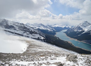
Hike up Windtower Mountain
5.06.2 mi / 3182.4 ft gainSpray Lakes is one of my favorite areas in Kananaskis, and the view of Spray Lakes from the summit is absolutely breathtaking.The trailhead is located along the Smith-Dorrien Trail (Spray Lakes Road) – look for a yellow sign on the eastern side of the road, about 1 mile (1.5 km) south of the Drif...Read more -
Improvement District No. 9, Alberta
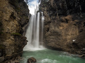
Hike Johnston Canyon
5.01.6 mi / 393.7 ft gainGetting There: The Canyon is very well marked, but here are directions anyway if you're coming from Banff: Head West on the Trans-Canada Highway for about 5 km or so. Take the Bow Valley Parkway exit, and continue West for another 18km - you'll then see signs to your right for Johnston Canyon. Th...Read more -
Improvement District No. 9, Alberta
Hike to the Ink Pots via Johnston Canyon
3.87.5 mi / 1050 ft gainThe hike through Johnston Canyon to its Upper and Lower falls is one of the most popular hikes to do in Banff - mostly due the little effort required for the great reward.To start, take the Bow Valley Parkway (Highway 1A) - the parking lot and trailhead are clearly marked by a Johnston Canyon sig...Read more -
Kananaskis, Alberta
Hike Spencer Creek
2.5 mi / 1968.5 ft gainSouth of the Driftwood turnoff (approximately 4 km) on Spray/Smith-Dorrien Trail a large creek bed on the east of the road is the beginning of Spencer Creek. The trail is easy enough to find, just have to do a bit of looking.Once on the trail, you'll basically have no trouble at all. The trail it...Read more -
Kananaskis, Alberta
Winter Climb Mount Allan
5.08.7 mi / 4429.1 ft gainMount Allan is a 14 km hike that gains 1400 metres of elevation and was one of my favourite hikes when I first moved to Calgary. On a recent snowshoe, a couple I crossed paths with mentioned they had just done Mount Allan in December, so I knew I had to put it on my winter list!The trail begins a...Read more -
Kananaskis, Alberta
Ribbon Falls
3.812.4 mi / 1148.3 ft gainRibbon Creek trail is accessible via Highway 40 at the turn off for Nakiska Mountain Resort. From there take a left at Centennial Drive and then a right onto Ribbon Creek Road. The hike begins at the far end of the Ribbon Creek Trailhead parking lot. There is an old coal mining cart at the start...Read more -
Kananaskis, Alberta
Hike Centennial Ridge
9.9 mi / 4592 ft gainThis hike can be done as a full traverse, starting at the Ribbon Creek Trailhead and taking you to Dead Man's Flats, just off of the Trans Canada Highway. Starting at the trailhead in the Ribbon Creek parking lot, go north on Hidden Trail. You will be on this trail for ~ 200 m before you need to ...Read more -
Edgewater, Alberta
Ski Sunshine Village
5.0Do you like skiing wide open slopes of light, fluffy powder? How about staring off at massive, jagged peaks while you do it? Then do I have the resort for you… Sunshine Village in the heart of Banff National Park offers something for everyone on the slopes. There are ample wide open groomers for ...Read more -
Improvement District No. 9, Alberta
Hike to Healy Pass
7.5 mi / 2198.2 ft gainHead up to Healy Pass in late September or early October to check out the beautiful larch trees in their golden glory. Sunshine Meadows, Assiniboine, and other amazing views can be seen from the top of this easy trail. Start your adventure in the Sunshine Village ski resort parking lot. Head behi...Read more -
Improvement District No. 9, Alberta
Sunshine Village Gondola and Standish Quad Chairlift Hike
6.2 mi / 902.2 ft gainIf you're looking for an adventure in the Banff area that's not as crowded as the main tourist attractions but offers as spectacular of views, check this gem out. Make sure to check hours of operation before going, gondola/ ski lift are not always running. Ride the gondola all the way to the to...Read more -
Banff, Alberta
Mount Assiniboine: Sunshine Village to Mount Shark
5.036.37 mi / 5869 ft gainThis trek specifically covers the distance from Sunshine Village to Mount Shark. You will need a car at Mt. Shark, as there are no shuttles from that location to Canomre or any local areas. Otherwise, you can try to hitch a ride back – your best bet is to talk with some locals or visit the Canmor...Read more -
Improvement District No. 9, Alberta
Hike to Silverton Falls
1.2 mi / 120 ft gainStarting at the Rockbound Lake trailhead you will want to follow the flat dirt path straight, until you see the junction in the road with the sign pointing you to Silverton Falls (it will be about 500 steps or a quarter of a mile). We made the mistake of taking the first junction which lead us to...Read more -
Improvement District No. 9, Alberta
Snowshoe to Rockbound Lake
3.011 mi / 2460 ft gainThis is an amazing trail, but not for the feint of heart!The trailhead is located on the Bow Valley Parkway (Highway 1A) in Banff National Park, AB at the Castle Mountain sign. The trailhead is marked by an information sign in the north of the parking lot and the trail initially heads north - not...Read more -
Kananaskis, Alberta
Hike Old Baldy Ridge
9.3 mi / 2952.8 ft gainPark at the Evan Thomas parking lot to and the trailhead is in the south of that parking lot. It follows a well-defined trail up for most of the way before you start gaining elevation. When the trail starts heading south, keep an eye out for a small trail that will keep you heading east. This por...Read more -
Turner Valley, Alberta
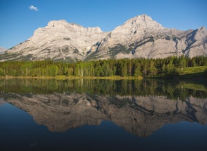
Photograph Wedge Pond
3.00.25 mi / 10 ft gainJust off Highway 1 in Kananaskis Country is a beautiful pond that makes for a wonderful spot to enjoy the first light on the Canadian Rockies. Bring warm clothes as this place can be especially cold. Don't forget a camera and a blanket. I recommend going for sunrise as this is when the lighting i...Read more -
Kananaskis, Alberta
Scramble the Wedge
5 mi / 3444.9 ft gainDrive south on Highway 40 and your adventure begins at Wedge Pond. Parking in the parking lot is easy enough if you're there early enough in the day (before 10:00). The trail up the Wedge starts near the bathrooms, and heads south - not southwest towards the pond. After only a few minutes of walk...Read more

