Bighorn No. 8, Alberta
Looking for the best photography in Bighorn No. 8? We've got you covered with the top trails, trips, hiking, backpacking, camping and more around Bighorn No. 8. The detailed guides, photos, and reviews are all submitted by the Outbound community.
Top Photography Spots in and near Bighorn No. 8
-
Eldon, Alberta
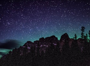
View the Castle Mountain Lookout
Castle mountain, so named for its fortress-like shape, is a quick hop away from the town of Banff. If you don't have time to hike to Rockbound Lake (at the base of Castle), head to the viewpoint just off of Highway 91 and snap some pictures of this epic mountain. Drive north for about 10 minutes...Read more -
Kananaskis, Alberta
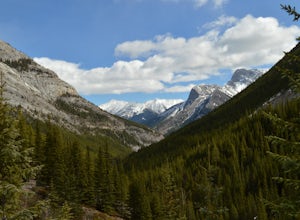
Hike up Galatea Creek to Lillian Lake
Located on Highway 40 (Kananaskis Trail) and marked by the "Galatea" sign, there's not much more to this hike other than putting one foot in front of the other, but the amount of traffic it sees is a testament to the quality of this hike.Even on the backend of winter the numerous shades of green ...Read more -
Improvement District No. 9, Alberta
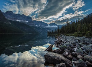
Hike to Boom Lake
4.06.2 miBoom Lake offers amazing views of Boom Mountain and the ridge separating Alberta and British Columbia. It is not as popular as many other hikes in the area, which means exclusion for anyone willing to explore the lake. The abundant wildlife in the area includes wolves, bears, mountain goats, de...Read more -
Kananaskis, Alberta
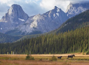
Hiking to Karst Spring in Kananaskis Country
4.5Every year, over 5 million visitors make their way through Banff National Park to soak in the surrounding peaks, bountiful wildlife, and turquoise-colored lakes. With this many visitors, it's hard to find yourself alone, especially during the peak seasons of summer and fall. Right next door to Ba...Read more -
Kananaskis, Alberta
Bryant Creek Lodge via Watridge Lake Trail
16.65 mi / 1401 ft gainThis moderate-graded backcountry hike or ski in the winter can take 5-8 hours (one way). Most people hike or ski in from the Mt. Shark parking lot in Kananaskis Country, a 30 min. drive from Canmore, Alberta. From Mt. Shark Parking Lot (off the Smith-Dorrien Road), take the Watridge Lake Trail t...Read more -
Edgewater, British Columbia
Hike to Nub Peak
5.07.3 mi / 2789 ft gainStarting right at Mt. Assiniboine Lodge, there is very clear signage for this hike. The arrows will lead you over a wooden walkway right before you begin a gentle assent through the woods,gaining elevation the further you go, and then arrive at The Nublet which is before the peak. The Nublet has ...Read more -
Edgewater, British Columbia
Explore Mount Assiniboine Provincial Park
5.0Mount Assiniboine Provincial Park is a UNESCO World Heritage Site sequestered 27 km from the nearest road. We took a helicopter in, and hiked out . You can also hike both ways, but the hiking once you are there is more amazing than on the way in. You can also ski in on backcountry skis in the Win...Read more -
Bragg Creek, Alberta
Hike Iyarhe Ipan
3.02.5 mi / 1476.4 ft gainIyarhe Ipan means "mountain point" in Stoney, and while it's far from the highest peak you'll ever climb, it certainly is worth it. Iyarhe Ipan was the fix for the scrambling itch I've had all winter.Before Highway 66 opens in the summer, you'll have to park your car at Elbow Falls parking lot an...Read more -
Bragg Creek, Alberta
Winter Hike Up Vent's Ridge
Whether it was the unseasonably warm weather; the forested, uneven, foot-wide, root-covered trail; limestone cliffs towering above me; the view of Myosotis Peak from the ridge; or exploring along Powderface Creek on the descent, this trail was an absolute blast.If you do this hike in February lik...Read more -
Kananaskis, Alberta
Snowshoe to Rummel Lake and Pass
4.07.5 mi / 2000 ft gainThe trailhead to Rummel Lake/Pass is off of Kananaskis Trail (Smith Dorrien Trail) directly across from the turn to Mt. Shark at the south end of Spray Lakes - it will likely be marked by cars attempting the same trail. The trail is well packed and snowshoes aren't even necessary until after Rumm...Read more -
Kananaskis, Alberta
Scramble Smutwood Peak
5.011.8 mi / 2772.3 ft gainThe trailhead is is located at the first left after the bridge past Engandine Lodge in Kananaskis. The trail forks after a while and you need to take a right which takes you into Smuts Pass. This trail is actually really cool and fun to walk - undulating, narrow, rooted, and right along the edge ...Read more -
Improvement District No. 9, Alberta
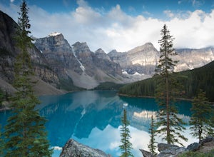
Moraine Lake
4.8Showing up at Moraine Lake before dawn is a must as to avoid the multitude of tours busses. The morning sun is subtle and magical. The lake, being glacially fed, does not reach its crest until mid to late June. When it is full, it reflects a distinct shade of blue. The color is due to the refract...Read more -
Kananaskis, Alberta
Hike Opal Ridge's South Summit
5.0Opal Ridge is located on the East side of highway 40 in Kananaskis.The trailhead starts at Fortress Gas Station. Park at the North end of the parking lot. The trailhead is easy to spot from here. Follow the creek a couple hundred meters till you reach an open area with power lines. Turn left. Con...Read more -
Kananaskis, Alberta
Scramble the Fortress
Have you ever done a hike where you just don't want the day to end? Scramble the Fortress and you'll know the feeling. The thing that drew me to the Fortress was its summit elevation of 3000 masl, as well as its blocky, fortress-like profile when viewed from the north. It's so much more than that...Read more -
Kananaskis, Alberta
Backpack the Fortress Cirque
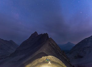
5.012.19 mi / 3507 ft gainNo better way to watch the stars with friends than huddled up in your sleeping bag on top of a 3000m summit. This describes the bivy at The Fortress. Starting at the Chester Lake Trailhead, take the unmarked trail on the right side of the parking lot. These winter cross-country ski trails take y...Read more -
Kananaskis, Alberta
Hike from Headwall Lakes to Chester Lake
5.010.6 mi / 2650.9 ft gainThe hike starts at the Chester Lake trailhead along the Smith Dorian road in Kananaskis. The first few kilometers follow the old logging roads, now used as cross country skiing trails. Find the beginning of the trail at the upper right end of the parking lot, and continue to follow parallel to t...Read more

