Bighorn No. 8, Alberta
Looking for the best hiking in Bighorn No. 8? We've got you covered with the top trails, trips, hiking, backpacking, camping and more around Bighorn No. 8. The detailed guides, photos, and reviews are all submitted by the Outbound community.
Top Hiking Spots in and near Bighorn No. 8
-
Improvement District No. 9, Alberta
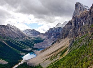
Scramble the Tower of Babel
4.01.94 mi / 1726 ft gainStarting at the Moraine Lake parking lot follow the trail East along behind the large pile of boulders along the lake shore. Once you reach the foot of the Tower of Babel scramble up the slope to heading towards the valley between the two peaks. The easiest route is along one of the cliff faces w...Read more -
Improvement District No. 9, Alberta
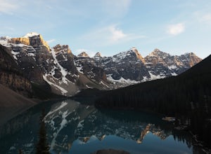
Sentinel Pass: Larch Valley to Paradise Valley
5.010.45 mi / 2618 ft gainThis popular hike starts out by the one the most iconic lakes in Banff National Park, Moraine Lake. Though the trail from Larch Valley attracts herds of tourists, this is a majestic hike you don’t want to miss. Before your hike, contact the park office at Moraine Lake about possible hiking restr...Read more -
East Kootenay G, British Columbia
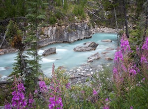
Hiking in Marble Canyon
1.2 miMarble Canyon is easily accessible off of the 93S in Kootenay National Park between Banff and Radium.This is a really beautiful area and a nice easy walk for the family with some beautiful scenery to go along with it. Make a visit here in August when the the Fireweed is at its prime, lining the f...Read more -
Improvement District No. 9, Alberta
Drive the Icefields Parkway
5.0145.45 mi / 6293 ft gainThe Icefields Parkway has been named One of the World's Most Scenic Drives by National Geographic and with all the scenic hikes, stops, and viewpoints, it's easy to see why. Starting at Lake Louise, a friend and I decided to drive up the Icefields Parkway which goes through Banff National Park i...Read more -
Lake Louise, Alberta
Plain of Six Glaciers
4.68.96 mi / 1565 ft gainStarting from the parking lot on the east end of Lake Louise, there are a few options you can take to get to the Plain of Six Glaciers. One is to head directly along the lakeshore trail, and in about 7 km (4.2 miles) you will be at the lookout offering the best vantage point of the glacier field....Read more -
Lake Louise, Alberta
Lake Agnes Tea House
4.84.58 mi / 1260 ft gainTowering peaks, glaciated valleys, and crystal clear water draw thousands of visitors a year to the shores of Lake Louise in Banff National Park. A short hike takes you beyond the crowds up to Lake Agnes, a beautiful valley surrounded by jagged peaks and golden Larch trees. At the foot of Lake ...Read more -
Lake Louise, Alberta
Hike Fairview Mountain
7.1 mi / 3280.8 ft gainFairview Mountain is a non-technical objective alpine summit located on the south side of Lake Louise. It's trailhead is accessed from the Lake Louise parking lot. The trail is well established and well marked throughout. You can expect a distance of about 11km return and elevation gain of 1000m,...Read more -
Lake Louise, Alberta
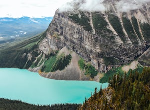
Hike to the Lake Louise Overlook
5.02 mi / 500 ft gainThis is a fairly steep, short hike that gives you a great view of Lake Louise. The hike begins right behind the canoe rental shop on the South side of the lake. The trail is very easy to follow and there are quite a few people that hike it. The hike is an hour and half round trip. The hike leads...Read more -
Lake Louise, Alberta
Hike to Big Beehive
5.06.2 mi / 1710 ft gainThe hike to Big Beehive begins at the base of Lake Louise. From the parking lot, hike along the paved trail on the northeastern shore of Lake Louise. The Fairmont Chateau Hotel will be to your right with the lake to your left. Continue toward the junction for the Lake Agnes Trail. Keep right t...Read more -
Improvement District No. 9, Alberta
Devil's Thumb Scramble
7.09 mi / 2575 ft gainPark in the visitor parking lot at the Chateau Lake Louise parking lot in time for sunrise at Lake Louise...not to be missed! Then follow the pathway to the right around the lake to the Lake Agnes turnoff (well marked, with a small bronze statue at the intersection.) The waterfall is just befor...Read more -
East Kootenay G, British Columbia
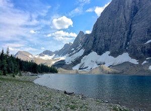
Hike The Floe Lake Trail
13 mi / 2350 ft gainKootenay National Park is one of the lesser visited parks in a chain of spectacular parks in the Canadian Rockies between Banff and Jasper. Straddling the Trans-Canadian Highway, the park offers hot springs, awesome mountain views, and glaciers. As you enter the park, keep an eye out for the griz...Read more -
Lake Louise, Alberta
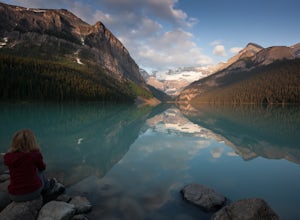
Exploring Lake Louise
4.6Lake Louise is one of the most photographed lakes in Canada, with reason. Many tourist walk the paved path round and head home. They miss out though. Hiking to the various tea houses surrounding the lake is a must. An easy 2 mile hike from the lake lies a tea house perched on a hill in a tight ci...Read more -
Lake Louise, Alberta
Hike to the Devils Thumb
5.0Park in the main Lake Louise parking lot. Be sure to have purchased your Park Pass. These can be purchased as you enter Banff National Park, or at the Banff and Lake Louise Information Centers. Follow the paved path along the lake shore in front of the Hotel, Chateau Lake Louise. At 0.8 km you wi...Read more -
Kananaskis, Alberta
Hike Alberta's Grizzly Peak
4.0The trailhead is located on the north side of Ripple Creek, the first creek you come across after passing the Grizzly Creek turnoff. There is an easy pull-off on the east side of the highway. You should be able to see the trailhead from the road, which follows the southern slope of the mountain f...Read more -
Improvement District No. 9, Alberta
Scramble up Mount Niblock
5.09.3 mi / 4068.2 ft gainThousands of tourists flock to Lake Louise and Lake Agnes every year (maybe even every month) and by scrambling Mount Niblock you'll see the same magnificent sites while leaving the crowd behind and seeing so much more!Mount Niblock offers a bit of a challenge in that there are some rock ribs tha...Read more -
East Kootenay G, British Columbia
Backpack the Rockwall Trail
68 mi / 8530 ft gainThe Rockwall trail is a famous 3-5 day trek in Kootenay National Park. We started from the North and camped at Helmet Falls our first night, and then continued south and exited out Floe Lake. I would recommend this direction for a backpack, and the opposite direction for a trail run (it's about ...Read more

