Bighorn No. 8, Alberta
Looking for the best hiking in Bighorn No. 8? We've got you covered with the top trails, trips, hiking, backpacking, camping and more around Bighorn No. 8. The detailed guides, photos, and reviews are all submitted by the Outbound community.
Top Hiking Spots in and near Bighorn No. 8
-
Kananaskis, Alberta
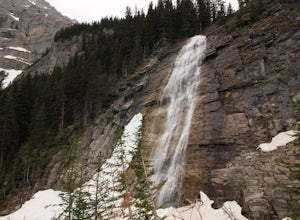
Ribbon Falls
3.812.4 mi / 1148.3 ft gainRibbon Creek trail is accessible via Highway 40 at the turn off for Nakiska Mountain Resort. From there take a left at Centennial Drive and then a right onto Ribbon Creek Road. The hike begins at the far end of the Ribbon Creek Trailhead parking lot. There is an old coal mining cart at the start...Read more -
Kananaskis, Alberta
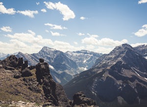
Hike Centennial Ridge
9.9 mi / 4592 ft gainThis hike can be done as a full traverse, starting at the Ribbon Creek Trailhead and taking you to Dead Man's Flats, just off of the Trans Canada Highway. Starting at the trailhead in the Ribbon Creek parking lot, go north on Hidden Trail. You will be on this trail for ~ 200 m before you need to ...Read more -
Improvement District No. 9, Alberta
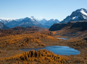
Hike to Healy Pass
7.5 mi / 2198.2 ft gainHead up to Healy Pass in late September or early October to check out the beautiful larch trees in their golden glory. Sunshine Meadows, Assiniboine, and other amazing views can be seen from the top of this easy trail. Start your adventure in the Sunshine Village ski resort parking lot. Head behi...Read more -
Improvement District No. 9, Alberta
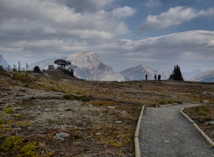
Sunshine Village Gondola and Standish Quad Chairlift Hike
6.2 mi / 902.2 ft gainIf you're looking for an adventure in the Banff area that's not as crowded as the main tourist attractions but offers as spectacular of views, check this gem out. Make sure to check hours of operation before going, gondola/ ski lift are not always running. Ride the gondola all the way to the to...Read more -
Banff, Alberta
Mount Assiniboine: Sunshine Village to Mount Shark
5.036.37 mi / 5869 ft gainThis trek specifically covers the distance from Sunshine Village to Mount Shark. You will need a car at Mt. Shark, as there are no shuttles from that location to Canomre or any local areas. Otherwise, you can try to hitch a ride back – your best bet is to talk with some locals or visit the Canmor...Read more -
Kananaskis, Alberta
Scramble up Mount Sparrowhawk for Sunrise
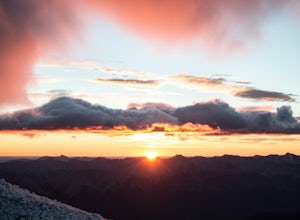
7.5 mi / 4527.6 ft gainMount Sparrowhawk was the first mountain I ever fell in love with -- I knew it well, and I knew that the summit would still be accessible with a bit of snow on it in October. With waning daylight hours, it was a perfect option - albeit intense - for a sunrise hike.The trailhead is located on the ...Read more -
Bragg Creek, Alberta
Hike Jumpingpound Summit
3.03.1 mi / 1148.3 ft gainThis is a great short hike that will only take about ½ day. Take Hwy. 1 west and take the exit for the Sibbald Creek Trail. Follow this road until you hit the Powderface Trail. (NOTE: this road is closed from December 1 – May 14 annually). Follow this road for approximately 15km’s. Take note tha...Read more -
Improvement District No. 9, Alberta
Hike to Silverton Falls
1.2 mi / 120 ft gainStarting at the Rockbound Lake trailhead you will want to follow the flat dirt path straight, until you see the junction in the road with the sign pointing you to Silverton Falls (it will be about 500 steps or a quarter of a mile). We made the mistake of taking the first junction which lead us to...Read more -
Improvement District No. 9, Alberta
Snowshoe to Silverton Falls and Rockbound Lake
10.4 mi / 2493.4 ft gainPark at Rockbound Lake Trailhead, 0.2 km east of Castle Junction on Bow Valley Parkway (Highway 1A).The trail wanders through forest until coming to a fork to the right, leading to SilvertonFalls. This is a worthwhile 1 km side trip to a beautiful small waterfall dropping into a turquoise blue po...Read more -
Improvement District No. 9, Alberta
Snowshoe to Rockbound Lake
3.011 mi / 2460 ft gainThis is an amazing trail, but not for the feint of heart!The trailhead is located on the Bow Valley Parkway (Highway 1A) in Banff National Park, AB at the Castle Mountain sign. The trailhead is marked by an information sign in the north of the parking lot and the trail initially heads north - not...Read more -
Kananaskis, Alberta
Hike Old Baldy Ridge
9.3 mi / 2952.8 ft gainPark at the Evan Thomas parking lot to and the trailhead is in the south of that parking lot. It follows a well-defined trail up for most of the way before you start gaining elevation. When the trail starts heading south, keep an eye out for a small trail that will keep you heading east. This por...Read more -
Turner Valley, Alberta
Photograph Wedge Pond
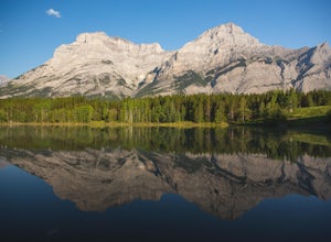
3.00.25 mi / 10 ft gainJust off Highway 1 in Kananaskis Country is a beautiful pond that makes for a wonderful spot to enjoy the first light on the Canadian Rockies. Bring warm clothes as this place can be especially cold. Don't forget a camera and a blanket. I recommend going for sunrise as this is when the lighting i...Read more -
Kananaskis, Alberta
Scramble the Wedge
5 mi / 3444.9 ft gainDrive south on Highway 40 and your adventure begins at Wedge Pond. Parking in the parking lot is easy enough if you're there early enough in the day (before 10:00). The trail up the Wedge starts near the bathrooms, and heads south - not southwest towards the pond. After only a few minutes of walk...Read more -
Kananaskis, Alberta
Hike up Galatea Creek to Lillian Lake
Located on Highway 40 (Kananaskis Trail) and marked by the "Galatea" sign, there's not much more to this hike other than putting one foot in front of the other, but the amount of traffic it sees is a testament to the quality of this hike.Even on the backend of winter the numerous shades of green ...Read more -
Kananaskis, Alberta
Hike to Lillian Lake and Galatea Lakes
2.09.3 mi / 3018.4 ft gainMake the trek down Hwy. 40 (about 33 km’s) to the trail head - Galatea Day Use Area. It’s very easy to find, as this is one of Kananaskis most popular day hikes. The trail leads into the forest, crossing a suspension bridge and a couple more bridges after that. Due to some flood damage, the bridg...Read more -
Improvement District No. 9, Alberta
Hike to Boom Lake
4.06.2 miBoom Lake offers amazing views of Boom Mountain and the ridge separating Alberta and British Columbia. It is not as popular as many other hikes in the area, which means exclusion for anyone willing to explore the lake. The abundant wildlife in the area includes wolves, bears, mountain goats, de...Read more

