Crozet, Virginia
Looking for the best hiking in Crozet? We've got you covered with the top trails, trips, hiking, backpacking, camping and more around Crozet. The detailed guides, photos, and reviews are all submitted by the Outbound community.
Top Hiking Spots in and near Crozet
-
Lyndhurst, Virginia
Camp at Sherando Lake
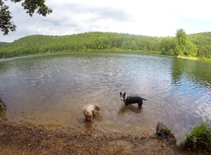
4.0Sherando Lake is a beautifully maintained dog/family friendly campground situated between two lakes. Upper Sherando Lake is available for fishing only but the larger, 25 acre, Lower Sherando Lake offers swimming, fishing, kayaking, and relaxing on the beach. The campground is divided into three ...Read more -
Elkton, Virginia
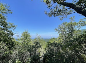
Hike to Hightop Mountain, Shenandoah NP
4.53.2 mi / 900 ft gainThe parking area for the Hightop Mountain hike is one mile south of the Swift Run Gap entrance on Skyline Drive. If you’re looking to add extra mileage to your hike, you can also park at the entrance and pick up the Appalachian Trail just south of the overpass (doing so will add 1.2 miles each w...Read more -
Vesuvius, Virginia
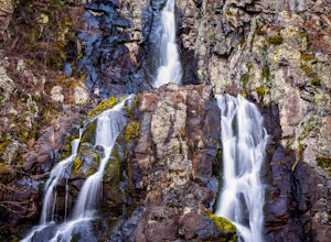
Hike to White Rock Falls
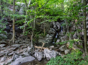
3.52.4 miPark in The Slacks Overlook parking lot on the Blue Ridge Parkway, around milepost 20. From there exit the parking lot back onto the road and head left. About 300 feet from the parking lot there is the trail entrance. It isn't too hard to find if you are looking for it, but there aren't any marki...Read more -
37.8962002590409,-79.0456008911133, Virginia
White Rock Falls Trail
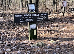
4.02.82 mi / 558 ft gainWhite Rock Falls Trail is an out-and-back trail that takes you by a waterfall located near Montebello, Virginia.Read more -
Lovingston, Virginia
Fortune's Cove Via Yellow Trail
3.05.02 mi / 1486 ft gainFortune's Cove via Yellow Trail is a loop trail where you may see beautiful wildflowers located near Lovingston, Virginia.Read more -
Stanardsville, Virginia
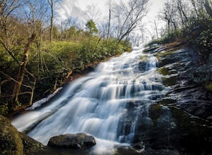
Hike South River Falls
4.54.4 miThe trail head for the South River Falls Trail is located at mile marker 63 off of Skyline Drive via the South River Picnic Area. Loop around the picnic area until you reach the Eastern corner where you will find a sign and a map marking the beginning of the 4.2-mile trail. Over the first mile...Read more -
Massanutten, Virginia
Kaylor's Knob Trail
4.03.56 mi / 381 ft gainKaylor's Knob Trail in Massanutten, Virginia is a moderately challenging hiking trail that spans approximately 3.56 miles. The trail is marked by a steady incline, making it a suitable choice for intermediate hikers. The trailhead is easily accessible, located near the Massanutten Resort. The tr...Read more -
Tyro, Virginia
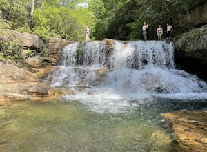
Crabtree Falls
4.53.05 mi / 1161 ft gainThis is an approximately 3 mile roundtrip hike. It will usually take anywhere from 1-2 hours to get up, depending on your experience and who you have with you, and about an hour down. As you come off of route 56, you will come up to the trailhead where there is a large parking area with restroom...Read more -
Raphine, Virginia
Saint Mary's Wilderness
4.56.03 mi / 538 ft gainSaint Mary's Wilderness is an out-and-back trail that takes you by a waterfall located near Vesuvius, Virginia.Read more -
Raphine, Virginia
Hike to Saint Mary's Falls
4.84.4 mi / 300 ft gainSaint Mary's Wilderness is one of Virginia's largest designated wilderness areas and is an old iron ore mining area. There are two ways to get to Saint Mary's Falls and this Blue Ridge adventure will start you off at the parking area off Saint Mary's Road. Once on Saint Mary's Road, you will dr...Read more -
Tyro, Virginia
The Priest via Shoe Creek Trail
4.43.01 mi / 843 ft gainStarting at the Upper Crabtree Falls Parking area, continue up the "road" on Shoe Creek Trail for half a mile until you come to the intersection of the Appalachian Trail. That will be the steepest part of the hike. Look for two rocks on either side of the trail with white blazes on them. Take a l...Read more -
Tyro, Virginia
Spy Rock via Cash Hollow
4.95.71 mi / 1191 ft gainThe hike is part of the George Washington National Forest, and can easily be combined with nearby Crabtree Falls (300ft cascading waterfall with a hike to the top). The entire trip is 5.7 miles, and there are nice campsites at the base of the summit (no water source) if you want to add on this pr...Read more -
Meadows Lane, Virginia
Camp near Crabtree Meadows in GWNF
5.0As stated, the campsites are free. They do not require reservations or permits and are on a first come, first served basis. Regardless of which direction you're coming from, you will be traveling on Crabtree Falls Highway until reaching Meadows Lane. This is a gravel access road that requires 4WD...Read more -
Wildwood, Virginia
Pleasant Grove Park: Heritage Trail and Beach Grove Loop
4.64 mi / 361 ft gainPleasant Grove Park has miles and miles of trails and you could easily hike a ten-mile loop if you linked everything together. This particular trail, Heritage Trail and Beach Grove Loop, is a 4.6 mile loop in the southern part of Pleasant Grove, which takes a little under two hours to complete de...Read more -
Elkton, Virginia
Bearfence Mountain Loop
4.81.04 mi / 220 ft gainThis is one of my favorite hikes in Shenandoah National Park for its views, easy access to the trail, and the option to combine it with a much further hike on the AT. There is also a really fun little rock scramble at the top that scares a lot of people away, but makes for a more secluded summit,...Read more -
Stanley, Virginia
Hike to Bear Church Rock via Bootens Gap
3.59.4 mi / 800 ft gainThe trail leads along the ridge of Jones Mountain to the gorgeous views at Bear Church Rock, and it's the perfect hike for those seeking solitude - didn't see another soul the entire time on a holiday weekend.From the parking lot, head out left on the AT northbound. In .4 miles you will come to a...Read more

