Morgan, Utah
Top Spots in and near Morgan
-
Kamas, Utah
Duck Lake to Marjorie Lake Loop in the Uintas
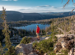
8.4 mi / 850 ft gainThe trail to Duck Lake in the Uinta Mountains starts at the Crystal Lake Trailhead and is a popular starting off point for many trails like Cliff Lake, so the parking lot fills up quickly. Starting off, follow the signs for Long Lake. At about 1.3 miles you'll come to a junction. Follow the si...Read more -
Kamas, Utah
Ibantik Lake via Crystal Lake Trailhead
5.03.96 mi / 646 ft gainFrom the Crystal Lake trailhead, follow the trail 1.1 miles north to Wall Lake. Here, you'll come to a junction with the trail from Trail Lake; take the left trail heading north to Notch Mountain, and Ibantik Lake is a mere .6 miles northeast, nestled next to Notch Peak. At Ibantik Lake, you'll ...Read more -
Kamas, Utah
Hike to Weir Lake
5 mi / 800 ft gainWeir Lake is one of many mountain lakes located in the High Uintas near Kamas, Utah. The trail can be accessed off the Mirror Lake Scenic Byway about 33 miles east of Kamas and starts at the Crystal Lake Trailhead. There is a parking lot near the start of the trailhead, but expect it to be fairly...Read more -
Kamas, Utah
Camp and Climb at Cliff Lake
4.3 miCliff Lake can be located from the Crystal Lake Trailhead. The exact location is pinned, but you get there driving from Kamas. From Kamas take the Mirror Lake Highway and take the exit for Trial Lake Campground, the turn north to the Crystal Lakes Trailhead. There is a parking lot with bathrooms ...Read more -
Kamas, Utah
Camp at Fire Lake
The hike to Fire Lake starts at the Crystal Lake Trailhead just off the Mirror Lake Highway in the Uinta mountains. The main trailhead parking lot fills up quickly on weekends since it serves multiple trail options. If it’s full, no need to worry, there is an overflow lot down the road. The trai...Read more -
Evanston, Utah
Camping and Skiing at Lily Lake
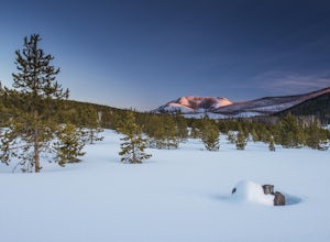
When driving to the trailhead you must go through Evanston Wyoming to get there. The trailhead is located near the Bear River Lodge off the Mirror Lake Highway (UT 150).The Lily Lake area in the Uintas is full of snowy landscapes waiting to be explored on skis, snowshoes, or even a snowmobile. Yo...Read more -
Kamas, Utah
Camp at Shallow Lake Meadow
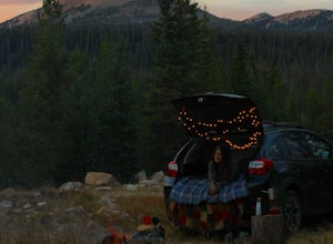
Located 1.5 hours from Salt Lake Cityand just 1 hour from Park City this mountain meadow is a great placeto take your next adventure! Getting there was a piece of cake, theroad is mainly paved then turns to lava...I mean gravel for the lastmile. Along the road are several already established camp...Read more -
Kamas, Utah
Backcountry Ski Mt. Watson in the Uinta Mountains
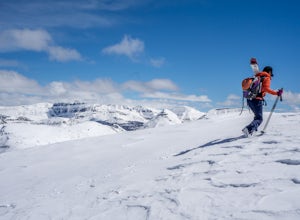
Mt. Watson is a beauty. It is one of the tallest peaks directly outside of the High Uintas Wilderness area and has a stunning East face that is very steep and littered with cliff bands. Many people hike around Mt. Watson in the summer, when the Mirror Lake Highway is open and the trailhead is eas...Read more -
Pleasant Grove, Utah
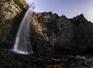
Battlecreek Falls
4.71.09 mi / 486 ft gainBattlecreek Falls is a great place to get away after a long day of work—or if you're looking for a great hike but are short on time. It's a great way to get the dog or your family out to enjoy some nature. The falls are about a 15-25 minute walk from the parking lot, the waterfall is enormous an...Read more -
Hanna, Utah
Hike to Cuberant Lake
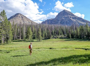
6 mi / 1066 ft gainThe hike to Cuberant Lake is 3-miles with a couple of steeper sections, but for the most part, it is a flat hike. From the Pass Lake Trailhead, you will head west on the Lofty Lake Loop Trail. On this part of the trail, you pass through meadows with Bald and Reid Peaks in the background, which is...Read more -
Hanna, Utah
Hike the Lofty Lake Loop Trail
4.54.2 mi / 935 ft gainLofty Lake Loop Trail is located in the High Uintas near Kamas, Utah. The trail can be found right off the Mirror Lake Scenic Byway about 32 miles east of Kamas and starts at the Pass Lake Trailhead. This is a fairly mellow trail with some areas of good elevation gain, enough to get your heart w...Read more -
Kamas, Utah
Backpack to Notch Lake
5.04.6 mi / -600 ft gainThe hike to Notch Lake begins at the Bald Mountain trailhead. You'll need to display a recreation pass in your vehicle to park at the trailhead. You can purchase a pass for $6 at the fee station entering the forest boundary (east of Kamas) or at the Forest Service office right in Kamas. Take the ...Read more -
Kamas, Utah
Photograph Bald Mountain in Utah
Bald Mountain is a 12,000' peak in the Uintas, and of the most popular hikes in the Uinta Mountains of Utah. If you're looking for more details on the hike, check out the adventure Hike Bald Mountain in the Uintas. Not only is it incredible to photograph from the top, with panoramic views of doze...Read more -
Kamas, Utah
Hike Bald Mountain in the Uintas
4.54 mi / 1250 ft gainBald Mountain is one of the most popular hikes in the Uintas, so get an early start if you want to beat the crowds. Those willing to hike in before dawn will be rewarded with an unforgettable sunrise at the summit. I HIGHLY recommend this as a sunrise hike. The trail starts out with steep switchb...Read more -
Tooele County, Utah
Stansbury Island Trail
2.88.87 mi / 2585 ft gainRarely will you ever see another person at the underrated Stansbury Island, the second largest island within the Great Salt Lake in Utah - even though a dirt causeway connects it to land, it is still considered an island. The lack of crowds make this a good place to hike, take photos, and enjoy t...Read more -
Kamas, Utah
Camp up Murdock Basin Road
4.0Murdock Basin Road is located about 22 miles up Mirror Lake Highway (UT-150) from Kamas, UT. After turning right onto Murdock Basin Rd, you'll cross a bridge over the Provo River and then it's onto the dirt road. Sites are scattered on the left and right (I suggest the left side spots) with plent...Read more

