Herriman, Utah
Top Spots in and near Herriman
-
Herriman, Utah
Drive Butterfield Canyon
4.5Butterfield Canyon is a little-known canyon on the west side of Utah Valley. Beautiful any time of the year, it is especially beautiful in the fall—all the leaves changing colors! When you reach the marked location, turn onto Butterfield Canyon Road. Drive until you reach the end of the road (it...Read more -
Herriman, Utah
Hike to Kennecott Copper Mine
5.04 miFrom Salt Lake City go on UT-201W, then take Bacchus Highway all the way until the intersection with Butterfield Canyon Road. This is where you can park your car and follow the dirt road for roughly 2 miles until you come to a fork. One road from the fork leads to Middle Canyon and the other to t...Read more -
South Jordan, Utah
Fish at the East Riverfront Fishing Ponds
5.00 mi / 0 ft gainThese are great little ponds located at 11267 S. River Front Pkwy in South Jordan. It is just off of a section of the Jordan River. Kidney Pond is the one located just by the parking. Midas is just above and you can see it from the parking. You can fish here for rainbow trout, channel catfish, bl...Read more -
Sandy, Utah
Dimple Dell Trail West
3.88 mi / 236 ft gainDimple Dell Trail West is an out-and-back trail where you may see beautiful wildflowers located near Sandy, Utah.Read more -
Draper, Utah
Lone Peak via Jacobs Ladder
4.714.2 mi / 6713 ft gainThe main trail to Lone Peak is via Jacobs Ladder. To get to the start of the trailhead you need to drive on a dirt road for a little bit until you get to a little parking area (start of the road indicated on the map). The trail starts just south of where you park on the dirt road. The Jacobs Lad...Read more -
Draper, Utah
Lone Peak via the Cherry Creek Logging Trail
14.8 mi / 6378 ft gainYou start this trail at the Orson Smith Park in Draper. It joins with the Bonneville Shoreline Trail briefly before turning off onto the cherry creek logging trail. It switchbacks for a long ways exposed on towards the valley. It is fairly steep in places, but doable. I had tennis shoes with ...Read more -
Sandy, Utah
Climbing in the Lone Peak Cirque
4.0Lone Peak reaches 11,253 feet at its summit. It's alpine feel is unique as it stands above the busy city below. While this gem is one of the highlights in the Wasatch range, it must be earned. A long steep approach, best done at night in the summer months, deposits you in the high meadow surround...Read more -
Sandy, Utah
Upper Bell Canyon Reservoir via Bell Canyon Trail
4.39.12 mi / 4285 ft gainThis is one of my favorite spots in the state of Utah! It is completely secluded high up on the Wasatch front. You can hike here for a nice relaxing day, an overnight camping trip, or do a little fly fishing and hook some fun little brooke and cutthroat trout. The Bell Canyon trail is one of the...Read more -
Sandy, Utah
South Thunder Mountain via Bell Canyon
11.78 mi / 5968 ft gainStarting at the Bell's Canyon trailhead, the trail follows a river for most of the way, passing two reservoirs and two waterfalls. This trail is intermediate, depending on your destination. The first and most commonly visited section of the trail is the first reservoir. An easy hike of less than ...Read more -
Saratoga Springs, Utah
Saratoga Hot Springs
3.30.7 mi / 46 ft gainAwesome all year round, but one of the best places to chill out during winter. The water is just hot enough to feel amazing and escape from the cold. This place is public and not supervised. It does close from 10pm-6am and police have been known to pass by and enforce it. Pulling in to the parki...Read more -
Lehi, Utah
Jordan River Parkway Trail
4.045.33 mi / 2113 ft gainJordan River Parkway Trail is a point-to-point trail that takes you by a lake located near Saratoga Springs, Utah.Read more -
Sandy, Utah
Bell Canyon's Waterfall
4.64.64 mi / 1549 ft gainIf you keep a steady pace, the hike takes about an hour each way, so allow time when trying to catch the sunset. The hike is pretty easy until right before you reach the falls, where there is a big, steep hill you have to climb. From the parking lot/trailhead, head up the path and head left when...Read more -
Alpine, Utah
Day Hike to South Thunder Mountain
12.2 mi / 5604 ft gainThe summit of South Thunder Mountain, sitting at 11,154 ft, is a superb peak. Located on the Alpine Ridge of the Wasatch Mountains, this peak is criminally overlooked.The Schoolhouse Springs trailhead leads you onto an old dirt road, that switchbacks for about 2 miles through the foothills, befor...Read more -
Cottonwood Heights, Utah
Rock Climbing at Dogwood
4.4If you can avoid the crowds, Dogwood is an easy crag to get to with a lot of 5.fun climbs and a legendary 5.13a sport climb. From the mouth of Big Cottonwood Canyon, the Dogwood picnic area is 1.1 miles up the canyon. Park on the street to avoid having to pay $8 and walk into the picnic area. Fol...Read more -
Cottonwood Heights, Utah
Fishing Big Cottonwood Creek
4.0Big Cottonwood Creek is a fun little creek that is often overlooked by the more popular fly-fishing waters of the Provo, Weber, and the Green Rivers of Utah. The fish aren't as big, but make up for it by being less selective with flies and a willingness to go after dry flies any time of the year....Read more -
Cottonwood Heights, Utah
Cycle Big Cottonwood Canyon
5.0Big Cottonwood Canyon (BCC) is one of the longest rideable canyons in the Salt Lake City area, taking you from the base of the canyon to Brighton Ski Resort. Riders have the option to ride any length of the canyon, all of which will be visually rewarding.There are 3 relatively steep sections in B...Read more
Camping and Lodging in Herriman
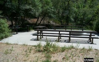
Cottonwood Heights, Utah
Dogwood Day Use
Overview
Dogwood Day Use Picnic Area is just 2 miles up Big Cottonwood Canyon, conveniently close to Salt Lake City. Big Cottonwood Creek...
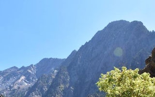
Salt Lake City, Utah
Storm Mountain
Overview
Storm Mountain Day Use Area is just 3 miles up Big Cottonwood Canyon, conveniently close to Salt Lake City. Big Cottonwood Creek...
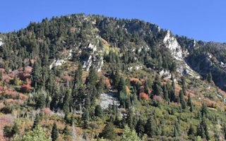
Sandy, Utah
Tanners Flat
Overview
Tanners Flat Campground is located in scenic Little Cottonwood Canyon at an elevation of 7,200 feet, just 6 miles from Sandy, Ut...
Salt Lake City, Utah
Salt Lake City KOA Holiday
This KOA is the RV park closest to downtown Salt Lake City. Enjoy a traditional camping experience along with easy access to all the city...
Provo, Utah
Little Mill
Overview
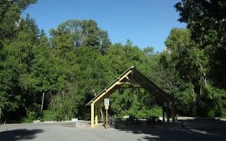
Little Mill Campground is located in American Fork Canyon on the banks of American Fork Creek. This popular campground is a grea...
Provo, Utah
Granite Flat (Utah)
Overview
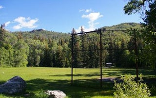
Granite Flat Campground is located a short distance up scenic American Fork Canyon, less than a mile from Tibble Fork Reservoir....


