Draper, Utah
Top Spots in and near Draper
-
Park City, Utah
Bike or Hike Park City's Mid Mountain Trail
5.022.8 mi / 4457 ft gainThe Mid-Mountain Trail is unique to Park City. It's an epic trail that connects Deer Valley, to Park City Mountain Resort, and Canyons Village. Traversing at approximately 8,300 feet elevation, the trail is comprised of 13 sections and is a 22.8 mile point-to-point ride from Deer Valley to Canyon...Read more -
Park City, Utah
Ride the RTS Trail
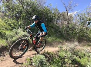
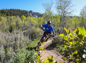
2.6 mi / 366 ft gainThe RTS trail at Utah's Olympic Park (ski jumping, bobsled, skeleton, and luge), is a fantastic beginner-to-intermediate trail. Since it's a short loop at only 2.6 miles and 366 feet of elevation gain, it's perfect for kids and beginners. Most of the sections are smooth dirt that winds through as...Read more -
Park City, Utah
Run the Historic Park City Union Pacific Rail Trail
28 mi / 800 ft gainThe Park City Rail Trail is a fantastic trail for walks, running, and biking in the spring, summer, and fall. During the winter it's groomed so you can Nordic ski, fat bike, run or walk. Park City's historic Union Pacific Rail Trail has been paved from Bonanza Drive in Park City all the way out ...Read more -
Provo, Utah
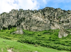
Hike to Summit of Buffalo Peak
1 mi / 500 ft gainDrive up Provo Canyon and turn right on Squaw Peak Road. Follow the road til you reach the T in the road and head left on Road 027. Follow it 2.9 miles to the unmarked trail head. It is located next to a wooden fence on the right of the road and next to a sign about fire and wildlife safety. ...Read more -
Provo, Utah
Buffalo Peak Trail
0.97 mi / 213 ft gainBuffalo Peak Trail is an out-and-back trail where you may see wildflowers located near Provo, Utah.Read more -
Park City, Utah
Mountain Bike Deer Valley, Park City
5.07 mi / 1200 ft gainIf you’re a downhill bomber, you came to the right place. The resort has lift-served singletrack of every difficulty with machine-built table tops, berms, tree runs and technical obstacles. If cross country is more your scene, there are miles of forested climbs, beautiful views and enjoyable down...Read more -
Provo, Utah
Rock Climb in Rock Canyon
4.5Rock Canyon, unsurprisingly, has a ton of great, local rock climbing routes for those in the Provo area. The marked location is for the parking lot. Once you're parked, head into the canyon. You will start to see bolts and anchors—and, depending on when you go, climbers—a few minutes in. There a...Read more -
Provo, Utah
Hike to Buckley's Abandoned Mine
4.63 mi / 200 ft gainOnce you reach the mine it's gated but you can slide in. Follow the main tunnel a hundred or so feet back and climb the 75 foot ladder up to the second level. You can then make your way back out to the cliff face where there is another gate to the outside. That gate is a little trickier to squeez...Read more -
Provo, Utah
Hike Squaw Peak
4.57.1 mi / 2700 ft gainSquaw Peak Trail is a great hike if you live in Provo, since it is a quick getaway. But still definitely worth the trip if you don't. This 7.1 mile hike has beautiful views and does not long to do Usually it takes about three hours from start (Rock Canyon) to finish (the Peak) at a decent clip. T...Read more -
Provo, Utah
Snowshoe the Rock Canyon Trail
3 mi / 1630 ft gainThe Rock Canyon trail is a heavily trafficked path that brings people of all ages. In the winter the mountains are covered in snow and the path is well packed down due to the volume of people that are hiking. After about a mile of hiking, you will enter the more dense part of the canyon with lo...Read more -
Provo, Utah
Hike Big Springs Hollow Loop
4.05 mi / 600 ft gainArriving to Big Springs Hollow is relatively easy. Drive up Provo Canyon and turn right onto South Fork Rd at Vivian Park. As you pass Vivian Park, you'll continue for 3 miles on South Fork Rd until you reach Big Springs Park. Continue up to the Upper level parking and the trailhead will be in...Read more -
Summit County, Utah
Mountain Bike the Genwild/Jeremy Ranch Trails
6 mi / 700 ft gainThere are several places to access the trail system and several good places to park on both the Jeremy Ranch side and the Glenwild side. One of my favorite options is to park at the end of Jeremy Road and then take the 24-7 trail into the action. This is also a good way to access the Flying Dog t...Read more -
Saratoga Springs, Utah
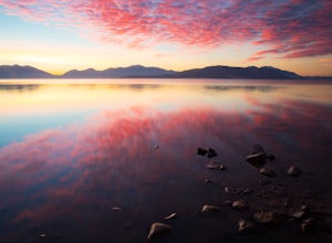
Photograph the Sunrise at Utah Lake
4.0Turn off Highway 68 onto a dirt road towards Utah Lake. You'll see a large sign on your left and a small hill with ATV trails in the distance on your right. Follow the dirt road straight down past the hill. After veering right you can park down fairly close to the water's edge. The dirt road is f...Read more -
Heber City, Utah
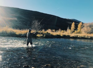
Fly Fish the Middle Provo River
The Middle Provo River runs from Jordanelle Reservoir to Deer Creek Reservoir through the Heber Valley. To get there from Salt Lake City, head southeast on I-80. Take exit 146 and merge onto US-189/US-40 toward Heber. Travel 17.1 miles; turning right onto W 100 South/River Road. 0.3 miles down Ri...Read more -
Provo, Utah
The Y Trail
3.52.29 mi / 1063 ft gainHiking the Y is a classic hike in Provo, Utah—but don't expect it to be easy! There's no shade and not much greenery, so it's a hot, dusty trek to the top. Once you reach the Y, though, the view of the Provo and Utah Lake is amazing. There are also benches at the top. When you reach the Y, you w...Read more -
Tooele, Utah
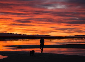
Catch a Sunset at the Great Salt Lake Marina
Head west on I-80 and get off on the Saltair exit. You will drive past the music venue and into the Great Salt Lake state park. Right before the marina you will veer left onto a dirt road and this will take you right up to the black rock. Prepare yourself for the wonderful smell of the Great Salt...Read more

