Draper, Utah
Top Spots in and near Draper
-
Salt Lake City, Utah
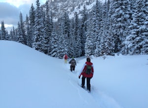
Snowshoe to Cardiff Mine
7 mi / 1500 ft gainThe trail starts from the same trailhead as Donut Falls which is extremely popular. In the winter, the gates are closed and you need to park just off the highway. Follow the road and crowds along the trail but once you cross the bridge continue straight ahead instead of following the trail that c...Read more -
Salt Lake City, Utah
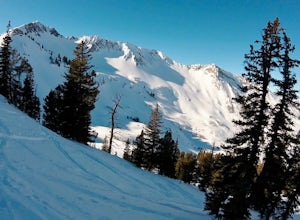
Backcountry Ski Cardiff Fork
4 miDrive up Big Cottonwood Canyon until you reach the Mill D South parking lot (aka Donut Falls parking). Head up the main road until you reach the bathrooms at the Donut Falls trailhead. Here you can either keep straight past the bathrooms, but the best way to go is to keep right along the road. Yo...Read more -
Salt Lake City, Utah
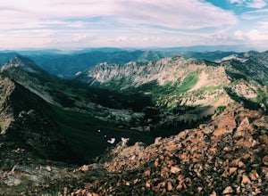
Hike Cardiff Fork
8 mi / 2880 ft gainCardiff Fork and Donut Falls share the same parking lot, so depending on what time of week you go exploring here, it may be the most packed parking in all of the Wasatch. Head up on a weekday for less crowds. The Cardiff Fork trailhead is follows the rocky jeep road around the parking lot to the...Read more -
Pleasant Grove, Utah
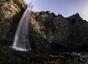
Battlecreek Falls
4.71.09 mi / 486 ft gainBattlecreek Falls is a great place to get away after a long day of work—or if you're looking for a great hike but are short on time. It's a great way to get the dog or your family out to enjoy some nature. The falls are about a 15-25 minute walk from the parking lot, the waterfall is enormous an...Read more -
Salt Lake City, Utah
Hike Porter Fork, Millcreek Canyon
5.06.8 mi / 3250 ft gainPorter Fork starts at the aptly named Porter Fork Trailhead about 4 miles up Millcreek Canyon. It’s actually Porter Fork Road for the first 1.5 miles of the trail. This section is a pleasant, paved path winding up through a dozen or so cabins. You’ll gain about 1,000 feet. If you make it past the...Read more -
Salt Lake City, Utah
Trail Run Burch Hollow Trail
5.3 mi / 2412 ft gainThe Burch Hollow trailhead is about a quarter mile up the Pipeline trail in Millcreek Canyon. After hiking along the switchbacks of the Pipeline trail, you'll see a sharp turn in the trail that leads you up the side of the mountain. This turn can easily be missed so keep a good look out for it. C...Read more -
Salt Lake City, Utah
Hike Bowman Fork to Baker Pass
5.08.3 mi / 3375 ft gainTo get to the trailhead, drive up Millcreek Canyon about 4.5 miles until you reach the Terraces Picnic area. Turn here and drive up the small road until you reach the parking lot by the bathrooms. You'll see the Bowman Fork trailhead marker next to the parking lot. The trail climbs steadily and i...Read more -
Salt Lake City, Utah
Hike to Big Cottonwood Canyon's Desolation Lake
4.67.4 mi / 1900 ft gainDrive 9 miles into Big Cottonwood Canyon and park at the Mill D North Trailhead (on the left). On the right side of the road, there is a restroom. The trial head begins on the left, there is a visible sign you cannot miss before beginning.The trail is about 7.4 miles round trip, about half way t...Read more -
Salt Lake City, Utah
Winter Backpack to Dog Lake and Backcountry Ski Reynolds Peak
4.55 mi / 1500 ft gainThe hike is considered moderate, but the 1500ft. elevation gain (2100ft. to Reynolds Peak) will definitely get your heart rate up. Snowshoes/skins are recommended but the trail is often packed enough to do without them.After crossing the street from the Spruces parking lot, follow the trail past...Read more -
Salt Lake City, Utah
Hike from Mill D to Desolation Peak
10 mi / 2500 ft gainLargely runnable trail up through pines and aspens with a few steep climbs. Incredible wildflowers. You can stop at Desolation Lake then continue up towards the ridge and up to Desolation Peak. You have to listen and watch for descending bikers coming fast around corners.Read more -
Salt Lake City, Utah
Hike Days Fork
5.07.5 mi / 2494 ft gainTo get to the trailhead drive up Big Cottonwood Canyon to Spruces Campground. Once in the parking lot, walk to the southwest corner of the parking lot and go up the road past the bathrooms. The trailhead will be next to the overgrown baseball field. The trail is awesome single track the whole wa...Read more -
Salt Lake City, Utah
Backcountry Ski Days Fork
3.2 miDays Fork is on the south side of Big Cottonwood Canyon behind the Spruces parking lot. The trail head begins on the south west corner of the parking lot. The approach to Days Fork is long, but gradual. Continue south along the skin track until you reach the end of the Days Fork Basin. Here you c...Read more -
Salt Lake City, Utah
Hike Jacks Mountain
4.02.4 mi / 1300 ft gainNamed for a toddler who died of Lukemia in 1995, Jacks Mountain is a beautiful place to sit above the valley and contemplate mortality. On the peak, you’ll find a couple mailboxes containing heartfelt notes from hundreds of hikers throughout the years. It’s the kind of place that restores your fa...Read more -
Salt Lake City, Utah
Backcountry Ski Short Swing, Mill D North
4 mi / 1900 ft gainDrive up Big Cottonwood Canyon until you reach the Spruces Campground on the right. You will park here and prep your gear for the day. Walk back out to the canyon road and cross the street to the trail head. As you hike up the trial, you'll pass some cabins, once you've passed all the cabins, you...Read more -
Salt Lake City, Utah
Backcountry Ski Beartrap Fork
5.04 mi / 2016 ft gainYou can access the trailhead to Beartrap by driving up Big Cottonwood Canyon 10.4 miles and parking on the right side of the road. You will see the "Bear Trap Fork Rd" sign on the left side of the road, this is where the trailhead begins. Make your way up the skin track through the dense aspens u...Read more -
Salt Lake City, Utah
Backcountry Ski Willow Fork
3 mi / 1700 ft gainWillow Fork is just across the mountain from Solitude Ski Resort in Big Cottonwood Canyon. You can access Willow Fork from a few different trailheads; either from the Willow Heights Trailhead or across the street from both the lower and upper Solitude parking lots. The Willow Heights Trailhead wi...Read more

