Draper, Utah
Looking for the best fitness in Draper? We've got you covered with the top trails, trips, hiking, backpacking, camping and more around Draper. The detailed guides, photos, and reviews are all submitted by the Outbound community.
Top Fitness Spots in and near Draper
-
Draper, Utah
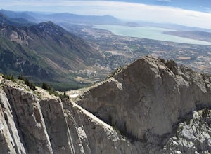
Lone Peak via the Cherry Creek Logging Trail
14.8 mi / 6378 ft gainYou start this trail at the Orson Smith Park in Draper. It joins with the Bonneville Shoreline Trail briefly before turning off onto the cherry creek logging trail. It switchbacks for a long ways exposed on towards the valley. It is fairly steep in places, but doable. I had tennis shoes with ...Read more -
Sandy, Utah
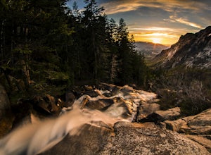
Bell Canyon's Waterfall
4.64.64 mi / 1549 ft gainIf you keep a steady pace, the hike takes about an hour each way, so allow time when trying to catch the sunset. The hike is pretty easy until right before you reach the falls, where there is a big, steep hill you have to climb. From the parking lot/trailhead, head up the path and head left when...Read more -
Holladay, Utah
Hike Heughs Canyon (Olympus Waterfall)
4.52 mi / 1000 ft gainHeughs Canyon starts right on the edge of Salt Lake City, but within minutes, you’re in a shady forest next to a gurgling stream. This is the prefect after-work hike that can be enjoyed year-round. Two miles round-trip and just over 1,000 feet, the path takes you to a beautiful waterfall that flo...Read more -
Sandy, Utah
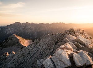
Summit the Pfeifferhorn
5.09 mi / 3700 ft gainStarting at the White Pine Trailhead in Little Cottonwood Canyon, UT, hike southwest until reaching the junction to Red Pine Canyon. Take the trail that crosses the stream and continues west around the ridge. The trail will quickly turn south and begin to gain elevation. Continue west as you pass...Read more -
Sandy, Utah
Backcountry Ski White Pine Fork
7 miThe White Pine Trailhead is up Little Cottonwood Canyon on the south side of the road just before you get to Snowbird Ski Resort. The parking lot fills up very quickly so an early start is recommended. The skin track starts in the southwest corner of the parking lot near the bathrooms. You will f...Read more -
Holladay, Utah
Mt. Olympus Trail
4.76.46 mi / 4124 ft gainThe trail begins right on Wasatch Blvd. and after the first 0.5 miles you're into the Superior Wilderness. This is a very strenuous hike and you will be gaining elevation the whole way from the parking lot (4830 ft) to the summit (9026 ft). About .2 mile from the summit you will reach a saddle....Read more -
Salt Lake City, Utah
Hike Stairs Gulch
4.2Drive up Big Cottonwood Canyon for around 2.8 miles, parking will be along the road and there will be a large rock waterfall on the right hand side of the road. The trailhead is just a short distance from that rock fall (40.623824, -111.743208)Stairs Gulch is an easy, short hike, unless you're lo...Read more -
Salt Lake City, Utah
Hike the Mineral Fork Trail
4.09.3 mi / 3500 ft gainThe trailhead begins along Big Cottonwood Canyon Road, with a relatively small parking lot at the trailhead. Starting early in the day is advised, as on nice summer days it will fill up quickly. The trail has a steady ascent for the first 2 miles starting around 6700' through aspen forests and cr...Read more -
10230 East Little Cottonwood Lane, Utah
Cross Country Ski Alta Ski Area's Nordic Track
Drive up Little Cottonwood Canyon until the first entrance into Alta. Park in the Collins lift parking lot, throw your boots on, and head over to the nordic track. Its just next to the tow rope that runs through Albion Basin. Now thats left to do is to step into your skis and ski. The track has a...Read more -
Alta, Utah
Ski Little Cottonwood Canyon
5.0It's no secret that Little Cottonwood Canyon (LCC) is home to some of the best skiing and snowboarding in the lower 48, if not North America. What many people are not aware of is the extremely easy and quick access from Salt Lake City.Enter the Dawn Patrollers. Skiers and snowboarders from Salt L...Read more -
Alta, Utah
Snowshoeing Twin Lakes Pass
5.05.21 mi / 1781 ft gainStarting at the parking lot near the Albion Basin gate, travel up the summer road until the second switchback. Just past the second switchback and cabins, leave the summer road heading east. The Trail heads northeast into Grizzly Gulch. It should be easy to follow—it gets a lot of traffic. From h...Read more -
Salt Lake City, Utah
Grandeur Peak West Face
2.23 mi / 3307 ft gainAre you planning a big adventure and need a boost getting ready for it? You came to the right place. This is my go-to when I’m preparing to climb a big mountain. It’s hard to find a steeper trail in the area (that’s not a game trail), and the West Face is usually free of snow early in the season....Read more -
Alta, Utah
Spring Backcountry Ski Alta Ski Area
5 mi / 1800 ft gainStill have the skiing itch but it's late in the spring and the resorts have closed and the other backcountry skiing areas have melted? No problem, just head up to Alta Ski Area and get some amazing backcountry corn skiing laps in. Drive up Little Cottonwood Canyon all the way to the top and park...Read more -
Alta, Utah
Backcountry Ski Grizzly Gulch
1.5 mi / 1400 ft gainTo get to the Grizzly Gulch trailhead, drive up Little Cottonwood until you reach Alta Ski Resort. Keep left along the road and park in the upper Alta parking lot. Head up the cat track with all the cats and snowmobiles parked to the side. About 100 yards up, you'll take a left and head up the st...Read more -
Salt Lake City, Utah
Hike Catherine Pass
4 mi / 1115 ft gainCatherine Pass is a must do if you are in the Salt Lake vicinity in July. The wildflowers are mind-blowing. But it’s a great hike to do in the Spring, after Alta Ski Resort has closed, and the Fall as well. It costs $6 per vehicle to drive to the trailhead, or $10 per person to ride the lift (if...Read more -
Salt Lake City, Utah
Hike Mount Wolverine
4 mi / 1425 ft gainThis mountain can be conquered two ways and is a great after-work adventure to watch the sunset, an early morning trail run, or a fun family challenge. The trail is 4 miles and 1,425 feet elevation gain (from the Alta side) or 6 miles and 2,050 feet (from the Brighton side). Both routes converge ...Read more

