Coalville, Utah
Top Spots in and near Coalville
-
Salt Lake County, Utah
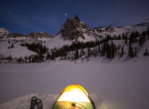
Lake Blanche & Sundial Peak
5.09.52 mi / 4098 ft gainThis is a popular hike all year round, but less popular in the winter. If you’re backpacking you’ll most likely be alone. In winter, the lake is covered in snow, but Sundial Peak is one of the most picturesque mountains in the Wasatch. Especially when it is dusted with snow. You’ll also be far en...Read more -
Salt Lake County, Utah
Broads Fork Twin Peaks
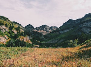
5.08.57 mi / 4984 ft gainThe Broads Fork trailhead starts in Big Cottonwood Canyon in the same parking lot as the Lake Blanche trailhead. This trailhead is on the west side of the parking lot. The trail is marked and easy to follow for a good chunk of the way. You will come to a big basin and alpine meadow where you wil...Read more -
Salt Lake City, Utah
Broads Fork Basin and Beaver Pond
4.05.1 mi / 2083 ft gainThe Broads Fork trailhead starts in Big Cottonwood Canyon in the same parking lot as the Lake Blanche trailhead, this trailhead is on the west side of the parking lot. The trail is very easy to follow and is well marked. Follow the trail until you come to a great big basin. Here you will be able...Read more -
Alta, Utah
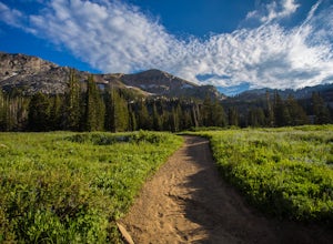
Cecret Lake
4.41.78 mi / 509 ft gainCecret Lake is reached by driving up Little Cottonwood Canyon to Albion Basin above Alta Ski Resort. The hike is just under 1 mile to the lake and should take about 30 minutes. The hike goes through fields full of wildflowers and wildlife is abundant. Moose, deer, and various wildlife can be s...Read more -
Salt Lake City, Utah
Parley's Historic Nature Park Trail Loop
3.02 mi / 135 ft gainParley's Historic Nature Park Trail Loop, located in Salt Lake City, Utah, is a well-known hiking trail. This 2-mile loop trail is rated as moderate, making it suitable for hikers with some experience. The trail is primarily used for hiking, walking, and nature trips and is accessible year-round....Read more -
Alta, Utah
Stargazing and Night Photography at Hellgate Spring
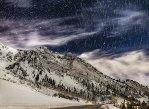
From the base of Little Cottonwood Canyon, follow the road approximately 7 miles until you reach the area between the Snowbird and Alta ski resorts. Looking north, several mountain peaks are visible, including both Mount Superior and Hellgate Spring. The mountain face of Hellgate Spring (GPS coor...Read more -
Kamas, Utah
Hike Riley's Canyon
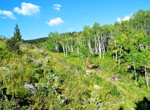
5 mi / 200 ft gainAproximately two miles Southeast of Woodland, UT on Highway 35 you will come to a small turnout on the North side of the road. It is sufficient in size for a handful of vehicles to park, so that passengers can make their way into Riley's Canyon. From the turn off, look to the North and you will s...Read more -
Salt Lake City, Utah
Cycle City Creek Canyon
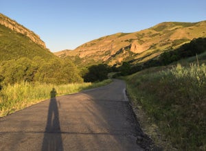
5.0City Creek Canyon is a hidden gem, just minutes away from downtown Salt Lake City. Secluded winding roads will take you deep into the canyon, away from the bustling city. The sounds of the creek, canyon views, and the thick forest that lines the road provide for the perfect, quick escape.Starting...Read more -
Sandy, Utah
Hike and Climb the S. Ridge of Mt. Superior
4.54.5 mi / 1800 ft gainApproach: Start by parking on the side of the road just above the Snowbird Cliff Lodge. Then there will be some bushwhacking as you work your way up the southern slopes of Mount Superior following the path of least resistance until reaching the winter avalanche path under the south face and to th...Read more -
Sandy, Utah
Backcountry Ski Suicide Chute on Mt. Superior
5.00.6 mi / 1245 ft gainFirst of all it's not as scary as it sounds, or as scary as it looks. That being said it's a steep chute in dangerous avalanche terrain so only experienced skiers with backcountry skiing knowledge/equipment should attempt this route.Suicide Chute is located on the South face of Mt. Superior in L...Read more -
Salt Lake City, Utah
Climb West Slabs of Mount Olympus
5.0Park at the top of Thousand Oaks Drive, and make your way to the dirt path heading east. It will be a well maintained, well-covered single dirt track which takes you to the base of a really impressive couloir. Follow the trail until you reach the couloir / rocky gully. You will then see the West ...Read more -
Sandy, Utah
Photograph Little Cottonwood Creek at Snowbird
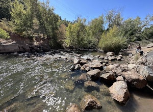
2.0Little Cottonwood Creek flows right through Snowbird Ski Resort and there are a few beautiful locations to go shoot the river at. The best place to start hiking down the river is right by where the tram takes off. That is just below the Cliff Lodge and right by the Peruvian Lift. There's a res...Read more -
Salt Lake City, Utah
Ensign Peak
4.20.97 mi / 354 ft gainThis hike is a piece of cake with a sizable reward. It starts just up the hill behind the Capitol Building and ascends 350 feet over about 0.5 miles to the top on a very well marked trail. It's great for a family with young ones or maybe a quick post-dinner evening date. Parking is all along a re...Read more -
Salt Lake City, Utah
Ski Baldy's Main Chute at Alta Ski Area
5.0Do you like hiking? In ski boots? Good.You start the hike from the gate to Snowbird at the EBT near the top of the Sugarloaf lift. The start of the bootpack is at 10,500 ft of elevation. From there, follow the likely well established boot pack to the top of Baldy. There is one rather steep sectio...Read more -
Salt Lake City, Utah
Hike Stairs Gulch
4.2Drive up Big Cottonwood Canyon for around 2.8 miles, parking will be along the road and there will be a large rock waterfall on the right hand side of the road. The trailhead is just a short distance from that rock fall (40.623824, -111.743208)Stairs Gulch is an easy, short hike, unless you're lo...Read more -
Huntsville, Utah
Hike the Skull Creek Trail of Causey Reservoir
4.8 mi / 400 ft gainTo get to the trailhead from Ogden, Utah, take 12th street east up canyon and around Pine View Reservoir. When you get to Huntsville, turn right and continue to head east up the canyon. IN 8 miles you will come to a sign for Causey Road. Turn right here and follow the road to the dam. Turn right ...Read more

