Coalville, Utah
Top Spots in and near Coalville
-
Salt Lake City, Utah
Winter Backpack to Dog Lake and Backcountry Ski Reynolds Peak
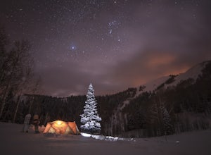
4.55 mi / 1500 ft gainThe hike is considered moderate, but the 1500ft. elevation gain (2100ft. to Reynolds Peak) will definitely get your heart rate up. Snowshoes/skins are recommended but the trail is often packed enough to do without them.After crossing the street from the Spruces parking lot, follow the trail past...Read more -
Salt Lake City, Utah
Hike from Mill D to Desolation Peak
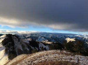
10 mi / 2500 ft gainLargely runnable trail up through pines and aspens with a few steep climbs. Incredible wildflowers. You can stop at Desolation Lake then continue up towards the ridge and up to Desolation Peak. You have to listen and watch for descending bikers coming fast around corners.Read more -
Salt Lake City, Utah
Hike Porter Fork, Millcreek Canyon
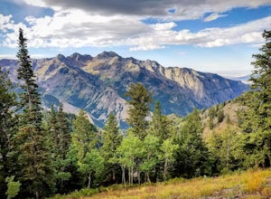
5.06.8 mi / 3250 ft gainPorter Fork starts at the aptly named Porter Fork Trailhead about 4 miles up Millcreek Canyon. It’s actually Porter Fork Road for the first 1.5 miles of the trail. This section is a pleasant, paved path winding up through a dozen or so cabins. You’ll gain about 1,000 feet. If you make it past the...Read more -
Salt Lake City, Utah
Backcountry Ski Short Swing, Mill D North
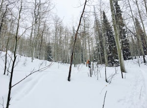
4 mi / 1900 ft gainDrive up Big Cottonwood Canyon until you reach the Spruces Campground on the right. You will park here and prep your gear for the day. Walk back out to the canyon road and cross the street to the trail head. As you hike up the trial, you'll pass some cabins, once you've passed all the cabins, you...Read more -
Salt Lake City, Utah
Backcountry Ski Days Fork
3.2 miDays Fork is on the south side of Big Cottonwood Canyon behind the Spruces parking lot. The trail head begins on the south west corner of the parking lot. The approach to Days Fork is long, but gradual. Continue south along the skin track until you reach the end of the Days Fork Basin. Here you c...Read more -
Salt Lake City, Utah
Backcountry Ski USA Bowl
1.6 mi / 1700 ft gainTo get the the trailhead, drive up Big Cottonwood Canyon until you reach the upper entrance into Solitude Ski Resort. You can park on the road just below the entrance to the resort. Across the street is a road called Old Stage Road, this is where the trail head begins. The road is covered in snow...Read more -
Salt Lake City, Utah
Hike Days Fork
5.07.5 mi / 2494 ft gainTo get to the trailhead drive up Big Cottonwood Canyon to Spruces Campground. Once in the parking lot, walk to the southwest corner of the parking lot and go up the road past the bathrooms. The trailhead will be next to the overgrown baseball field. The trail is awesome single track the whole wa...Read more -
Salt Lake City, Utah
Mountain Bike the Wasatch Crest Trail
5.0There are two popular starting points from Guardsman Road. The lower trail climbs and the higher one trail descends, then they converge at Scott's Pass below Puke Hill. The shuttled ride ends with a pavement rush down Mill Creek Canyon (and a possible detour onto Mill Creek Pipeline on the way do...Read more -
Salt Lake City, Utah
Hike Clayton Peak in Utah's Wasatch Mountains
4.03 mi / 1600 ft gainClayton Peak is approximately 1.5 miles from Guardsman Pass (3 miles round trip), and you'll gain about 1,600 feet of climbing. There is parking on top of the pass, but it fills up quickly with hikers and mountain bikers during peak season as this serves as the trailhead for Bloods Lake, Jupiter...Read more -
Salt Lake City, Utah
Backpack to Bloods and Lackawaxen Lakes
4.84 mi / 1040 ft gainThis trail is just outside of Big Cottonwood Canyon which forbids both dogs and swimming due to the Salt Lake watershed. As a result, dogs and swimming are more than welcome. Blood Lake and Lackawaxen Lake Trailhead can be reached by driving up Big Cottonwood approximately 15 miles until the tur...Read more -
Brighton, Utah
Hike or Trail Run Butler Fork
5.07.2 mi / 1964 ft gainTo get to the trailhead, drive up Big Cottonwood Canyon 8 miles. The parking lot is on the left side of the road. The first half mile is the steepest of the whole trail so don't get too intimidated by it, it mellows out a lot after. You will come to fork in the trail about a mile in, you can eith...Read more -
Brighton, Utah
Backcountry Ski Butler Fork
2 miThe trail head for Butler Fork is 8 miles up Big Cottonwood Canyon on the left side of the road. Throw your gear on and head up the trail. Continue along the skin track and after about 20 minutes you'll come upon a fork in the trail. The right trail will take you up the East Fork towards Butler B...Read more -
Kamas, Utah
Hike to Round, Sand, and Fish Lake in the Uinta Mountains
9 mi / 2000 ft gainThe Dry Fork Trailhead at the end of Weber Canyon Rd is the starting point for the hike to Round, Sand, and Fish Lakes in the Uinta Mountains of Utah. In the early spring and summer, this trail can be wet due to snowmelt runoff, but by mid-summer, it dries out and is a fantastic hike. The trail i...Read more -
Salt Lake City, Utah
Photograph Guardsman Pass & The Alpine Loop
5.0Since this is a loop you can start at either end, but this is the way we did it. Start driving up Big Cottonwood Canyon. Enjoy the views and take in the impressive peaks on either side of the road. See the changes in vegetation as you gain elevation in the canyon. As you near the top and pass Sol...Read more -
Salt Lake City, Utah
Snowboard or Ski Guardsman Pass
4.0If you want to escape the crowds and get in some nice powder, then a hike up Guardsman Pass is well worth the effort. To reach the trail, park on the side streets just below the gates to avoid the no parking signs and keep your tires just on the road to avoid getting stuck.When you pack up your g...Read more -
Bountiful, Utah
Backpack to Rudy's Flat
4.07 miRudy's Flat is a great overnight hike with plenty of tent or hammock space and multiple established fire rings. This hike offers multiple options for distance depending on your availability and skill level.From the Mueller Park Canyon trailhead (5,234 ft), hikers will experience a gradual ascent ...Read more

