Corbett, Oregon
Top Spots in and near Corbett
-
High Prairie Trailhead, Oregon
Lookout Mountain via High Prairie Trailhead
2.69 mi / 531 ft gainLookout Mountain should be the most popular destination in Oregon given its views to effort ratio. Mount Hood seems close enough to reach out and touch from the open, rocky summit, and views extend from the Three Sisters in the south to Mount Rainier to the north. While the hike is popular in the...Read more -
Skamania County, Washington
Camp Forlorn Lakes & Explore Guler Ice Cave
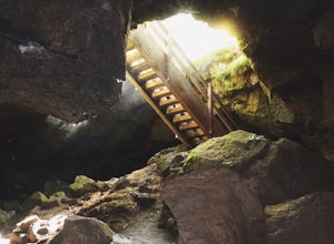
Camp at scenic and easily-accessible Forlorn Lakes, where the 25 campsites ($10/night) are both isolated and roomy. Sites have a picnic table and fire ring and provide access to the series of lakes, as well as the East Crater Trailhead which leads into the Indian Heaven Wilderness.Nearby, explore...Read more -
Skamania County, Washington
Fly Fish Lewis River, Cougar, WA
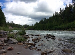
2.0An 1.5 hour drive NE from Vancouver, WA this section of the Lewis River makes for a perfect day fishing trip. Heading North on I-5 for approximately 20 miles take the Woodland / HWY 503 exit East and head towards Mt St. Helens. You'll follow the Lewis River along Hwy 503 (Lewis River Road) the ...Read more -
Skamania County, Washington
Indian Heaven to Blue Lake
4.56.71 mi / 997 ft gainCrowds and mosquitoes were nonexistent as we went a bit early in the season. The trails were all covered in snow, but we were able to do some way finding with a GPS and topo map. 3.5 miles in we found a dry spot next to Blue Lake and set up shop. After dropping off our gear we climbed up Gifford...Read more -
Skamania County, Washington
McClellan Falls
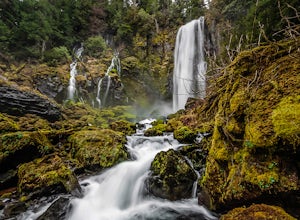
1.00.7 mi / 200 ft gainThe trail begins at the parking for McClellan Overlook. Head out of the parking area and cross over the highway before heading onto a faint, unmarked trail. You may have to do a little routefinding, so it's best to download this map before heading out so you can make sure you stay on path. This...Read more -
Hood River, Oregon
Kiteboard in the Columbia River Gorge
5.0Kiteboarding is one of the fastest growing sports in the world and for good reason. Imagine racing over the water with 30 mph winds, jumping from waves and grinding on a rail with your board. Ok ok maybe that is way to much for most of us and just standing up would be an accomplishment, but Kite...Read more -
Hood River, Oregon
Bike from Hood River to The Dalles
2.040 mi / 2800 ft gainThe ride from Hood River to The Dalles is one of the best 20 mile stretches of road biking in Oregon, and arguably the best. The ride starts out in the wonderful town of Hood River - a tourist and adventure destination in its own right - and follows the historic Columbia River Gorge highway (US-3...Read more -
Cougar, Washington
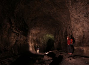
Explore the Ape Caves
4.0As if erupting volcanoes weren't awesome enough, ancient lava flows also left behind these giant, hollow tubes as they cooled. Spend all day exploring deep underground in this 2.5 mile cave.To get there, head to the SOUTH side of Mount Saint Helens. You must pass through the town of Cougar to get...Read more -
Clackamas County, Oregon
Bagby Hot Springs
4.32.91 mi / 397 ft gainBagby Hot Springs is actually a set of amazing bathhouses nestled in the forest outside of Estacada. They are one of Oregon’s most poplar hot springs, and for good reason. The hike into the hot springs is easy and quite scenic. You’ll cross a bridge over Nohorn Creek and follow the Hot Springs Fo...Read more -
Cougar, Washington
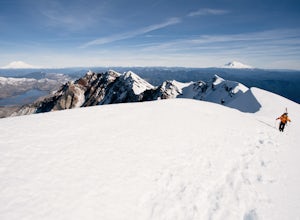
Mount St. Helens Summit via Worm Flows
4.810.53 mi / 5725 ft gainThe Worm Flow Route, starting at Marble Mountain Sno Park, is the most direct winter route up to the summit. You'll start at around 2,700 feet and begin a steady walk along the trail for 2 miles. Although the trail is fairly well marked well above the snow, you'll want to pay attention to the arr...Read more -
Cougar, Washington
June Lake Loop via Pine Martin Trail
5.05.93 mi / 1079 ft gainIn the winter you will need to start at Marble Mt. Snowpark and purchase a snow park permit. The hike starts here on the eastern side. Follow the Pine Ski Trail for about 1 mile along NF-83 Road. Then follow the June Lake Trailhead up to June Lake for about 1.5 miles. You will come to June Lake a...Read more -
Cougar, Washington
Loowit Trail Loop
4.032.46 mi / 7014 ft gainThis is a very difficult hike. Camp sites are scarce and access to water is very limited. Overexposure is a concern so be sure to pack a hat and apply sunscreen frequently. There are sketchy sections of the trail where you will be forced to navigate steep washed out gullies that are unstable due ...Read more -
Cougar, Washington
June Lake
2.47 mi / 0 ft gainJune Lake, is a beautiful mountain lake located in Gifford Pinchot National Forest, Washington. The out-and-back trail starts at the June Lake Trailhead and parking area. This hike is family-friendly at just under 2.5 miles to June Lake. Dogs are permitted on the trail on their leash. This park...Read more -
Cougar, Washington
Mount St. Helens Summit via Monitor Ridge
4.48.64 mi / 4652 ft gainMonitor Ridge is the "easiest" of the routes one can take in order to claim that they have stood on top of the sleeping giant better known as Mount St. Helens. This route is heavily favored over Worm Flows as the starting elevation is not only an additional 1,000 feet higher but the overall asce...Read more -
Scotts Mills, Oregon
Upper Butte Creek Falls
4.00.73 mi / 308 ft gainFrom Scott Mills Follow Crooked Finger RD NE for 13.3 Miles to the Upper Butte Creek Trailhead. The last 2-3 miles or so is gravel road with some potholes but most cars shouldn't have a problem. The path down to the falls starts near the bathrooms. A short .3 mile walk on a few switchbacks and...Read more -
Scotts Mills, Oregon
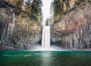
Abiqua Falls
4.90.69 mi / 115 ft gainThis trail is unmarked and a little rough and rugged. The land is privately owned by Mount Angel Abbey, but they don't appear to have problems with courteous hikers. Walking out of the parking area back up the road in the direction you came from, you’ll pass one dirt trail right at the ending of ...Read more

