Jemez Springs, New Mexico
Top Spots in and near Jemez Springs
-
Jemez Springs, New Mexico
Visit the Jemez Soda Dam
For the past 7,000 years, calcium carbonate at this spot in northern New Mexico. And after all those centuries, it has formed into a natural bridge across the Jemez river, roughly 300 feet in length. Drive northeast from Jemez Springs on New Mexico State Route 4. Just under 2 miles later, the fo...Read more -
Jemez Springs, New Mexico
Dip into Spence Hot Springs
4.01.2 mi / 193 ft gainExit Interstate 550 and head North on Highway 4 heading towards Jemez Springs. The Spence Hot Springs Parking Lot and Trailhead is about 25 miles North off Highway 4. The trail starts on a decline into the canyon for about 800 feet before you cross the bridge over the scenic river. Continue follo...Read more -
Jemez Pueblo, New Mexico
Drive the Jemez Mountains Scenic Byway
Start your road trip at the Pueblo Visitor Center. You can stop at the Jemez State Monument to visit the old ruins of the Mission. Then head to the Jemez Falls. Continue the drive through beautiful red rock scenery to Los Alamos and Bandelier National Monument.Read more -
Jemez Springs, New Mexico
Climb Las Conchas
5.05 mi75 minutes north of Albuquerque, Las Conchas is a trailhead that sits right off the highway with two accessible, although small, parking lots. Right out of the gate the wide and well worn trail drops down to follow the river north through a wide mountain valley lined with large stands of trees, ...Read more -
Jemez Springs, New Mexico
San Antonio Hot Springs via Thompson Ridge Route
5.02.66 mi / 469 ft gainAlthough you can reach these hot springs via the main trail in the winter, the Thompson Ridge route is a shorter option that comes in from above the springs rather than below. If you go in winter, you'll need winter route finding skills for the trail (there's no signage at any point) and an all w...Read more -
Jemez Springs, New Mexico
San Antonio Hot Springs
4.61.46 mi / 312 ft gainThese hot springs are a short hike from the parking area along the top of Forest Service Road 376. I've added additional details below in the event that the road is closed due to seasonality or you prefer to stretch your legs for a significantly longer, yet scenic hike. The GPX track is displayin...Read more -
Jemez Springs, New Mexico
Kasha-Katuwe Tent Rocks National Monument (CLOSED)
4.83 miKasha-Katuwe Tent Rocks National Monument is temporarily closed. Visit the BLM website for more updates. Hiking at Tent Rocks is a must-do for anyone in the northern New Mexico area. It's an accessible trail that gives you incredible rewards with little effort. The cone-shaped "tent rocks" are...Read more -
Rio Arriba County, New Mexico
Backpack the Vacas Trail Loop
4.015 mi / 1000 ft gainYou start at the hiking at base of the the San Pedro Wilderness at the San Gregorio Lake Trailhead! This particular hike is called the Vacas Trail loop.For directions: Take US 550 to Cuba (north west of Albuquerque), turn east on NM 126 and go for about 9 miles. Just past the community of Deer La...Read more -
Los Alamos, New Mexico
Hike to Alcove House
4.62.2 mi / 140 ft gainStart your hike from the Visitor's Center and head out on the Main Loop Trail to begin. You can hike the loop in either direction, either first crossing the river across from the Visitor's Center or heading out from directly behind the Center. If you start from across the river, you'll begin with...Read more -
Los Alamos, New Mexico
Hike the Main Loop Trail at Bandelier National Monument
5.01.2 mi / 150 ft gainBandelier National Monument encompasses over 33,000 acres of public land, including Frijoles Canyon, the home of the Ancestral Puebloans that once lived in the area. The park has miles of trails to explore the rugged countryside, but the main attractions are the cliff dwellings you'll find on the...Read more -
Los Alamos, New Mexico
Climb in Diablo Canyon
Diablo Canyon has grown in popularity over the last decade, particularly due to its frequent appearance in television and films. It has hundreds of sport and trad climbs of varying difficulty on basalt cliffs that reach over 300 feet high, with approaches varying from 5 to 30 minutes.Grades range...Read more -
Albuquerque, New Mexico
Hike the Piedra Lisa Trail
5.04.2 mi / 1000 ft gainUp near the iconic La Luz Trailhead is a smaller and somewhat hidden trail a little farther up the road, Piedra Lisa Trail. This short two mile climb to the ridge that divides the view of Albuquerque and Placitas tops out at a rocky outcrop that provides simply stellar views of the city and to t...Read more -
Albuquerque, New Mexico
Summit Point 8300
6.5 mi / 1300 ft gainPoint 8300, also nicknamed Mayan Temple by the locals, is the highest point in the Rincon Ridge. In order to reach the summit you start by following the South Piedra Lisa Trail for about 2.25 miles to the ridge. Once you reach the ridge the Piedra Lisa goes off to the right, but there is an unmar...Read more -
Albuquerque, New Mexico
Hike La Luz Trail
5.07.2 mi / 3378 ft gainLeaving from the foothills above Albuquerque this trail leads you from the desert up to the peaks of the Sandia Mountains. You'll climb from the city at 7000 ft above sea level all the way up to 10,378 ft in altitude along a trail the changes from high desert to deep pine forest. The views alon...Read more -
Albuquerque, New Mexico
Photograph the Albuquerque International Balloon Fiesta
5.0This is one of the most photographed festivals in the world. Professionals and amateurs gather here each year to take millions of photos, and your goal (albeit a difficult one) is to capture a unique perspective at this event. Something that conveys the particular emotion of what the balloon fest...Read more -
Sandia Park, New Mexico
Golden Open Space Mesa Trail Loop
5.02.07 mi / 131 ft gainGolden Open Space Mesa Trail Loop is a dog and family-friendly loop trail located near Sandia Park, New Mexico. The trail is open year-round and offers expansive views of the valleys and mountains alongside Juniper and Pinyon trees. These trails are used by mountain bikers as well, so please keep...Read more
Top Activities
Camping and Lodging in Jemez Springs
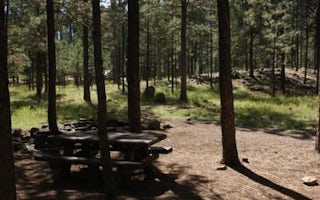
Jemez Springs, New Mexico
Jemez Falls Campground
Overview
Jemez Falls Campground is located in a stunning Ponderosa Pine and forest meadow environment. The campground elevation is 7,880 ...
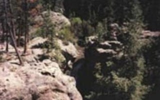
Jemez Springs, New Mexico
Jemez Falls (Nm) Picnic Area
Overview
Jemez Falls Picnic Area is great place to spend the day, especially when planning a day hike to nearby Jemez Falls on the Jemez ...
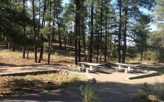
Jemez Springs, New Mexico
Paliza
Overview
Paliza Campground sits beneath sandstone cliffs on the Jemez Ranger District of the Santa Fe National Forest. The area is replet...
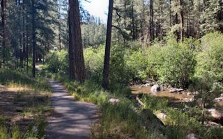
Jemez Springs, New Mexico
San Antonio Campground
Overview
San Antonio Campground is adjacent to the San Antonio River, tucked into a forest of ponderosa pine at 7,600 feet above sea leve...
Los Alamos, New Mexico
Ponderosa Campground (Nm)
Overview
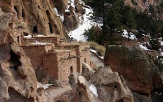
For large groups coming to Bandelier National Monument, Ponderosa Campground is an ideal place to stay. Located 6 miles from the...
Cochiti Lake, New Mexico
Cochiti Area
Overview
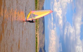
Cochiti Recreation Area is located in Sandoval County, New Mexico, within the boundaries of the Pueblo de Cochiti Indian Reserva...


