San Antonio Campground
Book this listing through our partner Recreation Gov
About San Antonio Campground
Overview
San Antonio Campground is adjacent to the San Antonio River, tucked into a forest of ponderosa pine at 7,600 feet above sea level. This popular campground is open from May through October in the Santa Fe National Forest. Visitors should be prepared for hot summer days and cool nights.San Antonio Campground was completely rebuilt and reopened in August 2010. It is designated as a reduced impact and recycle campground.
Recreation
A paved walking trail along the river provides access for fishing. Anglers can fish for rainbow trout. Visitors enjoy wading in the river on hot summer days.The campground offers easy driving access to several recreational sites nearby, including the popular La Cueva Picnic Site, Spence Hot Spring Trailhead, Battleship Rock Trailhead and a couple of fishing sites along the San Antonio River.
Facilities
The campground has 20 standard sites that can accommodate tents, trailers and RVs. A group area on the north end of the campground includes a pavilion that can accommodate up to 100 people.The group area includes nine tent sites. Accessible sites are located on the south end of the campground.
Sites are equipped with picnic tables and pedestal grills, and sites 1-6 have water and electric hookups. Site 3 can accommodate two RVs.
Drinking water and vault toilets are provided. Parking areas, spurs and roads within the campground are paved. A camp host is available during the peak season. Visitors are encouraged to pack out trash, but recycling bins are provided.
Natural Features
Some of the finest mountain scenery in the Southwest is found in the 1.6 million acres within the Santa Fe National Forest. Elevations range from 5,300 to 13,103 feet at the summit of Truchas Peak, located within the Pecos Wilderness.The diverse ecosystems of the Santa Fe National Forest are home to a variety of wildlife species. The ponderosa pine forests at 6,000-9,500 feet provide habitat for the Jemez Mountain salamander, northern goshawk, Merriam's turkey, Abert's squirrel and hairy woodpecker.
Nearby Attractions
The 163-mile Jemez Mountain Trail Scenic Byway passes amazing geological formations, ancient Indian ruins and an Indian pueblo. The area is rich in logging, mining and ranching heritage.San Antonio Campground Reviews
Have you stayed here? Be the first to leave a review!
Top Spots in or near Jemez Springs
San Antonio Hot Springs via Thompson Ridge Route
Jemez Springs, New Mexico
5.0
2.66 mi
/ 469 ft gain
Although you can reach these hot springs via the main trail in the winter, the Thompson Ridge route is a shorter option that comes in from above the springs rather than below. If you go in winter, you'll need winter route finding skills for the trail (there's no signage at any point) and an all wheel or 4 wheel drive for the road in.
The trailhead starts on a Forest Service Road (accessible du...
Dip into Spence Hot Springs
Jemez Springs, New Mexico
4.0
1.2 mi
/ 193 ft gain
Exit Interstate 550 and head North on Highway 4 heading towards Jemez Springs. The Spence Hot Springs Parking Lot and Trailhead is about 25 miles North off Highway 4. The trail starts on a decline into the canyon for about 800 feet before you cross the bridge over the scenic river. Continue following the trail up a brief, yet steep incline towards the two hot springs. Take a dip and enjoy the J...
San Antonio Hot Springs
Jemez Springs, New Mexico
4.6
1.46 mi
/ 312 ft gain
These hot springs are a short hike from the parking area along the top of Forest Service Road 376. I've added additional details below in the event that the road is closed due to seasonality or you prefer to stretch your legs for a significantly longer, yet scenic hike. The GPX track is displaying the shorter version.
Starting from Jemez Springs New Mexico you will drive north on NM-4 for app...
Visit the Jemez Soda Dam
Jemez Springs, New MexicoFor the past 7,000 years, calcium carbonate at this spot in northern New Mexico. And after all those centuries, it has formed into a natural bridge across the Jemez river, roughly 300 feet in length.
Drive northeast from Jemez Springs on New Mexico State Route 4. Just under 2 miles later, the formation is on the right side of the road, but parking is immediately following on the left side. Tak...
Climb Las Conchas
Jemez Springs, New Mexico
5.0
5 mi
75 minutes north of Albuquerque, Las Conchas is a trailhead that sits right off the highway with two accessible, although small, parking lots. Right out of the gate the wide and well worn trail drops down to follow the river north through a wide mountain valley lined with large stands of trees, beautiful cliff faces, and tall grass meadows. Hike in along the trail over wooden boardwalks and w...
Backpack the Vacas Trail Loop
Rio Arriba County, New Mexico
4.0
15 mi
/ 1000 ft gain
You start at the hiking at base of the the San Pedro Wilderness at the San Gregorio Lake Trailhead! This particular hike is called the Vacas Trail loop.For directions: Take US 550 to Cuba (north west of Albuquerque), turn east on NM 126 and go for about 9 miles. Just past the community of Deer Lake, look for the forest road heading north, possible marked Forest Road 70 or there may be a sign to...
Camping and Lodging in Jemez Springs
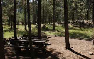
Jemez Springs, New Mexico
Jemez Falls Campground
Overview
Jemez Falls Campground is located in a stunning Ponderosa Pine and forest meadow environment. The campground elevation is 7,880 ...
Jemez Springs, New Mexico
Jemez Falls (Nm) Picnic Area
Overview
Jemez Falls Picnic Area is great place to spend the day, especially when planning a day hike to nearby Jemez Falls on the Jemez ...
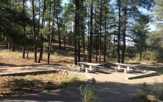
Jemez Springs, New Mexico
Paliza
Overview
Paliza Campground sits beneath sandstone cliffs on the Jemez Ranger District of the Santa Fe National Forest. The area is replet...
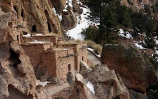
Los Alamos, New Mexico
Ponderosa Campground (Nm)
Overview
For large groups coming to Bandelier National Monument, Ponderosa Campground is an ideal place to stay. Located 6 miles from the...
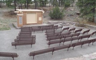
Los Alamos, New Mexico
Juniper Campground
Overview
For visitors to Bandelier National Monument, Juniper Group Campground is an ideal place to stay. Located just inside the main pa...
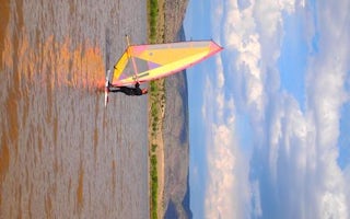
Cochiti Lake, New Mexico
Cochiti Area
Overview
Cochiti Recreation Area is located in Sandoval County, New Mexico, within the boundaries of the Pueblo de Cochiti Indian Reserva...
Unfortunately, we don't have up-to date pricing data for this listing, but you can check pricing through Recreation Gov.
Book NowAdd your business today to reach The Outbound's audience of adventurous travelers.
Community
© 2024 The Outbound Collective - Terms of Use - Privacy Policy


