Blue Diamond, Nevada
Looking for the best hiking in Blue Diamond? We've got you covered with the top trails, trips, hiking, backpacking, camping and more around Blue Diamond. The detailed guides, photos, and reviews are all submitted by the Outbound community.
Top Hiking Spots in and near Blue Diamond
-
Las Vegas, Nevada
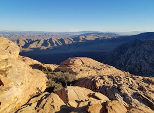
Hike The Mountain Springs Trail
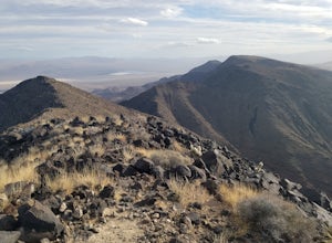
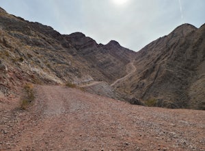
5 mi / 1012 ft gainGetting there is pretty straight forward. Take 160 west towards mountain springs and use your phone to pull up the trail head on a map. It comes up quick on the right, and is nothing more than a gravel lot with a few 4x4 trails headed out of it. There is one main trail, a vehicle path, that leav...Read more -
Las Vegas, Nevada
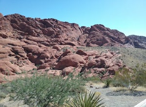
Drive the Red Rock Canyon Scenic Loop
4.512 miBegin your drive from the visitor center. Drive along the scenic highway and stop at one of the multiple parking areas to get out of the car, stretch your legs, and hike some the trails starting from the parking area. There is a variety of easy to moderate difficulty trails stemming from the park...Read more -
Las Vegas, Nevada
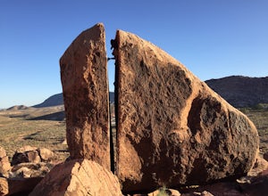
Bouldering at Kraft Boulders, Red Rock
0.25 miDrive through Calico Basin near Red Rock Canyon Conservatory Area, and park at the end of the road. (The parking lot is pinpointed above) Once you're out of your car, you'll see the Cube. It's a 25 foot boulder, with both easy and extremely difficult climbs on it. Head toward the Cube (toward the...Read more -
Las Vegas, Nevada
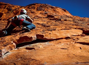
Rock Climb the Black Corridor
5.00.4 miThis is a popular area for beginners and intermediate rope climbers. The corridor is sheltered from the wind, which makes it climbable year-round (but bring a light jacket!). Approach: Climbing coordinates are 36.15547, -115.43613.Driving on Scenic Loop Dr., park on the right at the second parkin...Read more -
Las Vegas, Nevada
Rock Climb at Red Rock Conservation Area
The official address for Red Rock Conservation area for you GPS travelers is: 1000 Scenic Loop Dr, Las Vegas, NV 89161. Head into the park, and you'll be on the one way Scenic Loop Drive. Red Rock is home to thousands of different routes, so it's easy to get lost amidst the rock. I recommend usin...Read more -
Las Vegas, Nevada
Hike Calico Tanks at Red Rock Canyon
4.52 mi / 400 ft gainEnjoy a easy scenic hike in this beautiful Nevada desert hike. Great for beginners who are willing to climb a little. This hike has about 400 ft elevation gain and go through a terrain of boulders and canyons that were fairly easy to walk on and climb. Towards the top of the hike, before reaching...Read more -
Las Vegas, Nevada
Hike Red Rock's Ice Box Canyon
4.8Red Rock Canyon is about 30-45 minutes outside of Las Vegas and is the perfect little get away from the noise of Sin City; however, it will still be slightly infested with tourists.From the trailhead it just looks a bit like thick brush, but once you get into it, you find tiny pools and a little ...Read more -
Las Vegas, Nevada
Hike or Trail Run White Rock to Willow Springs
4.4 mi / 200 ft gainThis hike is located along the 13 mile scenic drive in the Red Rock Canyon National Conservation Area. To enter the park you will need to pay a $7.00 entry fee per car (or $3.00 fee per bike). About halfway through the drive you will find the upper parking area for the White Rock Spring. [There ...Read more -
Henderson, Nevada
Hike the Summit of Black Mountain
4.56.75 mi / 1910 ft gainThis hike is cool because you park in a residential area and follow the (paved) anthem east trail for about 3/4 of a mile before you hit dirt. Once you do though you start to climb quickly and every time you turn around the view gets better. I recommend and afternoon hike that would let you catch...Read more -
Mount Charleston, Nevada
Mt. Charleston via Trail Canyon
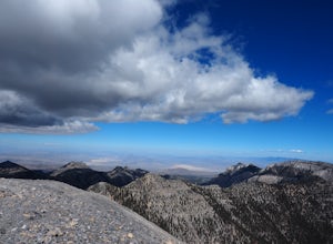
5.016.3 mi / 5030 ft gainEscape the heat and ditch the bright lights of Las Vegas and hike to the summit of Mt. Charleston. Less than an hour drive from Sin City it provides desert dwellers and visitors alike with a dramatic change of scenery and a taste of high-altitude hiking. With a total round trip hike of 16 miles ...Read more -
Mount Charleston, Nevada
Trail Canyon in the Mt. Charleston Wilderness
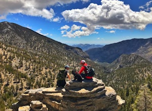
3.82 mi / 1588 ft gainTHE TRAIL The Trail Canyon Trail is a 3.8 mile out-and-back moderately trafficked route located in the Mt. Charleston Wilderness located approximately 45 minutes northeast of Las Vegas, NV. This difficult trail offers access to Mt. Charleston Peak, the western side of the Mummy Mountain Trail,...Read more -
Las Vegas, Nevada
Frenchman Mountain Trail
5.04.5 mi / 2139 ft gainA popular out and back (or up and down) hike just outside Vegas. The trip up will burn you out, go early and bring water! The top will reward you with some of the best views of Las Vegas to the West, Lake Las Vegas to the South, and Lake Mead to the east.Read more -
Boulder City, Nevada
Hike the Sunset View Trail
4.00.1 mi / 0 ft gainThe trail is .1 miles, and is perfect for all skill levels and for families who want to see some of the scenery in Lake Mead National Recreation Area. The trail is accessible year round and allows dogs.Read more -
Boulder City, Nevada
Hike the Railroad Tunnel Trail
3.77.2 mi / 1332 ft gainThese tunnels were built to support the construction of the Hoover Dam. If you decide to go all the way to the dam, there is an elevator for accessibility along with stairs. This hike is relatively flat, and perfect for children - but mind the distance. Driving directions: From Las Vegas, NV, t...Read more -
Clark County, Nevada
Camp at Boxcar Cove
0 mi / 0 ft gainThe shoreline of "Lake" Mead is what you would expect of a large, man-made reservoir with fluctuating water levels (muddy & unpleasant), but that is not to say that the Lake Mead National Recreation Area is not filled with incredible places to explore (it is), and Boxcar Cove is a solid spot ...Read more -
Boulder City, Nevada
Goldstrike Hot Springs
4.54.54 mi / 1293 ft gainThe first mile is flat and deceivingly easy as you walk under a highway bridge and in between looming canyon walls. But don't get too comfortable -- at around the 1.5 mile mark you will reach the first of eight ropes along the trail and the challenge begins. You will need to use these ropes to ...Read more

