Kissee Mills, Missouri
Top Spots in and near Kissee Mills
-
Highlandville, Missouri
Ride the Slopestyle Course at Two Rivers
Located just about 20 minutes outside of Springfield, Missouri these are the best slopestyle courses you will find in Missouri. These courses start at the top of a service road that leads out of the parking lot. There are tons of great features such as wall rides, berms, and tabletops. There are...Read more -
Flippin, Arkansas
Fly Fish the White River
5.0Spend a week or weekend trout fishing on the world famous White River, located in north central Arkansas.The White River is a tailwater of Bull Shoals Lake, and is known worldwide as the “Capital of Trout Fishing.” Its beautiful banks are lined with fishing resorts that offer cabins, boat rentals...Read more -
Harrison, Arkansas
Hike to Paige Falls and Broadwater Hollow Falls
5.00.5 mi / 100 ft gainAlthough there is no official trailhead, Paige and Broadwater Hollow Falls can be accessed off of NC 2660 in Compton, Arkansas. Once on NC 2660, head straight down this rugged gravel road for approximately 2 miles. Soon you’ll reach a sharp bend to the left with a small parking area just before...Read more -
Jasper, Arkansas
Canoe or Kayak the Buffalo River From Pruitt Landing to Hasty
5.0The Buffalo River is America's first National River and flows freely for 135 miles. Many of the upper sections are whitewater, but lower down there are some great, flat, easy paddling spots that are fantastic for canoes!As with all river paddling you need to first shuttle a car down to the take o...Read more -
Eureka Springs, Arkansas
Black Bass Lake Trail
4.51.85 mi / 338 ft gainBlack Bass Lake Trail is a loop trail that is good for all skill levels located near Eureka Springs, Arkansas.Read more -
Harrison, Arkansas
Backpacking Cecil Creek
5.08 miFrom Tulsa, head out east along US-412 until you reach HWY 103. Take a right (south) on HWY 103 and follow it toward Compton, Arkansas. Shortly before reaching Compton, take the dirt road on the right (before the road starts to head north), and follow the road south. Keep on it as it bends to the...Read more -
Harrison, Arkansas
Hike to Hideout Hollow
4.02 miAfter parking at the trailhead, head down the well-trodden path and follow it the 0.85 miles downhill to the overlook. Once you are at the overlook, go left and follow the path as it loops around the top of the overhang. You’ll arrive at a small creek (which creates the waterfall that flows into ...Read more -
Compton, Arkansas
Hemmed In Hollow Falls via Hemmed In Hollow Trail
5.05.78 mi / 1572 ft gainAfter parking at the Hemmed In Hollow Falls Trailhead, follow the path down as it descends into the valley. As you approach one of the vistas, you’ll be able to spot the emerald green waters of the Buffalo River, as well as the bluffs to your east where the waterfall hides. After reaching the va...Read more -
Harrison, Arkansas
Camp at Kyle's Landing
5.0Kyles Landing is located directly beside the beautiful Buffalo river, hardly a stone's throw from the cool refreshing water. With huge bluffs soaring over 400ft into the air, multiple hiking trails available, and access to the river itself, the campground is a perfect weekend getaway to get outsi...Read more -
Harrison, Arkansas
Twin Falls (aka Triple Falls)
5.00.27 mi / 72 ft gainProceed to the Camp Orr Campground down near the banks of the Buffalo River. Once you reach the bottom of the hill you will cross a low water bridge over a small creek. Park in the small parking lot on the right hand side once you cross the creek. Once you park simply walk through the gated are...Read more -
Harrison, Arkansas
Indian Creek to The Eye Of The Needle
5.04.27 mi / 705 ft gainStarting at approx. 900' in elevation, this 5 mile out and back hike ascends 700' in elevation to 1,400 at the highest point- The Eye of The Needle. The trail head is located next to the Buffalo River sign at Kyles Landing on the West side of the campground. You will follow the trail less than ...Read more -
Compton, Arkansas
Hike to Scenic Big Bluff
5.06 miThe hike starts at the Centerpoint Trailhead and follows a clearly defined trail for 3 miles (approximately one hour) with mostly downhill or flat terrain and views through the trees of the rolling Ozark landscape. When you are almost to Big Bluff, the trail opens up into a large round area with ...Read more -
Compton, Arkansas
Big Bluff via the Centerpoint Trailhead
4.96.21 mi / 991 ft gainThis adventure begins at the Counterpoint Trailhead just north of Ponca, AR. Follow the trail downhill for about 2.7 miles until you reach a split in the trail. Take the trail off to the right and follow it for another .5 miles until you reach the Big Bluff area. There is a lot of area to expl...Read more -
Compton, Arkansas
Backpacking Along the Buffalo River
5.012 miPark at the Centerpoint Trailhead and follow the Centerpoint trail as it heads about 3 miles downhill towards Big Bluff. You’ll know you’ve reached the trail junction for Big Bluff when you come to a clearing that has a large firepit in the middle and a small unmaintained trail heading off to the...Read more -
Compton, Arkansas
Centerpoint to Goat Trail
5.82 mi / 1001 ft gainCenterpoint to Goat Trail is an out-and-back trail that takes you by a river located near Ponca, Arkansas.Read more -
Huntsville, Arkansas
Kings River Overlook
5.01.2 mi / 145 ft gainThis is a great family hike short enough for little ones but with enough features to keep little ones engaged. From the parking area, it's about .6 miles on a relatively flat, well-marked trial to the overlook. (Plenty of room to step off trail for social distancing) We went in April with thre...Read more
Top Activities
Camping and Lodging in Kissee Mills
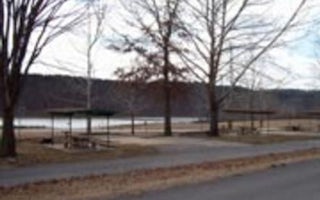
Kissee Mills, Missouri
Beaver Creek (Mo)
Overview
Escape from the hustle and bustle of city-life at Beaver Creek, a small, quiet campground tucked between a forested area and the...
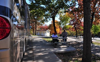
Branson, Missouri
Branson KOA Holiday
"Simply the Best" camping experience, location and services can be found at this KOA, less than a half mile from the bustling Branson Str...
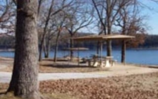
Lead Hill, Arkansas
Tucker Hollow Park
Overview
Tucker Hollow, a small 28-campsite park, sits near the upper part of Bull Shoals Lake. There's something for everyone at the reg...
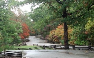
Chadwick, Missouri
Cobb Ridge
Overview
Cobb Ridge Campground is adjacent to the Chadwick Riding area, which is popular among and off-road vehicles (dirt bikes; ATVs an...
Branson, Missouri
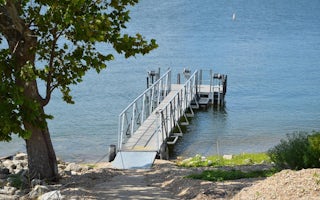
Moonshine Beach Rec. Area
Overview
Moonshine Beach Recreation Area is a very popular sandy swimming beach along the shores of Table Rock Lake.Unlike the smaller sw...
Branson, Missouri
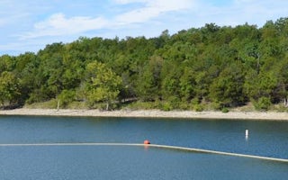
Indian Point
Overview
Indian Point is a green and spacious campground on the White River Arm of Table Rock Lake in the mountainous Missouri countrysid...


