Sedalia, Colorado
Looking for the best photography in Sedalia? We've got you covered with the top trails, trips, hiking, backpacking, camping and more around Sedalia. The detailed guides, photos, and reviews are all submitted by the Outbound community.
Top Photography Spots in and near Sedalia
-
Manitou Springs, Colorado
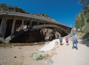
Walk to Rainbow Falls
0.5 miThis waterfall was designated a historic site in 2016 due to its rich history dating back to the Native Americans and more recently the locals of Manitou Springs. The bridge itself that crosses over the falls was created in the early 20th century and was an architectural marvel during the time. ...Read more -
Colorado Springs, Colorado
Hike the Upper Loop Trail
5.00.75 mi / 72 ft gainThis short spur trail is right off Perkins Central Garden Trail. Most people walk by it because the walkway changes from paved to dirt, but it is definitely a must-see if you're exploring the park. It climbs just a short amount before reaching the rocks you can climb on. Make sure you take a mome...Read more -
Colorado Springs, Colorado
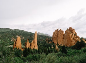
Perkins Central Garden Trail
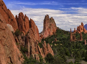
5.01.13 mi / 138 ft gainGarden of the Gods has dozens of hiking trails that cover miles through the park itself. The Perkins Central Garden Trail takes you through the heart of the rock formations and really gives you perspective on the size of these red rocks. This trail also takes you past several areas where rock cl...Read more -
Manitou Springs, Colorado
Hike Red Mountain
2 mi / 750 ft gainThe hike can be started from where the Intemann trail meets Ruxton Ave close to Iron Spring. For parking, you can park at one of the few pay-for parking along the street or park in town and take the bus up to the incline. The hike starts up what seems to be a driveway until you reach a small gate...Read more -
Colorado Springs, Colorado
Hike Pulpit Rock
4.12.2 mi / 505 ft gainHeading South on N. Nevada Blvd. you will pass a Harley Davidson dealership on your left, about a mile after that there is a large parking lot for Pulpit Rock Park. Once you park, there is a clearly marked trailhead that will get you on your way! There are various trails you can take to get the t...Read more -
Manitou Springs, Colorado
Manitou Springs' Mineral Springs
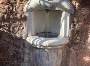
5.0Manitou Springs is home to eight mineral springs all fairly close to the main shopping strip of Manitou. The springs were originally utilized by the Native Americans. In the 19th century, they were utilized by visitors from all over the world due to their supposed health benefits. They all taste ...Read more -
Colorado Springs, Colorado
Climb and Hike in the Garden of the Gods
4.7If you are new to the area a stop by the visitor center can helpful to get a map of the trails and roads in the area as well as obtaining a climbing permit (one is needed to climb and is free).Once you have entered the area there are multiple trails and pull outs that you can explore. Many of the...Read more -
Colorado Springs, Colorado
Bike the Garden of the Gods Loop
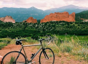
5.06 mi / 500 ft gainThe Basics: Garden of the Gods is a free, public park on the Western edge of Colorado Springs. Open year round, the excellent paved roads with wide bike lanes provide road bikers with multiple loop options from 3 to 10+ miles. From casual bike riders to seasoned pros, you choose your distance and...Read more -
Colorado Springs, Colorado
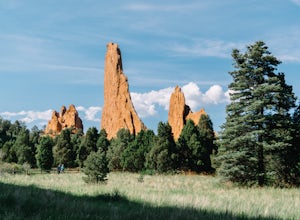
Siamese Twins Loop
4.00.55 mi / 105 ft gainSiamese twins is about a half mile hike with little elevation gain that is a quick hike while driving the park. The hardest thing about this is getting a parking spot to tell you the truth. On a weekend or pretty much any summer day the five or so spots available at the trailhead are constantly...Read more -
Evergreen, Colorado
Pence Park's Independence Mountain Trail
4.42.09 mi / 869 ft gainPence Park, part of the Denver Mountain Parks system, is nestled between the mountain communities of Indian Hills and Kittredge on Myers Gulch Road. It's one of those places I always drove right past without bothering to check it out. From the road, it looks the same as any other place in the foo...Read more -
Evergreen, Colorado
Evergreen Mountain Loop
4.75.89 mi / 0 ft gainThe way up Evergreen Mountain is actually a few different trails stitched together throughout Alderfer/Three Sisters Park. The trail connects to both parking lots in the park, so if one is full you can just start from the other one, giving you lots of options for a quick day-hike. If you start ...Read more -
Morrison, Colorado
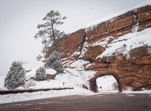
Explore Red Rocks Park in Winter
4.3Red Rocks is a bustling park in the summer when its famous amphitheater is filled with concerts. In winter though, the park dies down and becomes even more quiet when snow is falling. Grab your camera and head to the park during a winter storm to truly enjoy the beautiful red sandstone formations...Read more -
Evergreen, Colorado
Hike Panorama Point at Corwina Park
4.72.7 mi / 640 ft gainJefferson County, the "Gateway to the Rockies" has dozens of great parks and trails. One of the best, however, is often overlooked, as it is sandwiched between bigger and more popular parks. Corwina Park is a small section located off Hwy. 74, near the village of Kittredge. Sitting between the po...Read more -
Manitou Springs, Colorado
Hike Palmer Trail Loop at Section 16
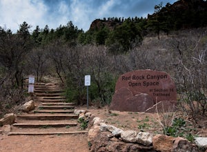
5.5 mi / 1400 ft gainThe Section 16 trailhead can be found on lower Gold Camp Road. Almost immediately, the trail begins to rise in elevation. The grade is gentle at first but soon becomes a steep steady climb for about a mile and a half, until you reach the ridge. Along the way, you will see many intersecting trail...Read more -
Guffey, Colorado
Paradise Cove
4.5From Colorado Springs, follow RT 24 to the town of Florissant (34.5 miles). From Florissant, follow Teller County Road 1 south for about 9.2 miles, until a Y fork, and bear right, into County Road 11. Follow County Road 11 for 4.1 miles, until a T intersection, and make a right turn at the inters...Read more -
Lakewood, Colorado
Green Mountain Mountain Bike Loop
4.06.9 mi / 1047 ft gainSkip the bar and spend happy hour hiking/biking this fun and easy loop. With convenient access from the Denver-Metro Area, this spot is perfect for a quick ride after work, or hike with your dog. The park has three parking lots, and the trail can be completed as a loop system (in either directio...Read more

