Parlin, Colorado
Looking for the best photography in Parlin? We've got you covered with the top trails, trips, hiking, backpacking, camping and more around Parlin. The detailed guides, photos, and reviews are all submitted by the Outbound community.
Top Photography Spots in and near Parlin
-
Buena Vista, Colorado
Hike Missouri Mountain
5.010.5 mi / 4500 ft gainGetting there: The trail begins at Missouri Gulch TH. If you are a car camper or are trying to snag a sunrise summit, there are many many drive off sites in trees and near water before and after the trailhead. The road to get to the trailhead is not paved, but is well maintained - a super high cl...Read more -
Buena Vista, Colorado
Summit La Plata Peak
5.09.25 mi / 4500 ft gainThe Northwest Ridge is the most easily accessible and popular route, and for good reasons. The trailhead is on the side of Hwy 82, otherwise known as Independence Pass, about 14.5 miles from the Hwy 24 junction, or about 10 miles from Twin Lakes to the east. The trailhead is hard to miss, and you...Read more -
Buena Vista, Colorado
Mt. Elbert via Black Cloud Trail
4.510.69 mi / 4967 ft gainDirections: Heading south from Leadville from U.S. 24: West on CO 82 for 10.5 miles to a hidden right turn that leads to a trail head. If you make it to the Mt. Elbert Lodge, you have gone just a bit too far. The parking lot (aka: dirt access) should be relatively empty as everyone tends to hik...Read more -
Buena Vista, Colorado
Hope Pass via Willis Gulch
5.08.75 mi / 3297 ft gainHope Pass is accessed from the Willis Gulch trailhead about 25 miles outside of Leadville, Colorado. To get to the trail head, follow Highway 24 East for about 16 miles until you arrive at the junction for Highway 82. Turn right and follow Highway 82 for about 8.3 miles. You will see a sign on th...Read more -
Aspen, Colorado
Grottos Trail
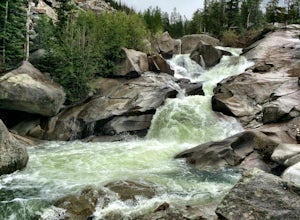
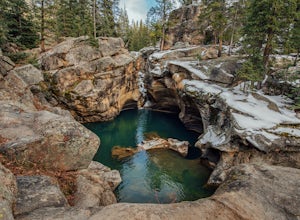
5.00.53 mi / 72 ft gainJust nine miles east of Aspen on Highway 82, Independence Pass, are grottos. A grotto is a geological term for a cave or cavern. The Grottos near Aspen were formed by rushing water of the Roaring Fork River. There is only an elevation gain of 300 feet on the three-quarters of a mile loop making...Read more -
Aspen, Colorado
Devil's Punch Bowl
4.7The Roaring Fork River has several little waterfalls that end up in a deep swimming hole called The Devil's Punch Bowl. This is a must-see if you are driving up to the Independence Pass. I have never seen such blue water before (outside of an amusement park). While Driving from Aspen on CO82 to...Read more -
Aspen, Colorado
Snowmass Lake via Maroon-Snowmass Trail
4.316.53 mi / 5023 ft gainFor the adventurous backpacker looking to get backcountry in central Colorado, the stunning beauty of the Maroon Bells-Snowmass Wilderness cannot be beaten. While the Maroon Bells just outside of Aspen might be the most photographed mountains in North America, the beauty is definitely rivaled by ...Read more -
Aspen, Colorado
Crater Lake via Maroon-Snowmass Trail
4.63.77 mi / 722 ft gainThe crater lake trail begins at Maroon Lake and quickly breaks off from the scenic trail at .3 miles. Be sure to follow the signs to crater lake, which will be heading higher into the valley. The trail passes through a beautiful Aspen grove most of the way with wonderful views of 14ers, the Maroo...Read more -
Aspen, Colorado
Backpack to Snowmass Creek in the Maroon Bells-Snowmass Wilderness
13 miFor beginner backpackers or just those who can't take off 3-4 days to do the Four Pass Loop, there's still options near the iconic Maroon Bells. If you are planning to do an overnight at the Bells, you need to get there early or late - before 7:30 am or after 5 pm. The overnight lot fills quickl...Read more -
Aspen, Colorado
Explore the Maroon Bells & Snowmass Wilderness
5.0The beautiful and iconic Maroon Bells-Snowmass wilderness is home to some of the most amazing scenery and adventures to be had in all of Colorado. It is world-famous for the Maroon Bells, two challenging 14ers just outside of Aspen, Colorado. The third 14er, Pyramid Peak is also considered a clas...Read more -
Aspen, Colorado
Relax at Maroon Lake
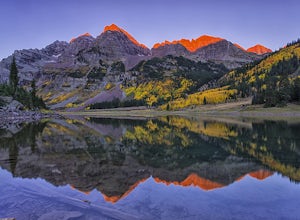
4.9The Maroon Bells are known around the world for being some of the most iconic, beautiful mountains in all of the United States. Even if you haven't heard of them, there's a chance you've seen them. And if you've seen them in person, it's likely you were there with 800+ of your closest friends.If ...Read more -
Aspen, Colorado
Car Camp at Maroon Lake
5.00.3 mi / 0 ft gainMaybe you've seen the photos a million times before - it's for good reason. Maroon Bells is just stunning. Watching the first rays of sunlight scratch the very top of Maroon Bells and slowly crawl their way down the massive slabs of granite is simply a must for the checklist. Taking in the sunris...Read more -
Independence, Ohio
Hike Mountain Boy Ridge from the Top of Independence Pass
5.06 miThe trailhead is to the Independence Pass viewing deck is located at the Summit parking area, which is about 20 miles from Aspen and 24 miles west of Highway 24 on the Leadville side. At the parking area you will notice a paved walkway that takes you to the viewdeck, which is a easy five minute w...Read more -
Independence, Ohio
Hike Lost Man Pass via Independence Lake
5.04.5 mi / 1200 ft gainPark at the pull out just west of independence pass. From there, begin on the Linkin's Lake Trail. The trail is generally easy to follow (although it can be muddy as it is a wet area) and climbs 900 feet in the 1.8 miles to independence lake. From Independence lake it is about 0.5 miles and 400 f...Read more -
Independence, Ohio
Watch the Sunset from Independence Pass
1.0Start in the town of either Aspen or Twin Lakes and continue on Interstate 82 to the top of Independence Pass. Along the way, keep your eyes peeled for the Ghost Town of Independence, fields of wildflowers and the occasional moose, elk or deer. Continue on to the top of the pass where you will fi...Read more -
Independence, Ohio
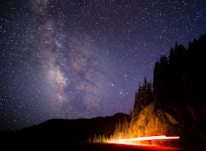
Photograph the Milky Way on Independence Pass
From Aspen CO, drive up highway 82 towards Twin Lakes and stop at the top of the pass.Once you reach the continental divide there will be a sign that says Independence Pass with an elevation of 12,095 feet. Here you can park the car for free and use the bathroom area.To photograph the milky way y...Read more


